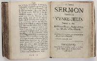
Greenham, Richard. M. M. Perkins, William, 1558-1602 Ro., Ri Rogers, Richard, 1550?-1618, creator Webbe, George, 1581-1642
Published / Created:
1630 [pt. 2, '29]
Call Number:
Mhc3 R633
Image Count:
136
Description:
Collation: pt. 1: [127] p.; pt. 2: [127] p., Imperfect: bled, with considerable damage to text., Signatures: pt. 1: A-H8; pt. 2: A-H8., and The abbreviations (except for the unidentified M.M.) stand for Richard Rogers, William Perkins, Richard Greenham, and George Webb.
Publisher:
Printed by T.B. for R. Bird, dwelling at the signe of the Bible in Cheapside
The English pilot: describing the West-India navigation, from Hudson's-Bay to the river Amazones
Image Count:
1
Description:
Imperfect: mutilated with some loss of image.
Subject (Geographic):
Africa, West --Maps --Early works to 1800, Atlantic Ocean --Maps --Early works to 1800, New England --Maps --Early works to 1800, Newfoundland and Labrador --Maps --Early works to 1800, Portugal --Maps --Early works to 1800, South America --Maps --Early works to 1800, and West Indies --Maps --Early works to 1800
Subject (Topic):
Navigation --Early works to 1800, Pilot guides --Atlantic Coast (U.S.) --Early works to 1800, and Pilot guides --Caribbean Area --Early works to 1800
The English pilot: describing the West-India navigation, from Hudson's-Bay to the river Amazones
Image Count:
2
Description:
Mathematical notations on one verso.
Subject (Geographic):
Africa, West --Maps --Early works to 1800, Atlantic Coast (North America) --Maps --Early works to 1800, Atlantic Ocean --Maps --Early works to 1800, Newfoundland and Labrador --Maps --Early works to 1800, South America --Maps --Early works to 1800, and West Indies --Maps --Early works to 1800
Subject (Topic):
Navigation --Early works to 1800, Pilot guides --Atlantic Coast (U.S.) --Early works to 1800, and Pilot guides --Caribbean Area --Early works to 1800
Collection Created:
London : Printed for W. and J. Mount, T. Page and son, on Tower-Hill, MDCCLX [1760]