Skip to search
Skip to main content
Skip to first result
Search
You Searched For
Genre
Manuscript maps
Resource Type
Maps, Atlases & Globes
Language
English
New Search
Search Results
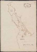
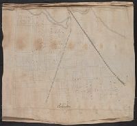
Published / Created:
1789
Call Number:
761 St24 1789
Container / Volume:
BRBL_00710
Image Count:
1
Resource Type:
Maps, Atlases & Globes
Description:
Color: pen and ink drawing.
Subject (Geographic):
Standish (Me. : Town)--Maps, Manuscript--Early works to 1800
Found in:
Beinecke Rare Book and Manuscript Library > A plan of Pearsontonn [i.e. Standish Township] planned by ... Ephraim Jones Surveyor. Falmonth, Sept. 26, 1775. Copied August 28th, 1789 (by) Saml. Freeman.
Creator:
Published / Created:
1751
Call Number:
732 H13 1751
Container / Volume:
BRBL_00708
Image Count:
1
Resource Type:
Maps, Atlases & Globes
Subject (Geographic):
Halifax Harbour (N.S.)--Maps--Early works to 1800
Subject (Topic):
Harbors--Nova Scotia--Halifax--Maps--Early works to 1800
Found in:
Beinecke Rare Book and Manuscript Library > A plan of the harbour of Halifax / by Charles Morris, chf. surveyr.
Published / Created:
1747
Call Number:
764 W52 1747
Container / Volume:
BRBL_00710
Image Count:
1
Resource Type:
Maps, Atlases & Globes
Description:
Color: pen and ink.
Subject (Geographic):
Westborough (Mass.)--Maps, Manuscript--Early works to 1800
Found in:
Beinecke Rare Book and Manuscript Library > An exact plan of Westborough South Precinct ... protracted and laid down by a scale of 200 perch for an inch by Hesebiah Ward, Surveyor.
Published / Created:
1757
Call Number:
732 An73 1757
Container / Volume:
BRBL_00708
Image Count:
1
Resource Type:
Maps, Atlases & Globes
Description:
2 sheets in 1., Color; some green and red, pen drawing., and Key at bottom right.
Subject (Geographic):
Nova Scotia--Maps, Manuscript--Early works to 1800
Found in:
Beinecke Rare Book and Manuscript Library > Annapolis-Royal with the adjacent country 1757.
Published / Created:
[1935?]
Call Number:
766 B76 1935
Container / Volume:
BRBL_00711
Image Count:
1
Resource Type:
Maps, Atlases & Globes
Description:
Color: green and blue with red and orange detail., Key in bottom right hand corner., and Manuscript map showing roadwork, bridges repaired & painted, parks and park development, public bldgs. repaired and painted, new buildings and proposed projects.
Subject (Geographic):
Bridgeport (Conn.)--Maps
Found in:
Beinecke Rare Book and Manuscript Library > C.W.A. - F.E.R.A., Bridgeport Conn. Prepared from Official records. [Drawn by G.W. Carmalt].
Creator:
Published / Created:
1861
Call Number:
BrSides Folio 2018 140
Image Count:
1
Resource Type:
Maps, Atlases & Globes
Description:
Coordinates not present on map and are approximated., From the Richard H. Rickard Papers., and North oriented towards the left.
Publisher:
Department of Crown Lands,
Subject (Name):
Montreal Mining Company., Ontario. Department of Crown Lands., and Rickard, Richard H.,---1885--Ownership.
Subject (Topic):
Mines and mineral resources--Ontario.
Found in:
Beinecke Rare Book and Manuscript Library > Copy of part of P.L.S. Salter's plan shewing mineral locations at and near Mamainse with a projection shewing Montreal Mining Company's location / Andrew Russell, Assistant Commissioner.
Published / Created:
[1886]
Call Number:
60 1886
Container / Volume:
BRBL_00707
Image Count:
2
Resource Type:
Maps, Atlases & Globes
Description:
"Roughly illustrated during a discussion for book "Aller" Nov. 24, 1886. Drawn and signed by Sir Henry M. Stanley., Color: pencil drawing., and Notes: on reverse, drawing called King's Road, Brighton. By Alfred Bryan.
Subject (Geographic):
Africa--Maps, Manuscript
Found in:
Beinecke Rare Book and Manuscript Library > Equatorial Africa.
Creator:
Published / Created:
[1847]
Call Number:
766 N46 1847A
Container / Volume:
BRBL_00712
Image Count:
2
Resource Type:
Maps, Atlases & Globes
Alternative Title:
Experimental survey for a railroad between New Haven and Humphreysville, forming part of the line to Waterbury
Description:
"Scale 800 feet to one inch.", Color: pen and ink with red, blue and yellow detail., Imperfect: mutilated in upper left corner., North oriented towards the lower right., and Relief shown by shading.
Subject (Geographic):
New Haven (Conn.)--Maps, Manuscript
Subject (Topic):
Railroads--Connecticut--New Haven County--Maps.
Found in:
Beinecke Rare Book and Manuscript Library > Experimental survey for a railroad between New Haven & Humphreysville, forming part of the line to Waterbury / made in July 1847 by J.P. Kirkwood.
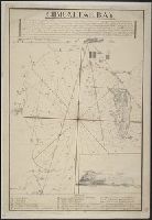
Published / Created:
[1800?]
Call Number:
399 1800
Container / Volume:
BRBL_00704
Image Count:
1
Resource Type:
Maps, Atlases & Globes
Description:
Drawing at bottom. and Key on bottom right hand corner.
Subject (Geographic):
Gibraltar--Maps, Manuscript--Early works to 1800
Found in:
Beinecke Rare Book and Manuscript Library > Gibraltar Bay.
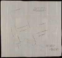
Published / Created:
[1870?]
Call Number:
766 N46 1870H
Container / Volume:
BRBL_00712
Image Count:
4
Resource Type:
Maps, Atlases & Globes
Alternative Title:
[Manuscript map of Drawings of New Haven. Both sides of the Mill River].
Description:
Title devised by cataloger.
Subject (Geographic):
New Haven (Conn.)--Maps, Manuscript
Found in:
Beinecke Rare Book and Manuscript Library > Manuscript maps of New Haven.
Branch:v1.61.8 ,Deployed:2024-06-20T11:14:46-04:00