Skip to search
Skip to main content
Skip to first result
Search
You Searched For
Genre
Manuscript maps
Resource Type
Maps, Atlases & Globes
New Search
Search Results
Creator:
Published / Created:
[1729]
Call Number:
BrSides Double Folio 2019 81
Image Count:
1
Resource Type:
Maps, Atlases & Globes
Description:
Mounted on linen.
Subject (Geographic):
Ladoga Lake (Russia)--Maps--Early works to 1800. and Shlisselʹburg (Russia)--Maps--Early works to 1800.
Subject (Topic):
Canals--Russia (Federation)--Leningradskai︠a︡ oblastʹ--Maps--Early works to 1800.
Found in:
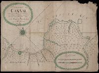
Beinecke Rare Book and Manuscript Library > Nieuwe kaarte van't canaal welke gegraven werd von Sleutelburg na nieu Ladoga / naukeurig opgesteld en getekend door Abraham Maas tot Sint Petersburg op d'oude Schans ter Ny 1729.
Published / Created:
1827
Call Number:
40 1840 (8) 618
Container / Volume:
BRBL_00200
Image Count:
1
Resource Type:
Maps, Atlases & Globes
Description:
In the text, "Marghera" is given as "Malghera.", Includes ten lines of tex, and Scale determined by comparison with a similar map by same surveyor. Bar scale on this map shown as 28mm = 100°. Above bar scale is written in later hand "1/8" = 1°, Tese di Parigi".
Publisher:
I.R. Direzione Locale del Genio di Venezia,
Subject (Geographic):
Mestre (Italy)--Maps
Found in:
Beinecke Rare Book and Manuscript Library > No. 1 [area around Marghera and Campalto, present day Mestre, near Venice, Italy] / firmato Castelli Capitano del Genio.
Published / Created:
1827
Call Number:
40 1840 (9) 617
Container / Volume:
BRBL_00200
Image Count:
1
Resource Type:
Maps, Atlases & Globes
Description:
Includes ten lines of text describing the survey and the various lines of limits and demarcations shown on the map, and mentions the Forte di St. Andrea and the Isole delle Vignole. and Scale determined by comparison with a present day map. Bar scale on this
Publisher:
I.R. Direzione del Genio di Venezia,
Subject (Geographic):
Venice (Italy)--Maps
Found in:
Beinecke Rare Book and Manuscript Library > No. 2 [area around Forte di St. Nicolo del Lido and La Certosa, Venice, Italy] / firmato Castelli Capitano del Genio, firmato gezeichnet vom Jacob Horkij Cadet et Sappefürher.
Published / Created:
1826
Call Number:
352 M85 1826
Container / Volume:
BRBL_00702
Image Count:
1
Resource Type:
Maps, Atlases & Globes
Description:
Color: ink with blue, red, orange, green., In French and Russian., Index to 20 Arrondisements on margin., Moscou, Imprimerie d'Auguste Semen, 1826., and Text in pamphlet box.
Publisher:
Imprimerie d'Auguste Semen,
Subject (Geographic):
Moscow (Russia)--Maps, Manuscript
Found in:
Beinecke Rare Book and Manuscript Library > Nouveau Plan de Moscou. Dressé par la Commission des bâtiments pour servir au Guide du Voyageur G.L. de Laveau.
Creator:
Published / Created:
An[n]o de 1768.
Call Number:
BrSides Elephant Folio 2018 13
Image Count:
1
Resource Type:
Maps, Atlases & Globes
Description:
Detached from cloth backing; manuscript note on verso of cloth backing, "Copie de la nouvelle carte manuscrite du nouveau Mexique.", Relief shown pictorially., Unidentified stamp in title cartouche, "Bibliotheque de [?].", Watermark., and With manuscript note in French in plain red cartouche signed "Grandjean De Fouchy" noting the copy was made for Jean-Baptiste Chappe d'Auteroche.
Subject (Geographic):
Mexico--Maps--Early works to 1800. and Southwest, Old--Maps--Early works to 1800.
Subject (Name):
Chappe d'Auteroche, abbé, 1728-1769 and Fouchy, Jean Paul Grandjean de.
Found in:
Beinecke Rare Book and Manuscript Library > Nuevo mapa geographico de la America Septentrional : perteneciente alvirreynato de Mexico / dedicado a los sabios miembros de lá Academia Real de la Ciencias de Paris, por sumy rendido servidor y capellan Don Josef Antonio de Alzate y Ramirez.
Published / Created:
[1780?]
Call Number:
40 P28 1780
Container / Volume:
BRBL_00705
Image Count:
1
Resource Type:
Maps, Atlases & Globes
Description:
Color: various shades of green and Notes: Drawing of male figure with a spear in bottom right hand corner.
Subject (Geographic):
Italy--Maps, Manuscript--Early works to 1800
Found in:
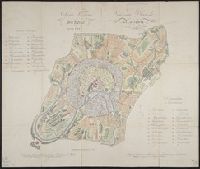
Beinecke Rare Book and Manuscript Library > Parco Nuovo Pavese delegazione XIII.
Published / Created:
[1780?]
Call Number:
40 P28 1780C
Container / Volume:
BRBL_00705
Image Count:
1
Resource Type:
Maps, Atlases & Globes
Description:
Color: various shades of green with some yellow detail. and Notes: Drawing of male figure in bottom right hand corner.
Subject (Geographic):
Italy--Maps, Manuscript--Early works to 1800
Found in:
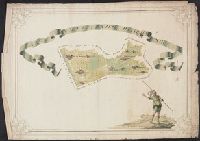
Beinecke Rare Book and Manuscript Library > Parco Vecchio Pavise Delegazione XII.
Published / Created:
1738
Call Number:
583 1738
Container / Volume:
BRBL_00707
Image Count:
1
Resource Type:
Maps, Atlases & Globes
Description:
Color: green, yellow. red detail.
Publisher:
Robt. Friund,
Subject (Geographic):
Malay Peninsula--Maps, Manuscript--Early works to 1800
Found in:
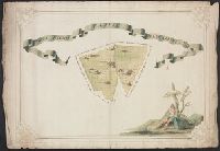
Beinecke Rare Book and Manuscript Library > Part of Malaya. Part of Tanasary.
Published / Created:
1717
Call Number:
461 B41 1717
Container / Volume:
BRBL_00706
Image Count:
1
Resource Type:
Maps, Atlases & Globes
Description:
Color: Green and pink with detail.
Subject (Geographic):
Yugoslavia--Maps, Manuscript--Early works to 1800
Found in:
Beinecke Rare Book and Manuscript Library > Pianta ... gran piazza de Belgrado ...
Published / Created:
[1830?]
Call Number:
40 M841 1830
Container / Volume:
BRBL_00705
Image Count:
1
Resource Type:
Maps, Atlases & Globes
Description:
Color: Pink, green and peach with some blue.
Subject (Geographic):
Mortara (Italy)--Maps, Manuscript
Found in:
Beinecke Rare Book and Manuscript Library > Pianta della Citta di Mortara.
Branch:v1.61.6 ,Deployed:2024-06-12T09:55:33-04:00