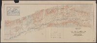
"Surveyed in 1909 and 1913 ; topography by Alaskan Branch, R.H. Sargent, topographic engineer.", Includes regional location map., and Relief shown by contours and spot heights.
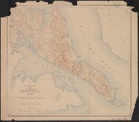
Contour interval 100 feet. Datum is mean sea level., Includes examples of "Conventional signs" used on the map in the upper right margin., and Relief shown by contours and spot heights.
Publisher:
Engraved and printed by the U.S. Geological Survey,
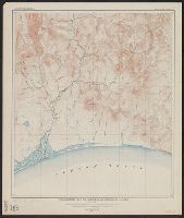
Contour interval 100 feet. Datum is mean sea level., Dissected and mounted on linen., Includes examples of "Conventional signs" used on the map in the upper right margin., and Relief shown by contours and spot heights.
Publisher:
Engraved and printed by the U.S. Geological Survey,
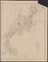
"Advance sheet. Subject to correction.", Includes inset index map showing areas mapped by individual topographers., Relief shown by contours and spot heights., and Topography by R.H. Sargent and C.G. Anderson.
Publisher:
Geological Survey,
Subject (Geographic):
Iditarod River Region (Alaska)--Maps, Innoko River Region (Alaska)--Maps, Kuskokwim Mountains (Alaska)--Maps, and Kuskokwin River Region (Alaska)--Maps
Subject (Name):
Anderson, C. G. (Cleland George), 1879- and Sargent, Rufus Harvey, b. 1875