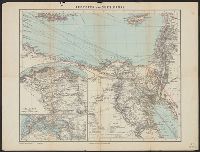
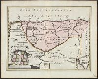
New England: the most remarqueable parts thus named by the high and mighty Prince Charles, nowe King of great Britaine [map] and Path-way to experience to erect a plantation.
Description:
Imperfect: damp-stained; added port. of Charles I., Map with portrait of Capt. Smith in corner: New England ... / observed and described by Captayn John Smith. 1614. Pendleton's Lithography, Boston. Drawn by J. Eddy. London, printed by Geor: Low., Signatures: A-F⁴., and Teaching resource: Professor John Mack Faragher, History 141: The American West.
Publisher:
Printed by I. Haviland, and are to be sold by R. Milbovrne,
Subject (Geographic):
Massachusetts--History--Colonial period, ca. 1600-1775, Massachusetts--Maps--Early works to 1800, New England--Description and travel, New England--History--Colonial period, ca. 1600-1775, and New England--Maps--Early works to 1800
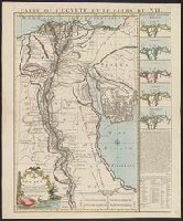
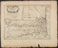
"Joannes Christophorus I.B. Homanni filius delineavit. Cum privilegio Sac. Caes. Majestatis.", Hand col. Sheet measures 65.5 x 56.5 cm., Includes illustrations of cataracts of the Nile, the pyramids, tombs, various antiquities, sce, and Relief shown by hachures.
Covers region of Egypt and Sudan adjoining the Nile River., Includes decorative cartouche with ill. of coins., and Relief shown pictorially.
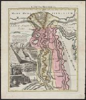
Publisher:
C. Weigel,
Subject (Geographic):
Egypt--Historical geography--Maps--Early works to 1800, Nile River Region--Historical geography--Maps--Early works to 1800, and Sudan--Historical geography--Maps--Early works to 1800
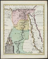
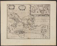
Appeared in Jansson's Accuratissima orbis antiqui delineatio., Covers also a portion of Libya., Manuscript notes on map. Manuscript number in upper left corner: 52., Oriented with north to the right., and Relief shown pictorially.
Subject (Geographic):
Egypt--Maps--Early works to 1800
Subject (Name):
Jansson, Jan, 1588-1664. Accuratissima orbis antiqui delineatio