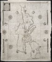
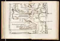
Navtica mediterranea / di Bartolomeo Crescentio Romano ... Nella quale si mostra la fabrica delle
Image Count:
1
Description:
Map bound in at end., Map cut and folded irregularly., Map done on two separate sheets and pasted together in center., Map has several small gray and black smudges on both the recto and verso that appear to be fingerprints left during the engraving process., Map has several small yellow and brown marks, most notably on verso, although one can be seen on recto in lower right section., and Scale [ca. 1:6,500,000].
Subject (Geographic):
Mediterranean Region --Maps --Early works to 1800 and Mediterranean Sea --Navigation --Early works to 1800
Subject (Topic):
Galleys --Early works to 1800, Navigation --Early works to 1800, and Pilot guides --Mediterranean Sea --Early works to 1800
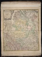
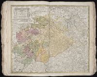
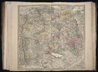
[Atlas factice of 50 maps, primarily by Johann Baptist Homann and/or issued by the Homann Erben
Image Count:
1
Publisher:
Edita sumtibus Homannianorum Heredum
Subject (Geographic):
Bremen (Germany : Duchy) --Maps --Early works to 1800, Hannover (Germany : Province) --Maps --Early works to 1800, Lower Saxony (Germany) --Maps --Early works to 1800, and Westphalia (Germany) --Maps --Early works to 1800
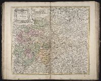
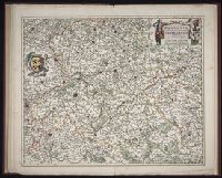
Anno a Christi natiuitate 1525. Tertio Kal'. Apriles.
Call Number:
1976 +325
Image Count:
1
Resource Type:
Books, Journals & Pamphlets
Description:
Each map is printed across two leaves of plates. Maps 1 to 49 are numbered and have text on recto of initial leaf; final map is unnumbered, has no text on recto of initial leaf., Imprint information from colophon (leaf Q8 recto)., Index ([68] p., third group) bound at end, after maps., Signatures: A-M⁶ N⁴ 0-P⁶ Q⁸ a-e⁶ f⁴., and Variant order of binding: index precedes maps. Autograph of Giovanni Battista Francino.
Publisher:
Iohannes Grieningerus, communibus Iohannis Koberger impensis excudebat,
Subject (Name):
Francino, Giovanni Battista,--1631-1698--Autograph. and Regiomontanus, Joannes, 1436-1476.