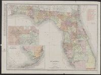
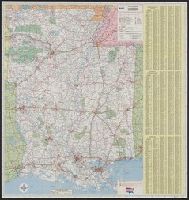
Rand, McNally & Co.'s New business atlas map of Florida
Description:
Includes table for identifying marked Florida railroads., Insets: Map showing part of Lake, Orange & Volusia Counties. [Scale ca. 1:321,870] -- Southern portion of Florida. [Scale ca. 1:1,203,840]., Prime meridian: Greenwich., and Relief shown by hachures.
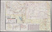
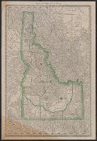
"0-5648-6.", At head of title: Sinclair., Includes indexes, ill., insets of "Waterton-Glacier International Peace Park, Alta.-Mont." and "Yellowstone and Grant Teton national parks, Wyo.," distance table, 3 local route maps, and text., and Relief shown pictorial
Publisher:
Rand McNally,
Subject (Geographic):
Idaho--Maps, Montana--Maps, and Wyoming--Maps
Subject (Name):
Sinclair Oil Corporation
Subject (Topic):
Roads--Idaho--Maps, Roads--Montana--Maps, and Roads--Wyoming--Maps
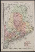
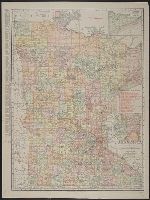
Rand McNally & Co.'s new business atlas map of Maine. and Rand-McNally indexed atlas.
Description:
Includes key to railroads., Indicates electric lines and steamship lines., Relief shown by hachures., and Title from copyright statement: Rand, McNally & Co.'s new business atlas map of Maine.
Publisher:
Rand, McNally & Co.,
Subject (Geographic):
Maine--Maps
Subject (Topic):
Electric lines--Maine--Maps, Railroads--Maine--Maps, and Steamboat lines--Maine--Maps
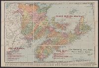
Rand, McNally & Co.'s New Brunswick, Nova Scotia, and Prince Edward Island and Rand, McNally & Co.'s New Business Atlas Map of the Maritime Provinces of Canada
Description:
"Copyright 1909, by Rand, McNally & Co. Copyright 1892, by Rand, McNally & Co.", Includes index of chief cities with their populations., Relief shown by hachures., and Shows railroads, lighthouses, counties, cities and towns, mountains, lakes, and rivers.
Publisher:
Rand, McNally & Co.,
Subject (Geographic):
New Brunswick--Maps, Nova Scotia--Maps, and Prince Edward Island--Maps
Subject (Topic):
Counties--New Brunswick--Maps, Counties--Nova Scotia--Maps, Lighthouses--New Brunswick--Maps, Lighthouses--Nova Scotia--Maps, Lighthouses--Prince Edward Island--Maps, and Railroads--New Brunswick--Maps
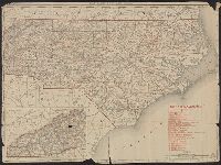
Rand, McNally & Co.'s New 11 x 14 map of North Carolina
Description:
Inset: Western portion of North Carolina)., Prime meridian: Greenwich., Printed in red: "North Carolina Railroads", Relief shown by hachures., and Verso:Index to counties and cities, figures on the extent of land and water areas, and population statistics.
"756747-8. 756747P-8.", Alternate title: Arkansas, Louisiana, Mississippi., and Ancillary maps on verso: Bull Shoals Recreation Area -- New Orleans and vicinity -- Business District, French Quarter [indexed] -- Hot Springs Nat'l Park [indexed] -- Shreveport, La. -- Baton Rouge, La. -- Jackson, Miss. -- Little Rock, Ark. -- Gulfport-Biloxi area.
Publisher:
Rand McNally & Co.,
Subject (Geographic):
Arkansas--Road maps, Louisiana--Road maps, and Mississippi--Road maps