Skip to search
Skip to main content
Skip to first result
Search
You Searched For
Language
English
New Search
Search Results
Published / Created:
1793
Call Number:
38 1793A
Container / Volume:
BRBL_00153
Image Count:
1
Resource Type:
Maps, Atlases & Globes
Publisher:
William Faden,
Subject (Geographic):
France--Maps--Early works to 1800
Found in:
Beinecke Rare Book and Manuscript Library > A map of the Northern part of France [and part of Belgium] to facilitate the knowledge ... by the Allied Armies against the French ...
Published / Created:
c1931.
Call Number:
831am P93 1931
Container / Volume:
BRBL_00581
Image Count:
1
Resource Type:
Maps, Atlases & Globes
Alternative Title:
Map of Prickly Pear gold mines :
Description:
Copyright: W. Smith., Includes text about significant historical events and places., Pictorial map., and Relief shown pictorially and by spot heights.
Publisher:
s.n.],
Subject (Geographic):
Helena Region (Mont.)--History--Maps
Subject (Name):
Smith, W
Subject (Topic):
Gold mines and mining--Montana--Prickly Pear Creek Valley--Maps
Found in:
Beinecke Rare Book and Manuscript Library > A map of the Prickley Pear gold mines : with stage routes, towns, principal streams & points of historic interest to the traveler.
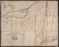
Published / Created:
1776
Call Number:
755 1776D
Container / Volume:
BRBL_00430
Image Count:
1
Resource Type:
Maps, Atlases & Globes
Description:
2 copies.
Publisher:
William Faden,
Subject (Geographic):
Canada--Maps--Early works to 1800 and New York (State)--Maps--Early works to 1800
Found in:
Beinecke Rare Book and Manuscript Library > A map of the Province of New York ... by Claude Joseph Sauthier ... New Jersey ... Engraved by Wm. Faden.
Published / Created:
[1827?]
Call Number:
735 1827
Container / Volume:
BRBL_00382
Image Count:
3
Resource Type:
Maps, Atlases & Globes
Publisher:
C. Smith & Son,
Subject (Geographic):
Ontario--Maps
Found in:
Beinecke Rare Book and Manuscript Library > A map of the Province of Upper Canada and the adjacent territories in North American compiled by James G. Chewett ...
Creator:
Published / Created:
[approximately 1745]
Call Number:
BrSides 2019 87
Image Count:
1
Resource Type:
Maps, Atlases & Globes
Description:
"No. 58" at bottom left; "Plate XLII. Vol. 2 page 159" at bottom right., Coordinates not present on map and are approximated., Relief shown pictorially and by soundings., Shows topography, waterways, routes, settlements., and Watermark.
Publisher:
[publisher not identified],
Subject (Geographic):
Gambia River--Maps--Early works to 1800. and Gambia--Maps--Early works to 1800.
Subject (Name):
Kitchin, Thomas, 1718-1784
Found in:
Beinecke Rare Book and Manuscript Library > A map of the River Gambra from Eropina to Barrakunda / by Captn. John Leach in 1732 ; Thos. Kitchin sculpt.
Published / Created:
1816
Call Number:
56 1816
Container / Volume:
BRBL_00295
Image Count:
1
Resource Type:
Maps, Atlases & Globes
Subject (Geographic):
China--Maps
Found in:
Beinecke Rare Book and Manuscript Library > A map of the Route of the British Embassy, from the mouth of the Peiho River, to Pekin and from thence to Canton, in the year 1816.
Published / Created:
1789
Call Number:
331 1789
Container / Volume:
BRBL_00078
Image Count:
1
Resource Type:
Maps, Atlases & Globes
Publisher:
W. Faden,
Subject (Geographic):
Netherlands--Maps--Early works to 1800
Found in:
Beinecke Rare Book and Manuscript Library > A map of the Seven United Provinces ... By W. Faden ... 1789.
Creator:
Published / Created:
1864
Call Number:
844 Al65 1864
Container / Volume:
BRBL_00604
Image Count:
1
Resource Type:
Maps, Atlases & Globes
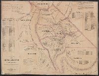
Alternative Title:
Silver Mountain mining districts
Description:
Includes tables of distances and altitudes and indexes of mines., Oriented with north toward the upper right., Relief shown by hachures and spot heights., and Shows drainage, roads, etc.
Publisher:
H.H. Bancroft & Co.,
Subject (Geographic):
Alpine County (Calif.)--Maps
Subject (Name):
H.H. Bancroft and Company and Kuchel, Charles Conrad, b. 1820
Subject (Topic):
Mines and mineral resources--California--Alpine County--Maps and Mining districts--California--Alpine County--Maps
Found in:
Beinecke Rare Book and Manuscript Library > A map of the Silver Mountain mining districts : including the territory of the proposed new county of Alpine [Calif.] / compiled by Theron Reed.
Call Number:
771gmb 1808
Container / Volume:
BRBL_00494
Image Count:
1
Resource Type:
Maps, Atlases & Globes
Subject (Geographic):
New York (N.Y.)--Maps
Found in:
Beinecke Rare Book and Manuscript Library > A map of the State of New York ... including the Turnpike Roads ... By Wm. McGalpin, Oxford, 1808.
Branch:v1.61.8 ,Deployed:2024-06-20T11:14:48-04:00