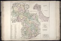
No. 18 of 43 maps bound together in composite atlas., Reduite d'apres la grande carte pour trouver facilement ce qu'on a envie de chercher dans celle-la., Relief shown pictorially., Scale [ca 1:3,750,000]., Table alphabetique des villes ... qui se trouvent dans cette carte., and With inset map: Morceau detache qui represente l'acroissement des etats de sa majeste le roi de Sardaigne, depuis l'an 1680.
Chart of the northwest coast of America and the northeast coast of Asia, explored in the years 1778 and 1779
Description:
Includes notes., No. 34 of 43 maps bound together in composite atlas., Prepared by Lieut. Heny. Roberts, under the immediate inspection of Capt. Cook ; engraved by W. Palmer., Relief shown pictorially. Depths shown by soundings., and Scale [ca. 1:13,500,000].
Publisher:
Wm. Faden, geographer to the King, Charing Cross
Subject (Geographic):
Bering Strait Region --Discovery and exploration --Maps --Early works to 1800, North America --Discovery and exploration --Maps --Early works to 1800, Pacific Coast (North America) --Discovery and exploration --Maps --Early works to 1800, and Russian Far east (Russia) --Discovery and exploration --Maps --Early works to 1800
Subject (Name):
Cook, James, 1728-1779
Subject (Topic):
Discoveries in geography --Maps --Early works to 1800