Skip to search
Skip to main content
Skip to first result
Search
You Searched For
Format
cartographic
Resource Type
Maps, Atlases & Globes
New Search
Search Results
Creator:
Call Number:
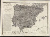
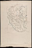
39hc 1823
Container / Volume:
BRBL_00192
Image Count:
1
Resource Type:
Maps, Atlases & Globes
Description:
Mounted on linen. and Relief shown by hachures.
Subject (Geographic):
Spain--History--Napoleonic Conquest, 1808-1813--Maps and Spain--Maps
Subject (Name):
Bordiga, Giovanni Battista, 1799-
Subject (Topic):
Peninsular War, 1807-1814--Maps
Found in:
Beinecke Rare Book and Manuscript Library > Carta generale delle Spagne : per servire alla storia militare delle campagne sostenute dalle varie divisioni italiane dal 1808 al 1813 ... / Cre. Vacani disegno ; Gio. Bordiga incise.
Published / Created:
[1910?]
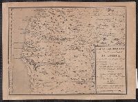
Call Number:
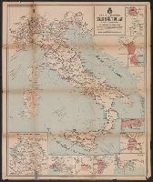
40gm 1910
Container / Volume:
BRBL_00229
Image Count:
2
Resource Type:
Maps, Atlases & Globes
Alternative Title:
Carta delle ferrovie principali di Europa della Colonia Eritrea e della Libia
Description:
Includes 10 inset maps, each showing a close-up view of a city or region.
Publisher:
Fratelli Pozzo,
Subject (Geographic):
Europe--Maps and Italy--Maps
Subject (Topic):
Ocean travel--Adriatic Sea--Maps, Ocean travel--Western Mediterranean--Maps, and Railroads--Italy--Maps
Found in:
Beinecke Rare Book and Manuscript Library > Carta generale delle strade ferrate Italiane e linee di navigazione.
Published / Created:
[1850]
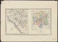
Call Number:
40 R66 1850
Container / Volume:
BRBL_00217
Image Count:
1
Resource Type:
Maps, Atlases & Globes
Description:
In lower right corner: La Farina. L'Italia Vol 2. and Individual maps titled: Regiones Urbi Adjacentes; Roma Vetus.
Publisher:
La Farina,
Subject (Geographic):
Rome (Italy : Province)--Maps and Rome (Italy)--Maps
Found in:
Beinecke Rare Book and Manuscript Library > Carta geografica dei dintorni di Roma antica, Pianta topografica di Roma antica.
Published / Created:
1911
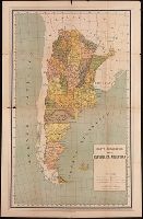
Call Number:
BrSides Double Folio 2019 94
Image Count:
2
Resource Type:
Maps, Atlases & Globes
Alternative Title:
Ricordo della repubblica Argentina all' Esposizione Internazionale delle Industrie e del Lavoro di Torino, 1911
Description:
Descriptive text on verso compiled by Alberto B. Martinez. and Relief shown by hachure.
Publisher:
Comite argentino,
Subject (Geographic):
Argentina--Description and travel and Argentina--Maps
Subject (Name):
Martínez, Alberto B.
Found in:
Beinecke Rare Book and Manuscript Library > Carta geografica della repubblica Argentina.
Published / Created:
1845]
Call Number:
88 1845D
Container / Volume:
BRBL_00645
Image Count:
1
Resource Type:
Maps, Atlases & Globes
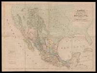
Description:
"Engraved by B.R. Davies, 16 George Str. Euston Squ., London. From the original survey made by order of the Mexican Government.", "Esta edicion se hace provicionalmente mientras se concluye la Carta en Escala mayor. Pedro Garcia Conde.", Prime meridian: Mexico City., and Relief shown by hachures.
Publisher:
s.n.,
Subject (Geographic):
Mexico--Maps and West (U.S.)--Maps
Subject (Name):
Davies, Benjamin Rees and García Conde, Pedro, 1806-1851
Found in:
Beinecke Rare Book and Manuscript Library > Carta geografica general de la republica Mexicana / formada el ano de 1845, con los datos que reunio la seccion de Geografia del Ministerio de la Guerra, por el General de Brigada Pedro Garcia Conde.
Creator:
Published / Created:
1750]
Call Number:
40 1760A
Container / Volume:
BRBL_00197
Image Count:
1
Resource Type:
Maps, Atlases & Globes
Description:
Appears in Guillaume de l'Isle's Atlante novissimo, vol. 2, pl. 17 (plate only num, Imperfect: Mutilated, with some loss of text. Mounted on linen. Sheet measures 38 x 49 cm. dgvmp2008., Includes scale in Italian miles., and Inset: Il regno di Sicilia.
Publisher:
Giambatista Albrizzi q. Girol.,
Subject (Geographic):
Italy--Maps--Early works to 1800
Found in:
Beinecke Rare Book and Manuscript Library > Carta geografica generale dell' Italia.
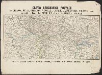
Published / Created:
[1858?]
Call Number:
40 M59 1858
Container / Volume:
BRBL_00211
Image Count:
1
Resource Type:
Maps, Atlases & Globes
Publisher:
Cesare Crivelli,
Subject (Geographic):
Italy, Northern--Maps
Found in:
Beinecke Rare Book and Manuscript Library > Carta geografica postale da Milano, Pavia, Piacenza, Vercelli, Casale, Alessandria, Voghera, ecc. : nonchè la linea del fiume po' sino a Mantova e Verona.
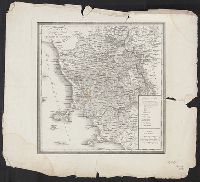
Published / Created:
[1835?]
Call Number:
405 1835
Container / Volume:
BRBL_00235
Image Count:
1
Resource Type:
Maps, Atlases & Globes
Publisher:
Presso Luigi Demicheli,
Subject (Geographic):
Tuscany (Italy)--Maps
Subject (Topic):
Post roads--Italy--Tuscany--Maps
Found in:
Beinecke Rare Book and Manuscript Library > Carta geografica postale del gran ducato di Toscana.
Published / Created:
[between 1840 and 1849?]
Call Number:
BrSides Double Folio 2018 104
Image Count:
1
Resource Type:
Maps, Atlases & Globes
Description:
Cartographer's name in lower right corner illegible., Coordinates not present on map and are approximated., Manuscript number at bottom: 334., and Manuscript number on verso: 2170.
Subject (Geographic):
Lombardy (Italy)--Maps.
Found in:
Beinecke Rare Book and Manuscript Library > Carta geographia della provincia di Milano.
Creator:
Published / Created:
[1887?]
Call Number:
651 1887
Container / Volume:
BRBL_00342
Image Count:
1
Resource Type:
Maps, Atlases & Globes
Description:
Coordinates not present on map and are approximated. and Relief shown pictorially.
Publisher:
[Sociedade de Geografia de Lisboa],
Subject (Geographic):
Angola--Maps
Found in:
Beinecke Rare Book and Manuscript Library > Carta geographica da Costa occidental da Africa : comprehendida entre 5° e 19° de Lat. śul, mostrande parte de Congo e os Reinos de Angola, Benguella etc. / desenhada pelo Tene. Coronel Engo. L.C.C. Pinheiro Furtado em 1790 ; gravada em Pariz por ordem d
Branch:v1.61.8 ,Deployed:2024-06-20T11:14:46-04:00