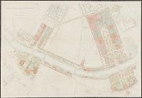
Exposition universelle internationale de 1900 a Paris : rapport general administratif et technique
Image Count:
1
Description:
Four plans, partly col., 90 x 130 cm. folded to 27 x 18 cm., in box with title: Exposition universelle international de 1900 a Paris ... plans generaux.
Publisher:
Imprimerie nationale
Subject (Geographic):
France
Subject (Name):
Exposition universelle internationale de 1900 (Paris, France)
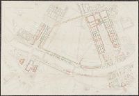
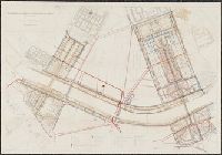
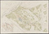
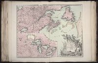
Haussard, C Robert de Vaugondy, Gilles, 1688-1766, creator
Published / Created:
1755
Call Number:
2003 Folio 85
Image Count:
1
Description:
Avec privilege 1755., BEIN 2003 Folio 85: No. 13 of 45 maps bound together with binder's spine title: Atlas of America; ms. table of contents. Bookplate: Robinson. Bookplate of Paul Mellon., C. Haussard sculp., From the author's Atlas universel. 1757[-1758]., Hand colored., Inset of Supplement pour les lacs du Canada. Scale [ca. 1:5,500,000]., par le Sr. Robert de Vaugondy, geog? ordinaire du Roy., Relief shown pictorially., and Scale [ca. 1:4,000,000].
Subject (Geographic):
Canada -- Maps -- Early works to 1800 and New France -- Maps -- Early works to 1800