Skip to search
Skip to main content
Skip to first result
Search
You Searched For
Date
1800 - 1999
Genre
Maps
Date Created
1800 to 1999
New Search
Search Results
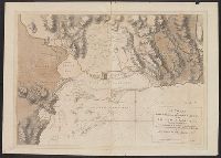
Published / Created:
1870]
Call Number:
8555cea K61 1780
Container / Volume:
BRBL_00642
Image Count:
1
Resource Type:
Maps, Atlases & Globes
Publisher:
s. n.,
Subject (Geographic):
Jamaica--Maps
Found in:
Beinecke Rare Book and Manuscript Library > A Chart of Port Royal and Kingston Harbours in the Island of Jamaica... / by Jos. Fred. W. des Barres.
Published / Created:
1812
Call Number:
29 1812
Container / Volume:
BRBL_00028
Image Count:
1
Resource Type:
Maps, Atlases & Globes
Description:
Preliminary record.
Publisher:
Black, Parry & Co.,
Subject (Geographic):
Indian Ocean--Maps
Found in:
Beinecke Rare Book and Manuscript Library > A Chart of the Great Ethiopian Archipelago in the Indian Seas ... M.D. Apres. For the History of Mauritus by Ch. Grant ... 1801 S.J. Neele Sculp. 1812.
Creator:
Published / Created:
1810
Call Number:
GA405 +W44 (LC)
Collection Title:
Mapping the transmississippi West, 1540-1861
Image Count:
1
Description:
Bound in between p. 24-25. and Map 297 from table of contents.
Publisher:
C. & A. Conrad, & Co
Subject (Geographic):
Louisiana--Maps, New Mexico--Maps, North America--Maps, and West (U.S.)--Maps
Collection Created:
San Francisco, Institute of Historical Cartography, 1957-63
Found in:
Beinecke Rare Book and Manuscript Library > A Chart of the Internal Part of Louisiana, Including all the hitherto unexplored Countries, lying between the River La Platte of the Missouri on the N: and the Red River on the S: the Mississippi East and the Mountains of Mexico West; with a Part of New M
Published / Created:
1825
Call Number:
23cea 1825
Container / Volume:
BRBL_00021
Image Count:
2
Resource Type:
Maps, Atlases & Globes
Description:
Covers the coast from 21° 30' North to 7° South Latitude. and Preliminary record.
Publisher:
Richard Patten,
Subject (Geographic):
Pacific Ocean--Maps
Found in:
Beinecke Rare Book and Manuscript Library > A Chart of the West Coast of America ... from the latest Spanish surveys. Engraved by J.M. Taylor, NY.
Published / Created:
1849
Call Number:
771 1779
Container / Volume:
BRBL_00477
Image Count:
1
Resource Type:
Maps, Atlases & Globes
Description:
Reproduction.
Publisher:
H. Pease,
Subject (Geographic):
New York--Maps--Early works to 1800
Found in:
Beinecke Rare Book and Manuscript Library > A Chorographical map of the Province of New York in North America, divided into counties, manors towns, patents and townships ... by Claude J. Sauthier ... London ... William Faden,1779.
Published / Created:
ca. 1880]
Call Number:
30 1880A
Container / Volume:
BRBL_00032
Image Count:
1
Resource Type:
Maps, Atlases & Globes
Description:
Ancillary text: A chave do enigma. and Caricature map depicting countries as humans or animals.
Subject (Geographic):
Europe--Maps
Subject (Topic):
Caricature--Europe--Maps and Russo-Turkish War, 1877-1878--Maps
Found in:
Beinecke Rare Book and Manuscript Library > A Europa em 1877 : mappa burlesco da guerra / por Abdul-Azis ; Livrarie Ferreira, editora ... ; Lith. Palhares ...
Published / Created:
1808
Call Number:
89cea 1808
Container / Volume:
BRBL_00658
Image Count:
4
Resource Type:
Maps, Atlases & Globes
Description:
Inset: Chart of the Virgin Islands.
Publisher:
W.Faden,
Subject (Geographic):
Central America--Maps
Found in:
Beinecke Rare Book and Manuscript Library > A General Chart of the West Indies and Gulf of Mexico, describing the Gulf and Winward Passages, Coasts of Florida, Louisiana and Mexico, Bay of Honduras and Musquito Shore ... Drawn from the surveys taken by Mr. Geo Gaulo ... by Foss Dessiou.
Published / Created:
[1822?]
Call Number:
767CA 1822
Container / Volume:
BRBL_00476
Image Count:
1
Resource Type:
Maps, Atlases & Globes
Description:
Engraved by A. Doolittle,1822.
Subject (Geographic):
Connecticut--Maps
Found in:
Beinecke Rare Book and Manuscript Library > A Geological Map of the Connecticut.
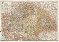
Creator:
Published / Created:
1913
Call Number:
43 1913
Container / Volume:
BRBL_00250
Image Count:
1
Resource Type:
Maps, Atlases & Globes
Publisher:
Magyar földrajzi intézet,
Subject (Geographic):
Hungary--Political and administrative divisions--Maps
Found in:
Beinecke Rare Book and Manuscript Library > A Magyar korona országainak közigazgatási térképe / tervezte és rajzolta Kogutowicz Manó.
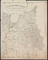
Published / Created:
1919?]
Call Number:
11hcf 1919B-20-7
Container / Volume:
BRBL_00010P
Image Count:
2
Resource Type:
Maps, Atlases & Globes
Alternative Title:
The Nationalities in the Roumanian territory of Hungary (Transylvania, the Adjoining Counties and the Banat)
Description:
"This map is a facsimile reproduction of the original map, published in addition to the book "The Races of Hungary," (A nepfajok Magyarorszagon), by the Hungarian professor Paul Balogh..." and 2 attached sheets with text in English.
Publisher:
The Roumanian National League of America,
Subject (Geographic):
Hungary--Maps and Romania--Maps
Found in:
Beinecke Rare Book and Manuscript Library > A Magyarorszagi Nepfajok Az Ország Mélyén / Tervezte: Balogh Pál ; Rajzolta: Br. Proff Kocsárd.
Branch:v1.61.8 ,Deployed:2024-06-20T11:14:55-04:00