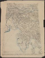
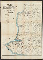
"Approximate scale in center of diagram 1:150,000, vertical exaggeration about 1 1/2 times.", 11hcf 1919E: Hand col. Sheet 1 with typed descriptive notes attached., and Relief shown by shading, land form drawing, hachures and spot heights.
Publisher:
American Geographical Society,
Subject (Geographic):
Friuli (Italy)--Maps, Istria (Croatia and Slovenia)--Maps, and Trieste Region (Italy)--Maps
Subject (Topic):
Block diagrams--Friuli (Italy : Province) and Block diagrams--Istria (Croatia and Slovenia)
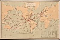
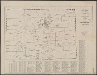
Includes "Table showing distances in miles between commercial ports of the world and distances saved by the Nicaragua Canal." and Shows "present routes" in black and "new routes via Nicaragua canal" in red.
Publisher:
Julius Bein & Co., Photo. Lith.,
Subject (Geographic):
Nicaragua Canal (Nicaragua)--Maps. and Nicaragua--Nicaragua Canal
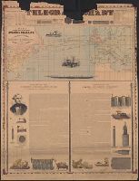
Incl. ill., 2 texts: [1.] Account of the invention and operation of the magnetic telegraph -- [2.] Description of making and laying submarine telegraph cables.
Publisher:
H.H. Lloyd & Co.,
Subject (Geographic):
Atlantic Ocean--Maps
Subject (Topic):
Cables, Submarine--Atlantic Ocean--Maps and Telegraph cables--Atlantic Ocean--Maps
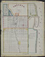
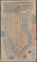
Citizens and travelers guide map into and from the City of New York and adjacent places and Guide map of New York City
Description:
Imperfect: mutilated, with some loss of text., Includes tourist information and inset map, Oriented with north to the upper left., Shows docks, local transit and ferry lines and radial distances from city hall., and Shows Manhattan south of 63rd St.
Publisher:
C.W. Hobbs,
Subject (Geographic):
Bronx (New York, N.Y.)--Maps, Manhattan (New York, N.Y.)--Maps, and New York (N.Y.)--Maps
Subject (Name):
Rand, Avery & Co
Subject (Topic):
Docks--New York (State)--Manhattan (N.Y.)--Maps and Local transit--New York (State)--Manhattan (N.Y.)--Maps
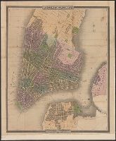
Engraved and printed by S. Stiles & Co. and Engraving tinted to show wards, squares, cemeteries, public buildings, the Navy yard, ect. Also shows ferry boat docks and distances of ferry travel.
Below title: Map no. 405., Copyright: American Map Company, New York., Date from stamp: Mar 20 1931., Indexed., and Shows county seats and boundaries, with few other towns.
Publisher:
American Map Company,
Subject (Geographic):
Colorado--Administrative and political divisions--Maps and Colorado--Maps