Skip to search
Skip to main content
Skip to first result
Search
You Searched For
Genre
Maps
Creator
Great Britain. War Office. General Staff. Geographical Section
New Search
Search Results
Creator:
Published / Created:
1918
Call Number:
11hcf 1919D-4
Container / Volume:
BRBL_00010X
Image Count:
1
Resource Type:
Maps, Atlases & Globes
Alternative Title:
G.S.G.S. ; 3703a and GSGS (Series) ; 3703a.
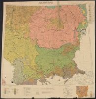
Description:
Includes ancillary map showing density of population.
Publisher:
War Office,
Subject (Geographic):
Balkan Peninsula--Maps
Subject (Topic):
Ethnology--Balkan Peninsula--Maps
Found in:
Beinecke Rare Book and Manuscript Library > South East Europe, ethnographical map [cartographic material].
Creator:
Published / Created:
1918
Call Number:
53ed 1918
Container / Volume:
BRBL_00286
Image Count:
1
Resource Type:
Maps, Atlases & Globes
Alternative Title:
G.S.G.S. ; 3703a and GSGS (Series) ; 3703a.
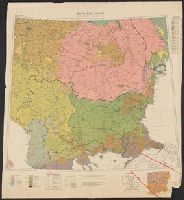
Description:
Includes ancillary map showing density of population.
Publisher:
War Office,
Subject (Geographic):
Balkan Peninsula--Maps
Subject (Topic):
Ethnology--Balkan Peninsula--Maps
Found in:
Beinecke Rare Book and Manuscript Library > South East Europe, ethnographical map [cartographic material].
Creator:
Published / Created:
1918
Call Number:
186 1918
Container / Volume:
BRBL_00013
Image Count:
1
Resource Type:
Maps, Atlases & Globes
Description:
"Ordnance Survey, August, 1918." and Insets: [1.] Bear Island. Scale 1:1,000,000 -- [2. Map of northern Europe.] Scale 1:35,000,000.
Publisher:
[GSGS, War Office],
Subject (Geographic):
Svalbard (Norway)--Maps
Found in:
Beinecke Rare Book and Manuscript Library > Spitsbergen, GSGS 2877.
Creator:
Published / Created:
1943
Call Number:
213 Sa59 1943
Container / Volume:
BRBL_00015
Image Count:
1
Resource Type:
Maps, Atlases & Globes
Alternative Title:
G.S.,G.S., ; 4118 and GSGS (Series) ; 4118.
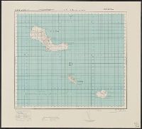
Description:
Elevations shown by form lines and spot heights., In upper margin: Cape Verde ids. ..., Index map cataloged with G. S. G. S. 4117., and Military grid.
Publisher:
Army Map Service, U.S. Army,
Subject (Geographic):
Santa Luzia Island (Cape Verde)--Maps, Topographic
Found in:
Beinecke Rare Book and Manuscript Library > Sta. Luzia and islands / drawn at War Office, 1940, from a Portuguese map of 1932.
Creator:
Published / Created:
1943
Call Number:
213 Sa 58 1943
Container / Volume:
BRBL_00015
Image Count:
1
Resource Type:
Maps, Atlases & Globes
Alternative Title:
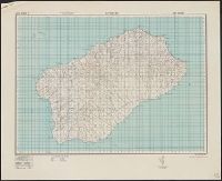
G.S.G.S. ; 4117 and GSGS (Series) ; 4117.
Description:
Elevations shown by form lines and spot heights., In upper margin: Cape Verde ids ..., and Military grid.
Publisher:
Army Map Service, U. S. Army,
Subject (Geographic):
Santo Antão Island (Cape Verde)--Maps, Topographic
Found in:
Beinecke Rare Book and Manuscript Library > Sto Antão / drawn at War Office, 1940, from a Portuguese map of 1930.
Creator:
Published / Created:
1928
Call Number:
615 1928
Container / Volume:
BRBL_00332
Image Count:
1
Resource Type:
Maps, Atlases & Globes
Alternative Title:
Geographical Section General Staff ; 2692 and GSGS (Series) ; 2692.
Description:
Relief shown by shading. and Shows: international and administrative boundaries, railways, roads, marsh.
Publisher:
G.S.G.S.,
Subject (Geographic):
Sudan--Maps
Found in:
Beinecke Rare Book and Manuscript Library > The Anglo-Egyptian Sudan [cartographic material].
Creator:
Published / Created:
1942
Call Number:
212 1942
Container / Volume:
BRBL_00014
Image Count:
1
Resource Type:
Maps, Atlases & Globes
Alternative Title:
Geographical section. General staff ; no. 4331 and GSGS (Series) ; 4331.
Description:
Military grid. and Spot heights in meters.
Publisher:
Army Map Service, U.S. Army,
Subject (Geographic):
Azores--Maps
Found in:
Beinecke Rare Book and Manuscript Library > The Azores. Compiled and drawn at the War Office, 1942.
Creator:
Published / Created:
1940
Call Number:
342 1944
Container / Volume:
BRBL_00092
Image Count:
2
Resource Type:
Maps, Atlases & Globes
Alternative Title:
G.S.G.S. ; 4139 and GSGS (Series) ; 4139.
Description:
Contents: North sheet -- South sheet., Contours at 50 meters interval., Copied from a Danish map of 1932., Four classes of roads are shown., and Military grid.
Publisher:
War Office,
Subject (Geographic):
Faroe Islands--Maps
Found in:
Beinecke Rare Book and Manuscript Library > The Faeroes / Drawn at the War Office, 1940, from a Danish map of 1932.
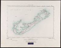
Creator:
Published / Created:
1927
Call Number:
BrSides Folio 2018 131
Image Count:
1
Resource Type:
Maps, Atlases & Globes
Alternative Title:
GSGS (Series) ; 3857
Description:
"250/27.", "Surveyed in 1898-99.", Bookseller's label at bottom of sheet: International Map Company, Inc. ... New York. N.Y., Relief shown by spot heights (in feet)., and Shows roads (2 categories) and parish boundaries.
Publisher:
Ordnance Survey Office,
Subject (Geographic):
Bermuda Islands--Maps.
Subject (Name):
Great Britain. Ordnance Survey and International Map Company
Found in:
Beinecke Rare Book and Manuscript Library > The islands of Bermuda [cartographic material].
Branch:v1.61.8 ,Deployed:2024-06-20T11:15:15-04:00