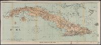
"482.", "Date of publication July 1898.", "To accompany report of Major General Commanding for 1898" outside lower margin., Includes compass rose., and Relief shown by hachures. Depths shown by soundings and isolines.
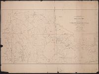
Outline map of the United States and Middle America showing proposed routes of the Pacific Rail Road and its branches in connection with the various systems of existing and unfinished rail roads from the Mississippi Valley to the Atlantic and Gulf coasts.
Description:
A table of distances appears to the right of the map., Designed to accompany Senator William Gwin's Congressional Bill of 1852., and Lithograph, printed in black with rail routes in red.
Publisher:
General Land Office,
Subject (Name):
Pacific Railroad and United States. General Land Office
Subject (Topic):
Railroads--North America--Maps and Railroads--United States--Maps
Geological and Geographical Survey of the Territories (U.S.)
Published / Created:
1879
Call Number:
80cbj 1879
Container / Volume:
BRBL_00537
Image Count:
1
Resource Type:
Maps, Atlases & Globes
Description:
Relief shown by hachures and spot heights.
Publisher:
the Survey,
Subject (Geographic):
Green River Watershed (Wyo.-Utah)--Maps
Subject (Name):
Bechler, G. R, Chittenden, George B, Clark, Fred A, Gannett, Henry, 1846-1914, Hayden, F. V. (Ferdinand Vandeveer), 1829-1887, Julius Bien & Co, and Wilson, A. D. (Allen D.)
Subject (Topic):
Watersheds--Idaho--Maps, Watersheds--Utah--Maps, and Watersheds--Wyoming--Maps
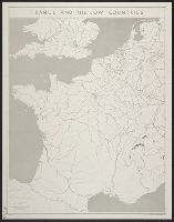
United States. Office of Strategic Services. Research and Analysis Branch
Published / Created:
1943
Call Number:
38gme 1943B
Container / Volume:
BRBL_00171
Image Count:
1
Resource Type:
Maps, Atlases & Globes
Description:
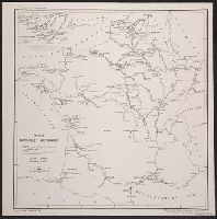
"Map no. 2318 (supersedes map no. 641); revised 14 July 1943.", Inset: Paris and environs., and Shows: international boundaries, railways (4 categories).