Great Britain. War Office. General Staff. Geographical Section
Published / Created:
[1918?]
Call Number:
36 K54 1918
Container / Volume:
BRBL_00124
Image Count:
1
Resource Type:
Maps, Atlases & Globes
Alternative Title:
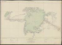
Helgoland und Düne, Sketch map showing southern portion of Jutland Peninsula and Heligoland., and The Kaiser Wilhelm Canal.
Description:
"Dec. 1918"--In lower right corner of margin., The Kaiser Wilhelm Canal -- Helgoland und Düne -- Sketch map showing southern portion of Jutland Peninsula & Heligoland., and Title from top margin.
Publisher:
War Office,
Subject (Geographic):
Helgoland (Germany)--Maps, Kiel Canal (Germany)--Maps, and Schleswig-Holstein (Germany)--Maps
Great Britain. War Office. General Staff. Geographical Section
Published / Created:
1945
Call Number:
5855 1945
Container / Volume:
BRBL_00315
Image Count:
1
Resource Type:
Maps, Atlases & Globes
Alternative Title:
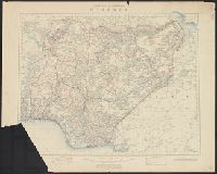
G.S.G.S. ; no. 4474, GSGS (Series) ; no. 4474., and Kota Bharu
Description:
"Copied from a map prepared by Survey Department F.M.S., dated 1937. Revised, and roads reclassified by I.S.T.D., 1945. Photolithographed by the War Office, 1945." and Stamped "AMS 1 324197".