Skip to search
Skip to main content
Skip to first result
Search
You Searched For
Extent of Digitization
Completely digitized
Format
cartographic
Publication Place
Paris
New Search
Search Results
Creator:
Published / Created:
1645
Call Number:
1983 Folio 19
Collection Title:
[Atlas factice of 96 maps by Blaeu, Visscher, Jansson, Hondius and others]
Image Count:
1
Description:
Numbered 58 on verso. and Reinforced along lower edges with manuscript waste. Sheet measures 39.5 x 51.7 cm. No. 54 of 92 maps bound together.
Publisher:
N. Berey
Subject (Geographic):
Boulonnais (France) --Maps --Early works to 1800 and Pas-de-Calais (France) --Maps --Early works to 1800
Found in:
Beinecke Rare Book and Manuscript Library > Boulonnois, Pontieu, Artois, Comte de S. Paul et Pays de la Locoue
Creator:
Published / Created:
1643
Call Number:
1983 Folio 19
Collection Title:
[Atlas factice of 96 maps by Blaeu, Visscher, Jansson, Hondius and others]
Image Count:
1
Description:
Sheet measures 39.1 x 51.3 cm. Reinforced along lower edges with manuscript waste. No. 37 of 92 maps bound together.
Publisher:
[Pierre Mariette]
Subject (Geographic):
Auvergne (France) --Maps --Early works to 1800
Collection Created:
[1556-1680]
Found in:
Beinecke Rare Book and Manuscript Library > Carte d'Auuergne
Creator:
Published / Created:
[ca. 1634]
Call Number:
1983 Folio 19
Collection Title:
[Atlas factice of 96 maps by Blaeu, Visscher, Jansson, Hondius and others]
Image Count:
1
Description:
Sheet measures 39.1 x 51.3 cm. Reinforced along lower edges with manuscript waste. No. 38 of 92 maps bound together.
Publisher:
Christophe Tassin
Subject (Geographic):
Berry (France) --Maps --Early works to 1800
Found in:
Beinecke Rare Book and Manuscript Library > Carte de Berry
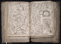
Creator:
Published / Created:
[1634]
Call Number:
1983 Folio 19
Collection Title:
[Atlas factice of 96 maps by Blaeu, Visscher, Jansson, Hondius and others]
Image Count:
1
Description:
Imperfect: wormhole in center crease, with some loss of text. Reinforced along lower edges with manuscript waste. Sheet measures 38.8 x 51.6 cm. No. 34 of 92 maps bound together.
Publisher:
Christophe Tassin
Subject (Geographic):
Bresse (France : Region) --Maps --Early works to 1800
Found in:
Beinecke Rare Book and Manuscript Library > Carte de Bresse
Creator:
Published / Created:
[1634]
Call Number:
1983 Folio 19
Collection Title:
[Atlas factice of 96 maps by Blaeu, Visscher, Jansson, Hondius and others]
Image Count:
1
Description:
Imperfect: wormhole in center crease, with no loss of text. Reinforced along lower edges with manuscript waste. Sheet measures 38.9 x 51.5 cm. No. 33 of 92 maps bound together.
Publisher:
Christophe Tassin
Subject (Geographic):
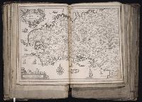
Brittany (France) --Maps --Early works to 1800
Found in:
Beinecke Rare Book and Manuscript Library > Carte de Bretagne
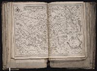
Creator:
Published / Created:
[1634?]
Call Number:
1983 Folio 19
Collection Title:
[Atlas factice of 96 maps by Blaeu, Visscher, Jansson, Hondius and others]
Image Count:
1
Description:
Sheet measures 39 x 51.5 cm. Reinforced along lower edges with manuscript waste. No. 40 of 92 maps bound together.
Publisher:
s.n
Subject (Geographic):
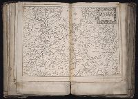
Dauphine (France) --Maps --Early works to 1800
Found in:
Beinecke Rare Book and Manuscript Library > Carte de Dauphine
Creator:
Published / Created:
1645
Call Number:
1983 Folio 19
Collection Title:
[Atlas factice of 96 maps by Blaeu, Visscher, Jansson, Hondius and others]
Image Count:
1
Description:
Numbered 61 on verso. and Reinforced along lower edges with manuscript waste. Sheet measures 39.1 x 51.3 cm. No. 57 of 92 maps bound together.
Publisher:
N. Berey proche les Augustins
Subject (Geographic):
Gelderland (Netherlands) --Maps --Early works to 1800
Found in:
Beinecke Rare Book and Manuscript Library > Carte des duches de Gueldres et Cleves, Comte de Zutphen, Frise et Overyssel
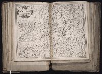
Creator:
Published / Created:
[1634]
Call Number:
1983 Folio 19
Collection Title:
[Atlas factice of 96 maps by Blaeu, Visscher, Jansson, Hondius and others]
Image Count:
1
Description:
Imperfect: wormed in middle crease, with some loss of text. Reinforced along lower edges with manuscript waste. Sheet measures 39 x 51.5 cm. No. 36 of 92 maps bound together.
Publisher:
Christophe Tassin
Subject (Geographic):
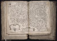
Languedoc (France) --Maps --Early works to 1800
Collection Created:
[1556-1680]
Found in:
Beinecke Rare Book and Manuscript Library > Carte du Languedoc
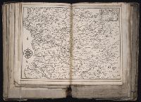
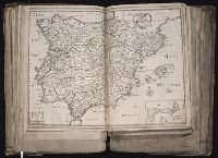
Creator:
Published / Created:
[1653]
Call Number:
1983 Folio 19
Collection Title:
[Atlas factice of 96 maps by Blaeu, Visscher, Jansson, Hondius and others]
Image Count:
1
Description:
BEIN 1983 Folio 19: Sheet measures 39.2 x 51.2 cm. Reinforced along edges with manuscript waste. No. 28 of 92 maps bound together.
Publisher:
Pierre Mariette
Subject (Geographic):
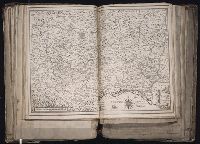
Spain --Maps --Early works to 1800
Collection Created:
[1556-1680]
Found in:
Beinecke Rare Book and Manuscript Library > Carte generale d'Hespagne
Branch:v1.61.6 ,Deployed:2024-06-12T09:55:36-04:00