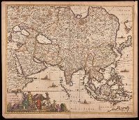
Appears in various editions of Wit's Atlas., Hand colored in outline., Imperfect: chipped and torn along edges, with no loss of text. Backed with paper., Map of Asia from Saudi Arabia, Russia, India, China, Japan to Southeast Asia., Number "4" in upper right corner., and Relief shown pictorially.
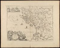
Achaiae noua & accurata descriptio and Achaiae nova et accurata descriptio
Description:
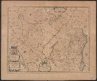
Coordinates not present on map and are approximated., Includes four bar scales., Manuscript number in upper left corner: 30. Cardinal directions written in Latin manuscript along neat line., Relief shown pictorially., and Verso blank.
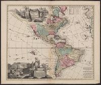
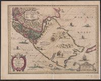
Includes ill., text, and table of latitudes and longitudes., Ms. no. on verso: No. 39. Label on verso [with ms. nos.]: 558/11. Sheet measures 55.5 x 66 cm. Cross Collection no. 122., Relief shown pictorially., and Shows California as an island.
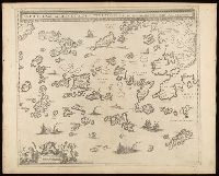
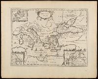
Archipelagi meridionalis, seu Cycladvm Insularum accurata delineatio
Description:
Includes three bar scales., Manuscript number in upper left corner: 33., Relief shown pictorially., and Verso blank.
Publisher:
[Jan Jansson],
Subject (Geographic):
Aegean Islands (Greece and Turkey)--Maps--Early works to 1800., Cyclades (Greece)--Maps--Early works to 1800., Dodecanese Islands (Greece)--Maps--Early works to 1800., and Sporades (Greece)--Maps--Early works to 1800.
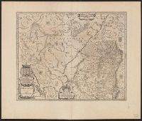
Appeared in various editions of Jan Jansson's Accuratissima orbis antiqui delineatio., Includes three insets: Europa; Minoium pelagus; Propontis [Sea of Marmora]., Manuscript number in upper left corner: 24., Relief shown pictorially., and Verso blank.
Publisher:
[Jan Jansson],
Subject (Geographic):
Mediterranean Region--Maps--Early works to 1800.
Subject (Name):
Jansson, Jan, 1588-1664. Accuratissima orbis antiqui delineatio.
Subject (Topic):
Argonauts (Greek mythology)--Travel--Maps--Early works to 1800. and Literary landmarks--Mediterranean Region--Maps--Early works to 1800.
Langren, Arnold Florent van, 1580-1644, cartographer
Published / Created:
[1638]
Call Number:
90 1638
Container / Volume:
BRBL_00661
Image Count:
1
Resource Type:
Maps, Atlases & Globes
Description:
From Jan Huygen van Linschoten's Histoire de la navigation de Iean Hvgves de Linschot Hollandois., Oriented with north to the right., Relief shown pictorially., and Watermark.
Publisher:
[Evert Cloppenburgh],
Subject (Geographic):
South America--Maps--Early works to 1800
Subject (Name):
Linschoten, Jan Huygen van, 1563-1611. Histoire de la navigation de Iean Hvgves de Linschot Hollandois
Cross Collection no. 350., From Jodocus Hondius's Appendix Atlantis majoris. [Amsterdam] : Per Iodocum Hondium, 1630., Imperfect: mutilated along fold at bottom, with no loss of text. Mounted on linen., Map of the Straits of Magellan, South America., Relief shown pictorially., and Title in Latin; place names in Dutch.
Publisher:
Judocus Hondius excudit,
Subject (Geographic):
Magellan, Strait of (Chile and Argentina)--Maps--Early works to 1800
Subject (Name):
Gryp, Dirck, engraver and Hondius, Jodocus, 1594 or 1595-1629. Appendix Atlantis majoris