Search
You Searched For
Search Results
- Published / Created:
- 1829
- Call Number:
- 771 L58 1829
- Container / Volume:
- BRBL_00483
- Image Count:
- 1
- Resource Type:
- Maps, Atlases & Globes
- Description:
- From Burr's "Atlas of the state of New York"
- Publisher:
- David H. Burr,
- Subject (Geographic):
- Lewis County (N.Y.)--Maps
- Found in:
- Beinecke Rare Book and Manuscript Library > Map of the County of Lewis [N.Y.]
- Published / Created:
- 1829
- Call Number:
- 771 M26 1829
- Container / Volume:
- BRBL_00483
- Image Count:
- 1
- Resource Type:
- Maps, Atlases & Globes
- Description:
- From Burr's "Atlas of the state of New York"
- Publisher:
- David H. Burr,
- Subject (Geographic):
- Madison County (N.Y.)--Maps
- Found in:
- Beinecke Rare Book and Manuscript Library > Map of the County of Madison, N.Y.
- Published / Created:
- 1829
- Call Number:
- 771 M766 1829
- Container / Volume:
- BRBL_00483
- Image Count:
- 1
- Resource Type:
- Maps, Atlases & Globes
- Description:
- From Burr's "Atlas of the state of New York"
- Publisher:
- David H. Burr,
- Subject (Geographic):
- Montgomery County (N.Y.)--Maps
- Found in:
- Beinecke Rare Book and Manuscript Library > Map of the County of Montgomery [N.Y.]
- Published / Created:
- 1829
- Call Number:
- 771 On2 1829
- Image Count:
- 1
- Resource Type:
- Maps, Atlases & Globes
- Description:
- From Burr's "Atlas of the State of New York" 1829.
- Publisher:
- David H. Burr,
- Subject (Geographic):
- Oneida County (N.Y.)--Maps
- Found in:
- Beinecke Rare Book and Manuscript Library > Map of the County of Oneida [N.Y.].
- Published / Created:
- 1829
- Call Number:
- 771 ON6 1829
- Container / Volume:
- BRBL_00490
- Image Count:
- 1
- Resource Type:
- Maps, Atlases & Globes
- Description:
- From Burr's "Atlas of the State of New York" 1829.
- Publisher:
- David H. Burr,
- Subject (Geographic):
- Onondaga County (N.Y.)--Maps--Early works to 1800
- Found in:
- Beinecke Rare Book and Manuscript Library > Map of the County of Onondaga [N.Y.]
- Published / Created:
- 1829
- Call Number:
- 771 OS9 1829
- Container / Volume:
- BRBL_00490
- Image Count:
- 1
- Resource Type:
- Maps, Atlases & Globes
- Description:
- From Burr's "Atlas of the State of New York", 1829.
- Publisher:
- David H. Burr,
- Subject (Geographic):
- Oswego County (N.Y.)--Maps
- Found in:
- Beinecke Rare Book and Manuscript Library > Map of the County of Oswego [N.Y.].
- Published / Created:
- 1829
- Call Number:
- 771 OT7 1829
- Container / Volume:
- BRBL_00490
- Image Count:
- 1
- Resource Type:
- Maps, Atlases & Globes
- Description:
- From Burr's "Atlas of the State of New York", 1829. and Preliminary record.
- Publisher:
- David H. Burr,
- Subject (Geographic):
- Otsego County (N.Y.)--Maps
- Found in:
- Beinecke Rare Book and Manuscript Library > Map of the County of Otsego [N.Y.].
- Published / Created:
- 1829
- Call Number:
- 771 OT7 1829A
- Container / Volume:
- BRBL_00490
- Image Count:
- 1
- Resource Type:
- Maps, Atlases & Globes
- Description:
- Engd. by Rawden, Clark & Co.
- Publisher:
- Albany & Rawden, Wright & Co.,
- Subject (Geographic):
- Otsego County (N.Y.)--Maps
- Found in:
- Beinecke Rare Book and Manuscript Library > Map of the County of Otsego. By David H. Burr. Published by the Surveyor General pursuant to an act of the Legislature.
- Published / Created:
- 1829
- Call Number:
- 771 Sa71 1829
- Container / Volume:
- BRBL_00491
- Image Count:
- 1
- Resource Type:
- Maps, Atlases & Globes
- Description:
- From Burr's "Atlas of the State of New York"
- Publisher:
- David Burr,
- Subject (Geographic):
- Saratoga County (N.Y.)--Maps
- Found in:
- Beinecke Rare Book and Manuscript Library > Map of the County of Saratoga [NY].
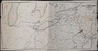
- Published / Created:
- 1853
- Call Number:
- 754gme 1853
- Container / Volume:
- BRBL_00419
- Image Count:
- 1
- Resource Type:
- Maps, Atlases & Globes
- Description:
- Includes distances from New York to Lake Ontario.
- Publisher:
- hand col.,
- Subject (Geographic):
- United States--Maps
- Subject (Topic):
- Railroads--United States--Maps
- Found in:
- Beinecke Rare Book and Manuscript Library > Map of the Delaware, Lackawanna & Western railroad : with its principal connections.