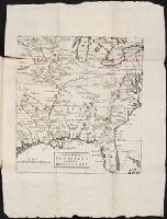
Anville, Jean Baptiste Bourguignon d', 1697-1782 Gravelot, Sr Major, Sr
Published / Created:
1746
Call Number:
2003 Folio 85
Image Count:
1
Description:
Inset map: [Hudson Bay-Labrador Region]. and No. 2 of 45 maps bound together with binder’s spine title: Atlas of America; ms. table of contents. Bookplate of Paul Mellon.
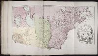
Anville, Jean Baptiste Bourguignon d', 1697-1782 Haye, G. de la
Published / Created:
avec privilege 1748
Call Number:
2003 Folio 85
Image Count:
1
Description:
Hand colored., 2003 Folio 85: No. 43 of 45 maps bound together with binder’s spine title: Atlas of America, Bookplate: Robinson. Bookplate of Paul Mellon, Relief shown pictorially., and Scale [ca. 1:2,500,000]
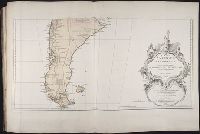
BEIN 2003 Folio 85: No. 42 of 45 maps bound together with binder's spine title: Atlas of America; ms. table of contents. Bookplate: Robinson. Bookplate of Paul Mellon., Hand colored., par le Sr. Robert de Vaugondy, fils de Mr. Robert, geographe ordinaire du roy., Relief shown pictorially., and Scale [ca. 1:17,000,000]
Boehm, Augustus Gottlieb Hase, Johann Matthias, 1684-1742 Homann Erben (Firm)
Published / Created:
1744
Call Number:
1983 Folio 23
Collection Title:
[Atlas factice of 50 maps, primarily by Johann Baptist Homann and/or issued by the Homann Erben
Image Count:
1
Alternative Title:
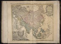
Asia secundum legitimas projectionis stereographicae regulas et juxta recentissimas observationes and Carte de l’Asie, projettee stereographiquement, tiree des relations et observations
Boehm, Augustus Gottlieb Hase, Johann Matthias, 1684-1742 Homann Erben (Firm)
Published / Created:
1744
Call Number:
1975 Folio 31
Collection Title:
[Atlas factice of 42 maps, produced by the Homann Erben firm]
Image Count:
1
Alternative Title:
Asia secundum legitimas projectionis stereographicae regulas et juxta recentissimas observationes and Carte de l’Asie, projettee stereographiquement, tiree des relations et observations
Homann Erben (Firm) Mayer, Tobias, 1723-1762 Schneider, R. A.
Published / Created:
1747 [i.e. 1748?]
Call Number:
1975 Folio 31
Collection Title:
[Atlas factice of 42 maps, produced by the Homann Erben firm]
Image Count:
1
Alternative Title:
Carte des XVII. provinces ou de l’Allemagne inferievre, dressee suivant la projection stereographique, et appueyee par les mesures faites de Mess. Cassini, Snellius et Mouschenbrok, par Mr. Tob. Majer de la Societe geographique, et publiee par les Heritiers de Homann, l’An 1748
Publisher:
Cura et Studio Homannianorum Heredum
Subject (Geographic):
Belgium --Maps --Early works to 1800, Benelux countries --Maps --Early works to 1800, Luxembourg --Maps --Early works to 1800, and Netherlands --Maps --Early works to 1800
[Atlas factice of 32 maps and 1 distance table, produced by the Homann Erben firm]
Image Count:
2
Alternative Title:
Carte des XVII. provinces ou de l’Allemagne inferievre, dressee suivant la projection stereographique, et appueyee par les mesures faites de Mess. Cassini, Snellius et Mouschenbrok, par Mr. Tob. Majer de la Societe geographique, et publiee par les Heritiers de Homann, l’An 1748
Publisher:
Cura et Studio Homannianorum Heredum
Subject (Geographic):
Belgium --Maps --Early works to 1800, Benelux countries --Maps --Early works to 1800, Luxembourg --Maps --Early works to 1800, and Netherlands --Maps --Early works to 1800