Skip to search
Skip to main content
Skip to first result
Search
You Searched For
Repository
Beinecke Rare Book and Manuscript Library
Format
cartographic
Genre
Maps
Subject (Topic)
World War, 1914-1918--Maps
New Search
Search Results
Creator:
Published / Created:
1915
Call Number:
11hcf 1919E-12
Image Count:
1
Resource Type:
Maps, Atlases & Globes
Alternative Title:
Europe 1:1,000,000, G.S.G.S. ; no. 2758, and GSGS (Series) ; no. 2758.
Description:
Includes index to adjoining sheets, index to boundaries, and pronunciation glossary.
Publisher:
Ordnance Survey,
Subject (Geographic):
Europe, Eastern--Maps
Subject (Topic):
World War, 1914-1918--Maps
Found in:
Beinecke Rare Book and Manuscript Library > (Warsaw) Varshava : North N. 34. / compiled at the Royal Geographical Society under the direction of the Geographical Section; drawn and printed by Ordnance Survey.
Creator:
Published / Created:
c1917.
Call Number:
30 1917B
Container / Volume:
BRBL_00032A
Image Count:
1
Resource Type:
Maps, Atlases & Globes
Description:
Caricature map., Copyright: Karel Horký., and Countries are represented by animal ill. to depict international relations.
Publisher:
s.n.],
Subject (Geographic):
Europe--Maps and Europe--Politics and government--Maps
Subject (Topic):
World War, 1914-1918--Maps
Found in:
Beinecke Rare Book and Manuscript Library > 1914--1915--1916--1917--?? / drawn by J. Lenhard.
Creator:
Published / Created:
1918?]
Call Number:
11hc 1917R
Container / Volume:
BRBL_00010E
Image Count:
1
Resource Type:
Maps, Atlases & Globes
Alternative Title:
No. 1, north-western Europe, showing the "Western Front" and North-western Europe, showing the "Western Front"
Description:
"Historical notes" in left and right margins. and Inset map: The World War.
Publisher:
Encylcopaedia Britannica,
Subject (Geographic):
Europe, Western--Maps
Subject (Topic):
World War, 1914-1918--Maps
Found in:
Beinecke Rare Book and Manuscript Library > A geographical and historical guide to the world's wars, 4000 B.C. to 1918 [cartographic material] : No. 1, north-western Europe, showing the "Western Front" / engraved and printed at the Matthews-Northrup Works, Buffalo, N.Y.
Creator:
Published / Created:
1918?]
Call Number:
11hc 1918J-2
Container / Volume:
BRBL_00010F
Image Count:
1
Resource Type:
Maps, Atlases & Globes
Alternative Title:
No. 1, north-western Europe, showing the "Western Front" and North-western Europe, showing the "Western Front"
Description:
"Historical notes" in left and right margins. and Inset map: The World War.
Publisher:
Encylcopaedia Britannica,
Subject (Geographic):
Europe, Western--Maps
Subject (Topic):
World War, 1914-1918--Maps
Found in:
Beinecke Rare Book and Manuscript Library > A geographical and historical guide to the world's wars, 4000 B.C. to 1918 [cartographic material] : No. 1, north-western Europe, showing the "Western Front" / engraved and printed at the Matthews-Northrup Works, Buffalo, N.Y.
Creator:
Published / Created:
1918?]
Call Number:
11hc 1918J
Container / Volume:
BRBL_00010F
Image Count:
1
Resource Type:
Maps, Atlases & Globes
Alternative Title:
Italian, Balkan, and Turkish fronts and No. 3, Showing the Italian, Balkan and Turkish Fronts
Description:
"Historical notes" in left and right margins. and Inset map: Map showing the Turkish fronts in Armenia, Mesopotamia, and Palestine.
Publisher:
Encylcopaedia Britannica,
Subject (Geographic):
Balkan Peninsula--Maps, Europe, Eastern, Italy--Maps, and Turkey--Maps
Subject (Topic):
World War, 1914-1918--Maps
Found in:
Beinecke Rare Book and Manuscript Library > A geographical and historical guide to the world's wars, 4000 B.C. to 1918 [cartographic material] : No. 3, Showing the Italian, Balkan and Turkish Fronts / engraved and printed at the Matthews-Northrup Works, Buffalo, N.Y.
Creator:
Published / Created:
[1918?]
Call Number:
11hcf 1919-14
Container / Volume:
BRBL_00010J
Image Count:
1
Resource Type:
Maps, Atlases & Globes
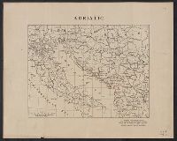
Description:
Ms. notes showing Italian land claims following World War I.
Publisher:
American Geographical Society,
Subject (Geographic):
Adriatic Sea Region--Maps
Subject (Topic):
World War, 1914-1918--Maps
Found in:
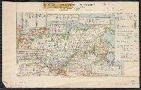
Beinecke Rare Book and Manuscript Library > Adriatic [Sea region].
Creator:
Published / Created:
1918
Call Number:
11hcf 1919E-14
Image Count:
1
Resource Type:
Maps, Atlases & Globes
Alternative Title:
Europe 1:1,000,000, G.S.G.S. ; no. 2758, and GSGS (Series) ; no. 2758.
Description:
Includes index to adjoining sheets, index to boundaries, and pronunciation glossary. and Inscription: [Charles] Seymour.
Publisher:
Ordnance Survey,
Subject (Geographic):
Europe, Eastern--Maps
Subject (Name):
Seymour, Charles,--1885-1963--Autograph
Subject (Topic):
World War, 1914-1918--Maps
Found in:
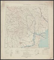
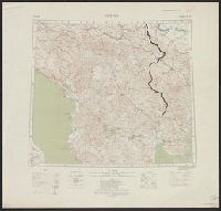
Beinecke Rare Book and Manuscript Library > Bucuresti : North L 35. / compiled at the Royal Geographical Society under the direction of the Geographical Section; drawn and printed by Ordnance Survey.
Creator:
Published / Created:
1918
Call Number:
11hcf 1919E-15
Image Count:
1
Resource Type:
Maps, Atlases & Globes
Alternative Title:
Europe 1:1,000,000, G.S.G.S. ; no. 2758, and GSGS (Series) ; no. 2758.
Description:
Elevation above sea level indicated by colored shading., Imperfect. Bled. Inscription: [Charles] Seymour., and Includes index to adjoining sheets, index to boundaries, and pronunciation glossary.
Publisher:
Ordnance Survey,
Subject (Geographic):
Europe, Eastern--Maps
Subject (Name):
Seymour, Charles,--1885-1963--Autograph
Subject (Topic):
World War, 1914-1918--Maps
Found in:
Beinecke Rare Book and Manuscript Library > Bucuresti : North L 35. / compiled at the Royal Geographical Society under the direction of the Geographical Section; drawn and printed by Ordnance Survey.
Branch:v1.61.6 ,Deployed:2024-06-12T09:55:37-04:00