Skip to search
Skip to main content
Skip to first result
Search
You Searched For
Genre
Atlases
Genre
Maps in books
Resource Type
Maps, Atlases & Globes
New Search
Search Results
Creator:
Published / Created:
1696
Call Number:
1973 Folio 10
Image Count:
1
Resource Type:
Maps, Atlases & Globes
Alternative Title:
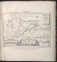
Cercle de Franconie, ou sont les eveches De Wurtzburg, de Bamberg, et d'Aichstet, les estats du grand Maistre des Chevaliers Teutons, les Marquisats de Cullembach, et d'Ohnspach, les Comtes d'Henneberg, d'Holach, de Reineck, de Wertheim, d'erpach, de Schwartzenberg, et de Castel, les Baronies de Limpurg, et de Sensheim, et les villes imperiales de Nurenberg, de Rotenburg, de Schweinfurt, Windsheim, et de Weissenburg
Description:
Bar scales in Italian miles, common leagues of Germany, great leagues of Germany, common leagues of France, great leagues of France, and leagues of one hours traveling., Dresse sur les Memoires les plus Nouveaux par le Sr. Sanson., Ferro meridian., No. 30 of 69 maps bound together in composite atlas., Relief shown pictorially., and Scale [ca. 1:510 000].
Publisher:
Chez H. Iaillot ...
Subject (Geographic):
Bavaria (Germany) --Maps --Early works to 1800
Found in:
Beinecke Rare Book and Manuscript Library > Le cercle de Franconie : subdivise en tous les estats qui le composent
Creator:
Published / Created:
1850
Call Number:
1975 Folio 26
Collection Title:
A new universal atlas containing maps of the various empires, kingdoms, states and republics of the
Image Count:
1
Resource Type:
Maps, Atlases & Globes
Alternative Title:
Heights of the principal mountains in the world
Subject (Name):
P.S. Duval & Son
Collection Created:
Philadelphia, Thomas, Cowperthwait & Co., No. 253 Market street, 1852
Found in:
Beinecke Rare Book and Manuscript Library > Lengths of the principal rivers in the world
Creator:
Published / Created:
[168-?]
Call Number:
1973 Folio 10
Image Count:
1
Resource Type:
Maps, Atlases & Globes
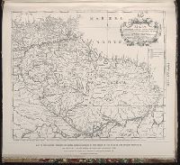
Description:
No. 13 of 69 maps bound together in composite atlas., Oriented with north towards upper left., Relief shown pictorially., Scale not given., and Title in Latin; place names in French.
Publisher:
Chez Jacques de la Feuille ...
Subject (Geographic):
Paris (France) --Maps --Early works to 1800
Found in:
Beinecke Rare Book and Manuscript Library > Lutetiae Parisiorum universae Galliae metropolis novissima [et] accuratissima
Creator:
Published / Created:
[1700?]
Call Number:
1973 Folio 10
Image Count:
1
Resource Type:
Maps, Atlases & Globes
Description:
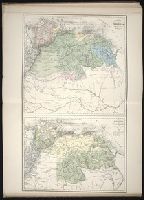
Ferro meridian., No. 51 of 69 maps bound together in composite atlas., Relief shown pictorially., and Scale [ca. 1:11 750 000].
Publisher:
[Frederik de Wit]
Subject (Geographic):
Asia --Maps --Early works to 1800
Found in:
Beinecke Rare Book and Manuscript Library > Magnae Tartariae : magni Mogolis imperii, Iaponiae et Chinae : nova descriptio ex tabula ampliss viri D.N. Witsen pro majori parte aliis auctoribus excerpta et dita
Creator:
Call Number:
1978 Folio 106
Collection Title:
Maps of the Orinoco-Essequibo region, South America. Compiled for the Commission appointed by the
Image Count:
1
Resource Type:
Maps, Atlases & Globes
Subject (Geographic):
Caribbean Area--Maps--Early works to 1800, Guyana --Maps, and Orinoco River Valley (Venezuela and Colombia) --Maps
Collection Created:
Washington, 1897
Found in:
Beinecke Rare Book and Manuscript Library > Map of Guiana and Caribana by N. Sanson d'Abbeville, Paris, 1656
Creator:
Call Number:
1978 Folio 106
Collection Title:
Maps of the Orinoco-Essequibo region, South America. Compiled for the Commission appointed by the
Image Count:
1
Resource Type:
Maps, Atlases & Globes
Subject (Geographic):
Guyana --Maps and Orinoco River Valley (Venezuela and Colombia)
Collection Created:
Washington, 1897
Found in:
Beinecke Rare Book and Manuscript Library > Map of Guiana by Theodore de Bry, 1599
Creator:
Published / Created:
1741
Call Number:
1978 Folio 106
Collection Title:
Maps of the Orinoco-Essequibo region, South America. Compiled for the Commission appointed by the
Image Count:
1
Resource Type:
Maps, Atlases & Globes
Subject (Geographic):
Caribbean Area--Maps--Early works to 1800, Colombia --Maps, Orinoco River Valley (Venezuela and Colombia) --Maps, and Venezuela --Maps
Collection Created:
Washington, 1897
Found in:
Beinecke Rare Book and Manuscript Library > Map of the Jesuit missions of New Granada, by father Joseph Gumilla, S. J., Madrid, 1741
Published / Created:
1778
Call Number:
1978 Folio 106
Collection Title:
Maps of the Orinoco-Essequibo region, South America. Compiled for the Commission appointed by the
Image Count:
1
Resource Type:
Maps, Atlases & Globes
Subject (Geographic):
Caribbean Area--Maps--Early works to 1800, Orinoco River Valley (Venezuela and Colombia) --Maps, South America --Maps --Early works to 1800, and Venezuela --Maps
Collection Created:
Washington, 1897
Found in:
Beinecke Rare Book and Manuscript Library > Map of the Spanish privince of Nueva Andalucia made at the order of the head of the Spanish Archive of the Indies by Luis de Surville, Assistant Archivist, 1778
Creator:
Published / Created:
[1840]
Call Number:
1973 Folio 105
Collection Title:
Atlas fisico y politico de la Republica de Venezuela ... por ... Agustin Codazzi ...
Image Count:
1
Resource Type:
Maps, Atlases & Globes
Description:
Double page width, tab mounted. and Lith. de Thierry Fres. Cite Bergere 1 a Paris, printers.
Subject (Geographic):
Orinoco River Valley (Venezuela and Colombia), Venezuela --Description and travel, and Venezuela --Maps
Subject (Topic):
Physical geography --Venezuela
Collection Created:
Caracas,
Found in:
Beinecke Rare Book and Manuscript Library > Mapa de las costas de Tierra-Firme desde el Orinoco hasta Yucatan: de las islas Antillas y la mayor parte de las Lucayas, con las derrotas que siguio Dn. Cristobal Colon en sus descubrimientos por estos mares y las derrotas de otros navegantes que reconoc
Creator:
Published / Created:
[1840]
Call Number:
1973 Folio 105
Collection Title:
Atlas fisico y politico de la Republica de Venezuela ... por ... Agustin Codazzi ...
Image Count:
1
Resource Type:
Maps, Atlases & Globes
Alternative Title:
Mapa fisico de Venezuela, divida en tres zonas
Description:
Double page width, tab mounted. and Lith. de Thierry Fres. Cite Bergere 1 a Paris, printers.
Subject (Geographic):
Orinoco River Valley (Venezuela and Colombia), Venezuela --Description and travel, and Venezuela --Maps
Subject (Topic):
Physical geography --Venezuela
Collection Created:
Caracas,
Found in:
Beinecke Rare Book and Manuscript Library > Mapa fisico de Venezuela, divida en hoyas hydrograficas.
Branch:v1.61.8 ,Deployed:2024-06-20T11:15:02-04:00