Skip to search
Skip to main content
Skip to first result
Search
You Searched For
Resource Type
Maps, Atlases & Globes
New Search
Search Results
Published / Created:
[19--]
Call Number:
11 1482
Image Count:
1
Resource Type:
Maps, Atlases & Globes
Description:
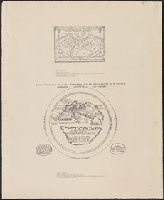
From: Histoire de la Geographie.
Subject (Geographic):
World--Maps--Early works to 1800
Found in:
Beinecke Rare Book and Manuscript Library > [The World according to Pomponius Mela. Venice, 1482].
Published / Created:
[1779]
Call Number:
787hca Sa91 1779P
Container / Volume:
BRBL_00730
Image Count:
1
Resource Type:
Maps, Atlases & Globes
Description:
"Nota" with details of changes in positions during the siege., Inset: "Explication des lettres du plan.", Map shows fortifications around the city, the positions of the French, American and British batteries, roads to surrounding towns, and the Savannah and Augustine rivers., Pen and ink ms. signed "O'Connor"., and Title supplied by cataloger.
Subject (Geographic):
Savannah (Ga.)--History--Siege, 1779--Maps, Manuscript--Early works to 1800 and Savannah (Ga.)--Maps, Manuscript--Early works to 1800
Found in:
Beinecke Rare Book and Manuscript Library > [The siege of Savannah, 1779].
Published / Created:
1863
Call Number:
783 Or1 1863
Container / Volume:
BRBL_00510
Image Count:
1
Resource Type:
Maps, Atlases & Globes
Subject (Geographic):
Virginia--Maps
Found in:
Beinecke Rare Book and Manuscript Library > [Topographic military map of region around Orange Courthouse, south to Mechanicsburg, east to Robertson's tavern, north to Madison C.H. and west to Burtonsville] / Office of Surveys and Maps for the Army of the Potomac.
Published / Created:
[1940?-1941]
Call Number:
42 1940
Container / Volume:
BRBL_00244
Image Count:
13
Resource Type:
Maps, Atlases & Globes
Publisher:
Kartographisches früher Militärgeographisches Institut,
Subject (Geographic):
Austria--Maps, Topographic
Found in:
Beinecke Rare Book and Manuscript Library > [Topographical map of Austria. 1: 25,000].
Published / Created:
1873?]
Call Number:
844cbf 1873A
Container / Volume:
BRBL_00613
Image Count:
1
Resource Type:
Maps, Atlases & Globes
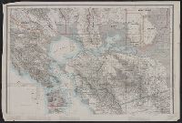
Description:
Library's copy missing southern sheet., Relief shown by hachures and spot heights. Depths shown by soundings., and Title devised by cataloger.
Publisher:
State Geological Survey of California?,
Subject (Geographic):
California--Maps
Subject (Name):
Geological Survey of California
Found in:
Beinecke Rare Book and Manuscript Library > [Topographical map of central California].
Published / Created:
[1940?]
Call Number:
456 1918
Container / Volume:
BRBL_00259
Image Count:
1
Resource Type:
Maps, Atlases & Globes
Description:
Red lines connecting some towns printed over base map.
Publisher:
Kgl. Ung. Staatl. Kartographischen Institutes,
Subject (Geographic):
Transylvania (Romania)--Maps
Found in:
Beinecke Rare Book and Manuscript Library > [Transylvania] / Entworfen von Robert Csallner.
Published / Created:
[1940?]
Call Number:
456 1918A
Container / Volume:
BRBL_00259
Image Count:
1
Resource Type:
Maps, Atlases & Globes
Description:
Red lines connecting some towns printed over base map. and Relief shown by shading.
Publisher:
Kgl. Ung. Staatl. Kartographischen Institutes,
Subject (Geographic):
Transylvania (Romania)--Maps
Found in:
Beinecke Rare Book and Manuscript Library > [Transylvania] / Entworfen von Robert Csallner.
Published / Created:
[1940?]
Call Number:
456 1940A
Container / Volume:
BRBL_00259
Image Count:
1
Resource Type:
Maps, Atlases & Globes
Description:
In lower left corner: "M.224/935L." and Relief shown by shading.
Publisher:
Kgl. Ung. Staatl. Kartographischen Institutes,
Subject (Geographic):
Transylvania (Romania)--Maps
Found in:
Beinecke Rare Book and Manuscript Library > [Transylvania] / Entworfen von Robert Csallner.
Published / Created:
1825
Call Number:
23cea 1825A
Container / Volume:
BRBL_00021
Image Count:
2
Resource Type:
Maps, Atlases & Globes
Description:
Insets: Honoruru or Fair Haven; Karakakooa Bay; chart of Sandwich Islands; Port Sn. Diego; the entrance of San Francisco Harbor. and Preliminary record.
Publisher:
J.W. Norie & Co.,
Subject (Geographic):
Pacific Ocean--Maps
Found in:
Beinecke Rare Book and Manuscript Library > [Two charts of the Pacific Ocean, showing the Northwestern America and Sandwich Islands and ports].
Published / Created:
188-]
Call Number:
754GM 1880
Container / Volume:
BRBL_00419
Image Count:
1
Resource Type:
Maps, Atlases & Globes
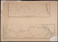
Alternative Title:
Enlarged map of Central transportation route and Enlarged map of Southern transportation route
Publisher:
s.n.,
Subject (Geographic):
Southern States (U.S.)--Maps
Found in:
Beinecke Rare Book and Manuscript Library > [Two maps showing the southern Atlantic states to point out the transportation routes to the Seaboard Central and Seaboard Southern routes].
Branch:v1.61.6 ,Deployed:2024-06-12T09:55:36-04:00