Skip to search
Skip to main content
Skip to first result
Search
You Searched For
Format
cartographic
Genre
Maps in books
New Search
Search Results
Creator:
Call Number:
1974 Folio 72
Collection Title:
The English pilot: describing the West-India navigation, from Hudson's-Bay to the river Amazones
Image Count:
1
Subject (Geographic):
Newfoundland and Labrador --Maps --Early works to 1800
Subject (Topic):
Navigation --Early works to 1800, Pilot guides --Atlantic Coast (U.S.) --Early works to 1800, and Pilot guides --Caribbean Area --Early works to 1800
Collection Created:
London : Printed for W. and J. Mount, T. Page and son, on Tower-Hill, MDCCLX [1760]
Found in:
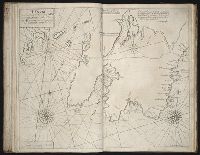
Beinecke Rare Book and Manuscript Library > A chart shewing part of the sea coast of New Foundland from ye Bay of Bulls to little Plecentia ...
Published / Created:
1715
Call Number:
1978 Folio 10
Collection Title:
The English pilot: describing the West-India navigation, from Hudson's-Bay to the river Amazones
Image Count:
1
Subject (Geographic):
Atlantic Ocean --Maps --Early works to 1800 and Newfoundland and Labrador --Maps --Early works to 1800
Subject (Topic):
Navigation --Early works to 1800, Pilot guides --Atlantic Coast (U.S.) --Early works to 1800, and Pilot guides --Caribbean Area --Early works to 1800
Collection Created:
London : Printed for Thomas Page, William and Fisher Mount, in Postern-Row on Tower-hill, MDCCXXV [1725]
Found in:
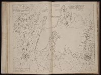
Beinecke Rare Book and Manuscript Library > A chart shewing part of the sea coast of New Foundland from ye Bay of Bulls to little Plecentia ...
Creator:
Call Number:
1973 Folio 116
Collection Title:
The English pilot: describing the West-India navigation, from Hudson's-Bay to the river Amazones
Image Count:
1
Subject (Geographic):
Atlantic Ocean --Maps --Early works to 1800 and Newfoundland and Labrador --Maps --Early works to 1800
Subject (Topic):
Navigation --Early works to 1800, Pilot guides --Atlantic Coast (U.S.) --Early works to 1800, and Pilot guides --Caribbean Area --Early works to 1800
Collection Created:
London :
Found in:
Beinecke Rare Book and Manuscript Library > A chart shewing part of the sea coast of New Foundland from ye Bay of Bulls to little Plecentia ...
Creator:
Call Number:
1973 Folio 114
Collection Title:
The English pilot: describing the West-India navigation, from Hudson's-Bay to the river Amazones
Image Count:
1
Resource Type:
Maps, Atlases & Globes
Subject (Geographic):
Atlantic Ocean --Maps --Early works to 1800 and Newfoundland and Labrador --Maps --Early works to 1800
Subject (Topic):
Navigation --Early works to 1800, Pilot guides --Atlantic Coast (U.S.) --Early works to 1800, and Pilot guides --Caribbean Area --Early works to 1800
Collection Created:
London : Printed for W. and J. Mount, T. Page and son, on Tower-Hill, MDCCLIX [1759]
Found in:
Beinecke Rare Book and Manuscript Library > A chart shewing part of the sea coast of New Foundland from ye Bay of Bulls to little Plecentia ...
Published / Created:
MDCI [1601]
Call Number:
Taylor 193 3
Collection Title:
Tertia pars Indiae Orientalis ... / de Germanico in Latinum translata, & bono ordine disposita a
Image Count:
1
Description:
In pencil on verso: Part 3. p 40.
Subject (Geographic):
Angra dos Reis (Brazil)
Collection Created:
Francofurti : Excudebat Matthaeus Beckerus, anno MDCI [1601]
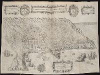
Found in:
Beinecke Rare Book and Manuscript Library > A cidade de Angra na ilhade ...
Call Number:
1974 Folio 72
Collection Title:
The English pilot: describing the West-India navigation, from Hudson's-Bay to the river Amazones
Image Count:
1
Subject (Geographic):
Atlantic Ocean --Maps --Early works to 1800, Hispaniola --Maps --Early works to 1800, and West Indies --Maps --Early works to 1800
Subject (Topic):
Navigation --Early works to 1800, Pilot guides --Atlantic Coast (U.S.) --Early works to 1800, and Pilot guides --Caribbean Area --Early works to 1800
Collection Created:
London : Printed for W. and J. Mount, T. Page and son, on Tower-Hill, MDCCLX [1760]
Found in:
Beinecke Rare Book and Manuscript Library > A correct chart of Hispaniola with the Windward Passage
Call Number:
1973 Folio 116
Collection Title:
The English pilot: describing the West-India navigation, from Hudson's-Bay to the river Amazones
Image Count:
1
Subject (Geographic):
Atlantic Ocean --Maps --Early works to 1800, Dominican Republic --Maps, Manuscript --Early works to 1800, Haiti --Maps --Early works to 1800, Hispaniola --Maps --Early works to 1800, and West Indies --Maps --Early works to 1800
Subject (Topic):
Navigation --Early works to 1800, Pilot guides --Atlantic Coast (U.S.) --Early works to 1800, and Pilot guides --Caribbean Area --Early works to 1800
Collection Created:
London :
Found in:
Beinecke Rare Book and Manuscript Library > A correct chart of Hispaniola with the Windward Passage
Creator:
Call Number:
1973 Folio 114
Collection Title:
The English pilot: describing the West-India navigation, from Hudson's-Bay to the river Amazones
Image Count:
1
Resource Type:
Maps, Atlases & Globes
Subject (Geographic):
Atlantic Ocean --Maps --Early works to 1800, Dominican Republic --Maps, Manuscript --Early works to 1800, Haiti --Maps --Early works to 1800, Hispaniola --Maps --Early works to 1800, and West Indies --Maps --Early works to 1800
Subject (Topic):
Navigation --Early works to 1800, Pilot guides --Atlantic Coast (U.S.) --Early works to 1800, and Pilot guides --Caribbean Area --Early works to 1800
Collection Created:
London : Printed for W. and J. Mount, T. Page and son, on Tower-Hill, MDCCLIX [1759]
Found in:
Beinecke Rare Book and Manuscript Library > A correct chart of Hispaniola with the Windward Passage
Call Number:
1974 Folio 72
Collection Title:
The English pilot: describing the West-India navigation, from Hudson's-Bay to the river Amazones
Image Count:
1
Subject (Geographic):
Atlantic Ocean --Maps --Early works to 1800 and West Indies --Maps --Early works to 1800
Subject (Topic):
Navigation --Early works to 1800, Pilot guides --Atlantic Coast (U.S.) --Early works to 1800, and Pilot guides --Caribbean Area --Early works to 1800
Collection Created:
London : Printed for W. and J. Mount, T. Page and son, on Tower-Hill, MDCCLX [1760]
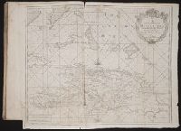
Found in:
Beinecke Rare Book and Manuscript Library > A correct chart of the Caribbee Islands
Call Number:
1973 Folio 116
Collection Title:
The English pilot: describing the West-India navigation, from Hudson's-Bay to the river Amazones
Image Count:
1
Subject (Geographic):
Atlantic Ocean --Maps --Early works to 1800 and West Indies --Maps --Early works to 1800
Subject (Topic):
Navigation --Early works to 1800, Pilot guides --Atlantic Coast (U.S.) --Early works to 1800, and Pilot guides --Caribbean Area --Early works to 1800
Collection Created:
London :
Found in:
Beinecke Rare Book and Manuscript Library > A correct chart of the Caribbee Islands
Branch:v1.64.0 ,Deployed:2024-09-11T10:25:35-04:00