Skip to search
Skip to main content
Skip to first result
Search
You Searched For
Language
German
New Search
Search Results
Creator:
From the Collection: Luhan, Mabel Dodge, 1879-1962
Published / Created:
n.d.
Call Number:
YCAL MSS 196
Container / Volume:
Box 71, folder 1928
Image Count:
3
Found in:
Beinecke Rare Book and Manuscript Library > Mabel Dodge Luhan papers (YCAL MSS 196) > Series III: Photographs > FRIENDS AND OTHERS > Broglie, "Princess" de
Creator:
Published / Created:
1867
Call Number:
36ca D81 1867
Container / Volume:
BRBL_00127
Image Count:
1
Resource Type:
Maps, Atlases & Globes
Alternative Title:
Umgegend von Dresden, Meissner Hochland und Sächsische Schweiz
Publisher:
E. Arnold,
Subject (Geographic):
Saxony (Germany)--Maps
Subject (Name):
Cotta, Bernhard von, 1808-1879
Subject (Topic):
Geology--Saxony--Maps
Found in:
Beinecke Rare Book and Manuscript Library > Brokk : Umgegend von Dresden, Meissner Hochland und Sächsische Schweiz / nach C. Naumann und B. von Cotta, geognostisch bearbeitet.
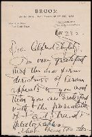
Creator:
From the Collection: Stieglitz, Alfred, 1864-1946
Published / Created:
1922-23
Call Number:
YCAL MSS 85
Container / Volume:
Box 8, folder 184
Image Count:
6
Found in:
Beinecke Rare Book and Manuscript Library > Alfred Stieglitz / Georgia O'Keeffe archive (YCAL MSS 85) > Series I: Alfred Stieglitz: Correspondence > PERSONAL AND BUSINESS CORRESPONDENCE > Broom
Creator:
From the Collection: Driver, Julia, 1961-
Published / Created:
1864-1869
Call Number:
GEN MSS 690
Container / Volume:
Box 4, folder 96
Image Count:
7
Description:
Active in Glasgow, Scotland, 1864-1869
Also known as Mrs. William Browning
Found in:
Beinecke Rare Book and Manuscript Library > Julia Driver collection of women in photography (GEN MSS 690) > Series II: Card Photographs and Other Photographic Materials > Photographic Materials > Browning, Teresa Dessurne, Mrs.
Creator:
Published / Created:
[1898?]
Call Number:
36 M92 1898
Container / Volume:
BRBL_00125
Image Count:
1
Resource Type:
Maps, Atlases & Globes
Publisher:
Verlag von Oscar Brunn, kartograph. Anstalt,
Subject (Geographic):
Munich (Germany)--Maps
Found in:
Beinecke Rare Book and Manuscript Library > Brunn's Plan von München / gezeichnet v. Oscar Brunn 1898.
Creator:
Published / Created:
[ca. 1900]
Call Number:
36 M92 1885
Container / Volume:
BRBL_00125
Image Count:
1
Resource Type:
Maps, Atlases & Globes
Publisher:
Verlag von Oscar Brunn, kartograph. Anstalt,
Subject (Geographic):
Munich (Germany)--Maps
Found in:
Beinecke Rare Book and Manuscript Library > Brunn's Plan von München / gezeichnet v. Oscar Brunn.
Published / Created:
[1910?]
Call Number:
428 K14 1910
Container / Volume:
BRBL_00248
Image Count:
2
Resource Type:
Maps, Atlases & Globes
Publisher:
Oscar Brunn,
Subject (Geographic):
Bavaria (Germany) and Karwendelgebirge (Austria)--Maps
Found in:
Beinecke Rare Book and Manuscript Library > Brunn's Spezialkarte vom Karwendelgebirge mit weiterer Umgebung / Bearbeitet v. Oscar Brunn
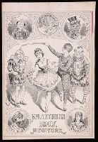
Creator:
From the Collection: Shirley, Betsy Beinecke
Published / Created:
circa 1880
Call Number:
GEN MSS 764
Container / Volume:
Box 34, folder 536
Image Count:
1
Found in:
Beinecke Rare Book and Manuscript Library > Betsy Beinecke Shirley collection of American children's literature (GEN MSS 764) > OVERSIZE > Bruton, W. (William): drawing, for poster for pantomime toy books (in Series I)
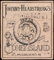
Creator:
From the Collection: Shirley, Betsy Beinecke
Published / Created:
circa 1882
Call Number:
GEN MSS 764
Container / Volume:
Box 42, folder 616-618
Image Count:
3
Found in:
Beinecke Rare Book and Manuscript Library > Betsy Beinecke Shirley collection of American children's literature (GEN MSS 764) > OVERSIZE > Bruton, W.: drawings (20) for Johnny Headstrong's Trip to Coney Island; ink and pencil on bristol board, with publisher's storage portfolio (in Series I)
Creator:
Published / Created:
[1980]
Call Number:
836 B51 1980
Container / Volume:
BRBL_00592
Image Count:
2
Resource Type:
Maps, Atlases & Globes
Alternative Title:
Bryce Canyon offizieller Führer mit Karte
Description:
"*GPO: 1980--311-309/28.", Includes text and ancillary map of "Bryce Amphitheater trailheads.", Panel title: Bryce Canyon., Relief shown by shading and spot heights., and Text, cross section, and col. ill. on verso.
Publisher:
The Service,
Subject (Geographic):
Bryce Canyon National Park (Utah)--Maps
Found in:
Beinecke Rare Book and Manuscript Library > Bryce Canyon National Park, Utah / National Park Service, U.S. Department of the Interior.
Branch:v1.61.6 ,Deployed:2024-06-12T09:55:19-04:00