[Atlas factice of 50 maps, primarily by Johann Baptist Homann and/or issued by the Homann Erben
Image Count:
1
Alternative Title:
Cercle d’Autriche : consistant dans l’Archiduche d’Autriche, le Duche de Stirie, de Carinthie, de Carniole, dans la Comte de Tyrol, et les pais autrichiens anterieurs dans la Souabe, avec ses confins, Circulus Austriacus, and Circvlvs Avstriacvs
Publisher:
Curantibus Homannianis Heridibus
Subject (Geographic):
Austria --Maps --Early works to 1800 and Europe, Central --Maps --Early works to 1800
[Atlas factice of 42 maps, produced by the Homann Erben firm]
Image Count:
1
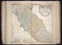
Alternative Title:
Etats de l’Eglise & du Grand Duche de Toscane, Etats de l’Eglise & du Grand Dvche de Toscane, and Status Ecclesiastici nec non Magni Ducatus Toscanae nova tabula geographica
Publisher:
Curantibus Homannianis Heredibus
Subject (Geographic):
Papal States --Maps --Early works to 1800 and Tuscany (Italy) --Maps --Early works to 1800
[Atlas factice of 50 maps, primarily by Johann Baptist Homann and/or issued by the Homann Erben
Image Count:
1
Alternative Title:
Etats de l’Eglise & du Grand Duche de Toscane, Etats de l’Eglise & du Grand Dvche de Toscane, and Status Ecclesiastici nec non Magni Ducatus Toscanae nova tabula geographica
Publisher:
Curantibus Homannianis Heredibus
Subject (Geographic):
Papal States --Maps --Early works to 1800 and Tuscany (Italy) --Maps --Early works to 1800
Descriptio ac delineatio geographica detectionis freti, sive, transitus ad occasum supra terras
Image Count:
1
Abstract:
Map depicts the Coat of Arms of the United Kingdom (era of the Union of the Crowns), reigning between the years 1603-1707.
Alternative Title:
Tabula nautica, qua repraesentantur orae maritimae, meatus, ac freta, noviter a H. Hudsono Anglo ad Caurum supra Novam Franciam
Description:
Bound in after p. [2]., In pencil on recto: 170., Map cut and folded irregularly., Map has multiple small stains on both the recto and verso., and Scale [ca. 1:9,000,000].
Descriptio ac delineatio geographica detectionis freti, sive, transitus ad occasum supra terras
Image Count:
1
Abstract:
Map depicts the Coat of Arms of the United Kingdom (era of the Union of the Crowns), reigning between the years 1603-1707.
Alternative Title:
Tabula nautica ...
Description:
Bound in after p. [6]., In ink on recto: place names "Okkak", "Nain"[?] and one longer handwritten note on the bottom margin., Map cut and folded irregularly., Map has been repaired with multiple pieces of tape on verso., Map has multiple small stains on both the recto and verso., Printed on recto in lower right corner: A1., and Scale [ca. 1:9,000,000].
Subject (Geographic):
North Atlantic Ocean --Maps --Early works to 1800
Subject (Name):
Hudson, Henry, d. 1611
Collection Created:
Amsterodami Ex officina Hesse lij Gerardi. Anno 1613
[Atlas factice of 50 maps, primarily by Johann Baptist Homann and/or issued by the Homann Erben
Image Count:
1
Alternative Title:
Cours de Danube
Publisher:
Cura Homannianorum Heredum, C.P.S.C.M
Subject (Geographic):
Balkan Peninsula --Maps --Early works to 1800, Danube River Valley --Maps --Early works to 1800, Europe, Central --Maps --Early works to 1800, and Europe, Southern --Maps --Early works to 1800
All volumes bound to match 1973 Folio 72. Factitious collection of about 549 maps taken from the atlases of the 17th and the beginning of the 18th cent., put together with the title "Atlas" and bound in 6 volumes. These volumes originally bore the imprint: Amstelaedamii apvd Reiniervm & Josvam Ottens. Over these words on the title-pages of v. 1-2, 4-6 is the name of Henrik de Leth who painted them. Volume 3 has only the erased imprint of Ottens., For fuller description see Phillips 3448 and C. Koeman's Atlantes Neerlandici, bibliography of terrestrial, maritime and celestial atlases and pilot books, published in the Netherlands up to 1800, Amsterdam c1967-71, v. 2, p. 63-83., and Maps by P. Schenck and son, G. Valck, F. de Wit, N. Visscher and others.
Publisher:
chez J. Covens & C. Mortier,
Subject (Geographic):
Denmark --Maps --Early works to 1800
Subject (Name):
Reiner et Josua Ottens (Firm), Schenk, Peter, 1660-1718 or 1719., and Valck, G. (Gerard), 1651 or 1652-1726.