Descriptio ac delineatio geographica detectionis freti, sive, transitus ad occasum supra terras
Image Count:
1
Abstract:
Map depicts the Coat of Arms of the United Kingdom (era of the Union of the Crowns), reigning between the years 1603-1707.
Alternative Title:
Tabula nautica ...
Description:
Bound in after p. [6]., In ink on recto: place names "Okkak", "Nain"[?] and one longer handwritten note on the bottom margin., Map cut and folded irregularly., Map has been repaired with multiple pieces of tape on verso., Map has multiple small stains on both the recto and verso., Printed on recto in lower right corner: A1., and Scale [ca. 1:9,000,000].
Subject (Geographic):
North Atlantic Ocean --Maps --Early works to 1800
Subject (Name):
Hudson, Henry, d. 1611
Collection Created:
Amsterodami Ex officina Hesse lij Gerardi. Anno 1613
Regnum Congo hoc est vera descriptio regni Africani : quod tam ab incolis quam Lusitanis Congus
Image Count:
1
Description:
Includes index., Map has two identical small holes on both the top left and top right corners., Scale [ca. 1: 15,000,000]., and Second of three maps bound following leaf [4] of preface.
Subject (Geographic):
Africa --Description and travel and Kongo Kingdom --Description and travel
Charts and title pages in English, text in Dutch., Map oriented with North at bottom left., and Volvelle on p. [17].
Publisher:
Jodocus Hondius excudit,
Subject (Geographic):
Europe --Maps --Early works to 1800, Great Britain --Maps --Early works to 1800, Netherlands --Maps --Early works to 1800, and North Sea --Maps --Early works to 1800
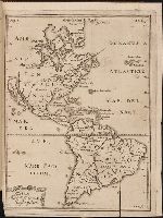
Kort beskrifning om provincien Nya Swerige uti America : som nu foertjden af the Engelske kallas
Image Count:
1
Description:
Preceding p. 1. and Teaching resource: Professor John Mack Faragher, History 141: The American West.
Subject (Geographic):
Canada --Discovery and exploration, South America --Discovery and exploration, United States --Discovery and exploration, and Western Hemisphere --Maps --Early works to 1800
Collection Created:
Stockholm : Tryckt uti Kongl. boktr. hos S. Wankijfs ankia, med egen bekostnad, af J. H. Werner, 1702
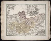
[Atlas factice of 50 maps, primarily by Johann Baptist Homann and/or issued by the Homann Erben
Image Count:
1
Alternative Title:
Cours de Danube
Publisher:
Cura Homannianorum Heredum, C.P.S.C.M
Subject (Geographic):
Balkan Peninsula --Maps --Early works to 1800, Danube River Valley --Maps --Early works to 1800, Europe, Central --Maps --Early works to 1800, and Europe, Southern --Maps --Early works to 1800
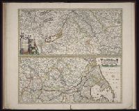
Blaeu, Joan, 1596-1673. Theatrum orbis terrarum Blaeu, Willem Janszoon, 1571-1638 Blaeu, Willem Janszoon, 1571-1638. Theatrum orbis terrarum
Published / Created:
[ca. 163-?]
Call Number:
1983 Folio 19
Collection Title:
[Atlas factice of 96 maps by Blaeu, Visscher, Jansson, Hondius and others]
Image Count:
2
Resource Type:
Maps, Atlases & Globes
Alternative Title:
Imperium Turcicum in Europa, Asia et Africa regiones proprias, tributar, et clientelares exhibens and Turcicum imperium
Description:
Imperfect: torn and mutilated along fold and edges, partially repaired, with some loss of text; cartouche cut-out and replicated in ms. with new title.