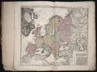
Hase, Johann Matthias, 1684-1742 Homann Erben (Firm)
Published / Created:
1746
Call Number:
1975 Folio 31
Collection Title:
[Atlas factice of 42 maps, produced by the Homann Erben firm]
Image Count:
1
Alternative Title:
Ducatus Silesiae tabula altera superiorem Silesiam exhibens and Haute Silesie, qui comprend les Principautes de Neise, de Munsterberg, de Laegerndorf, de Troppau, d’Oppeln, de Ratibor, de Teschen dessinee par les Heritiers de Homann, l’an 1746
Publisher:
Homann Erben
Subject (Geographic):
Silesia, Upper (Poland and Czech Republic) --Maps --Early works to 1800
Hase, Johann Matthias, 1684-1742 Homann Erben (Firm) Mayer, Tobias, 1723-1762
Published / Created:
1745
Call Number:
1975 Folio 31
Collection Title:
[Atlas factice of 42 maps, produced by the Homann Erben firm]
Image Count:
1
Alternative Title:
Basse Silesie qui comprend les Principautes de Schweidnitz, de Iauer, de Glogau, de Breslau, de Liegnitz, de Brieg, de Wolau, de Oels & de Sagan and Ducatus Silesiae tabula geographica prima inferiorem eius partem
Publisher:
Homann Erben
Subject (Geographic):
Silesia, Lower (Poland and Germany) --Maps --Early works to 1800
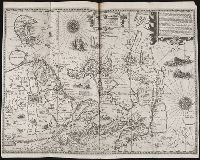
Langren, Henricus F. ab (Henricus Florentius), ca. 1574-1648
Published / Created:
1595
Call Number:
Z3 017
Collection Title:
John Huighen van Linschoten, his Discours of Voyages into ye Easte & West Indies
Image Count:
1
Description:
[Scale ca. 1:13,500,000]., Bound in following p. 32., Map has some small tears along fold lines., and Map properly belongs to the Dutch edition of 1596.
Subject (Geographic):
Borneo --Maps --Early works to 1800, China --Maps --1368-1644, Japan --Maps --Early works to 1800, Java (Indonesia) --Maps --Early works to 1800, and Sumatra (Indonesia) --Maps
Subject (Topic):
Voyages and travels --Early works to 1800
Collection Created:
[London] : Printed at London by [John Windet for] Iohn Wolfe, printer to ye Honorable Cittie of London, [1598]
Navigatio ac itinerarivm Iohannis Hvgonis Linscotani in Orientalem sive Lvsitanorvm Indiam
Image Count:
1
Description:
[Scale ca. 1:13,500,000]., Bound in following page 22., Map has several areas of small brown and yellow stains on the recto as well as two areas of linear white chalky lines on the verso; one forms a cross., and Map has significant tear along bottom center fold.
Subject (Geographic):
Borneo --Maps, China --Maps --Early works to 1800, Indonesia --Maps, Japan --Maps --Early works to 1800, Java (Indonesia) --Maps --Early works to 1800, and Philippines --Maps
Subject (Name):
Claesz, Cornelis, ca. 1546-1609, publisher, Elzevier, Gillis, bookseller, Hendricksz, Aelbrecht, fl. 1573-1605, printer, and Langren, Arnold Florent van, 1580-1644
Subject (Topic):
Voyages and travels --Early works to 1800
Collection Created:
Hagae-Comitis : Ex officina Alberti Henrici, impensis authoris & Cornelii Nicolai, prostantque apud Aegidium Elseuirum, anno 1599