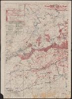
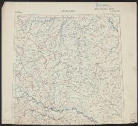
"19./6.-26./6./18"., Legend indicates weekly artillery information in red ink, roads, barriers, and trenches in green ink., Ms. annotations in German indicating artillery locations., and Verso: Map of other parts of same regions, with trenches indicated in red ink, new roads indicated in green ink.
Publisher:
s.n.,
Subject (Geographic):
Île-de-France (France)--Military maps and Lorraine (France)--Military maps
Subject (Topic):
World War, 1914-1918--France--Lorraine and World War, 1914-1918--Maps
Ordnance Survey of Great Britain and Ireland Royal Geographical Society (Great Britain). Geographical Section
Published / Created:
1915
Call Number:
11hcf 1919E-18
Container / Volume:
BRBL_00010Z
Image Count:
1
Resource Type:
Maps, Atlases & Globes
Alternative Title:
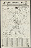
Europe 1:1,000,000, G.S.G.S. ; no. 2758, and GSGS (Series) ; no. 2758.
Description:
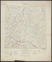
Copy 2. Imperfect. Bled, bottom of map and indexes wanting., Includes index to adjoining sheets, index to boundaries, and pronunciation glossary., and Ms. notes. Inscription: [Charles] Seymour.
Ordnance Survey of Great Britain and Ireland Royal Geographical Society (Great Britain). Geographical Section
Published / Created:
1915
Call Number:
11hcf 1919E-18
Image Count:
1
Resource Type:
Maps, Atlases & Globes
Alternative Title:
Europe 1:1,000,000, G.S.G.S. ; no. 2758, and GSGS (Series) ; no. 2758.
Description:
Copy 1. Imperfect. Mutilated. Ms. notes. Inscription: [Charles] Seymour., Includes index to adjoining sheets, index to boundaries, and pronunciation glossary., and Ms. notes. Inscription: [Charles] Seymour.
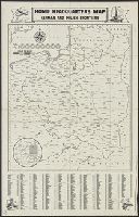
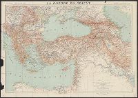
Map of Jugoslav territory and Map of Southern Slav territory
Description:
Imperfect: Cover wanting. Overprint in red on map indicating "Territory occupied by Italy 4000 S.q Mi.". Red stamp in upper right corner of sheet: "American Embassy. Paris, France Dec. 13, 1918"., Legend in English, Croatian, and French., and Sh
Publisher:
Christophers,
Subject (Geographic):
Yugoslavia--Maps and Yugoslavia--Maps--1915
Subject (Topic):
Ethnology--Yugoslavia--Maps and World War, 1914-1918--Maps
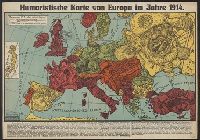
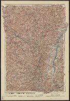
"Front au 1er. Janvier 1916.", "Supplément à l'illustration.", Ms. note outside bottom right margin "L'illus MY'19"., and Shows location of Western Front, railways, roads, canals, borders, and fortifications.