Skip to search
Skip to main content
Skip to first result
Search
You Searched For
Genre
Engravings
Resource Type
Maps, Atlases & Globes
New Search
Search Results
Creator:
Published / Created:
1696
Call Number:
1973 Folio 10
Image Count:
1
Resource Type:
Maps, Atlases & Globes
Alternative Title:
Cercle de Franconie, ou sont les eveches De Wurtzburg, de Bamberg, et d'Aichstet, les estats du grand Maistre des Chevaliers Teutons, les Marquisats de Cullembach, et d'Ohnspach, les Comtes d'Henneberg, d'Holach, de Reineck, de Wertheim, d'erpach, de Schwartzenberg, et de Castel, les Baronies de Limpurg, et de Sensheim, et les villes imperiales de Nurenberg, de Rotenburg, de Schweinfurt, Windsheim, et de Weissenburg
Description:
Bar scales in Italian miles, common leagues of Germany, great leagues of Germany, common leagues of France, great leagues of France, and leagues of one hours traveling., Dresse sur les Memoires les plus Nouveaux par le Sr. Sanson., Ferro meridian., No. 30 of 69 maps bound together in composite atlas., Relief shown pictorially., and Scale [ca. 1:510 000].
Publisher:
Chez H. Iaillot ...
Subject (Geographic):
Bavaria (Germany) --Maps --Early works to 1800
Found in:
Beinecke Rare Book and Manuscript Library > Le cercle de Franconie : subdivise en tous les estats qui le composent
Creator:
Published / Created:
1713
Call Number:
1978 Folio 112
Image Count:
1
Resource Type:
Maps, Atlases & Globes
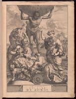
Alternative Title:
Geographie royale
Description:
Title in red and black with vignette.
Publisher:
Chez Pierre vander Aa, marchand libraire,
Subject (Topic):
Atlases, French, Atlases--Early works to 1800, and Geography--Early works to 1800
Found in:
Beinecke Rare Book and Manuscript Library > Le nouveau theatre du monde. ou La geographie royale, composée de nouvelles cartes tres-exactes ... Avec une description geographique et historique des quatre parties de l'univers, desquelles l'Europe en detail est écrite par Mr. Gueudeville, & les trois autres parties par Mr. Ferrarius ...
Creator:
Published / Created:
1779
Call Number:
1977 Folio 78
Collection Title:
A New and accurate chart of the West-India Islands and coast, with the gulf passage through the New
Image Count:
1
Resource Type:
Maps, Atlases & Globes
Alternative Title:
A plan of Cape Nicola Mole, on the west end of Hispaniola from a French survey. pl. 34
Description:
Printed for R. Sayer and J. Bennet
Subject (Geographic):
Cuba., Hispaniola., and Port-au-Prince (Haiti)
Subject (Topic):
Nautical charts
Collection Created:
London, Printed for Robert Sayer and John Bennett, Fleet-Street, 1779
Found in:
Beinecke Rare Book and Manuscript Library > Leogane and Port au Prince in the island of Hispaniola. pl. 33
Creator:
Published / Created:
1691
Call Number:
1984 Folio 3
Collection Title:
Atlas nouveau : contenant toutes les parties du monde ou sont exactement remarques les empires
Image Count:
1
Resource Type:
Maps, Atlases & Globes
Subject (Geographic):
France. and Switzerland
Subject (Topic):
Atlases --Early works to 1800 and Atlases, French.
Collection Created:
A Paris : Chez Hubert Iaillot ioignant les Grands Augustins aux deux Globes, 1692
Found in:
Beinecke Rare Book and Manuscript Library > Les Etats de Savoye et de Piemont
Creator:
Published / Created:
[168-?]
Call Number:
1973 Folio 10
Image Count:
1
Resource Type:
Maps, Atlases & Globes
Description:
No. 13 of 69 maps bound together in composite atlas., Oriented with north towards upper left., Relief shown pictorially., Scale not given., and Title in Latin; place names in French.
Publisher:
Chez Jacques de la Feuille ...
Subject (Geographic):
Paris (France) --Maps --Early works to 1800
Found in:
Beinecke Rare Book and Manuscript Library > Lutetiae Parisiorum universae Galliae metropolis novissima [et] accuratissima
Creator:
Call Number:
1973 Folio 103
Collection Title:
De Nieuwe groote lichtende zee-fakkel ...
Image Count:
1
Resource Type:
Maps, Atlases & Globes
Subject (Geographic):
Madagascar
Subject (Topic):
Atlases and Nautical charts.
Collection Created:
tAmsterdam, Johannes van Keulen, 1753-81
Found in:
Beinecke Rare Book and Manuscript Library > Madagascar
Creator:
Published / Created:
[1700?]
Call Number:
1973 Folio 10
Image Count:
1
Resource Type:
Maps, Atlases & Globes
Description:
Ferro meridian., No. 51 of 69 maps bound together in composite atlas., Relief shown pictorially., and Scale [ca. 1:11 750 000].
Publisher:
[Frederik de Wit]
Subject (Geographic):
Asia --Maps --Early works to 1800
Found in:
Beinecke Rare Book and Manuscript Library > Magnae Tartariae : magni Mogolis imperii, Iaponiae et Chinae : nova descriptio ex tabula ampliss viri D.N. Witsen pro majori parte aliis auctoribus excerpta et dita
Creator:
Published / Created:
[ca. 1680]
Call Number:
1973 Folio 10
Image Count:
1
Resource Type:
Maps, Atlases & Globes
Alternative Title:
Mediterranean Sea divided into the eastern and western seas, subdivides into its principal parts or seas ... described by Sanson, corrected and amended by William Berry
Description:
Based on La Mer Mediterranee divisee enses Principales Parties, ou Mers by Nicolas Sanson., Dedicated To the most serene and most sacred majesty James II ... by William Berry., Ms. mathematical annotations in left margin., No. 23 of 69 maps bound together in composite atlas., Relief shown pictorially., and Scale [ca. 1:610 000].
Publisher:
Sold by William Berry at the signe of the Globe between Charing-Cross and White-Hall
Subject (Geographic):
Mediterranean Region --Maps --Early works to 1800
Found in:
Beinecke Rare Book and Manuscript Library > Mediterranean Sea divided into its principal parts or seas
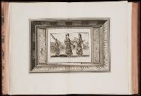
Call Number:
1973 +32
Collection Title:
La galerie agreable du monde, où l'on voit en un grand nombre de cartes tres-exactes et de belles
Image Count:
1
Resource Type:
Maps, Atlases & Globes
Alternative Title:
Ministres d'etat au cour du Grand Mogol.
Subject (Topic):
Atlases--Early works to 1800 and Geography--Pictorial works
Collection Created:
Le tout mis en ordre & executé à Leide, par Pierre vander Aa [1729?]
Found in:
Beinecke Rare Book and Manuscript Library > Mine de Diamans, aux Indes Orientales
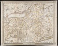
Creator:
Published / Created:
1836
Call Number:
1973 432
Collection Title:
Atlas of New York
Image Count:
1
Resource Type:
Maps, Atlases & Globes
Description:
Removed from Atlas of New York, 1838 for conservation treatment.
Publisher:
J.H. Colton & Co
Subject (Geographic):
New York (State)
Collection Created:
New York : For sale by the principal booksellers, 1838
Found in:
Beinecke Rare Book and Manuscript Library > New-York
Branch:v1.61.8 ,Deployed:2024-06-20T11:15:02-04:00