Skip to search
Skip to main content
Skip to first result
Search
You Searched For
Resource Type
Maps, Atlases & Globes
New Search
Search Results
Published / Created:
1905
Call Number:
565 H212 1905
Container / Volume:
BRBL_00299
Image Count:
1
Resource Type:
Maps, Atlases & Globes
Alternative Title:
TSGS ; 2019 and TSGS ; 2019.
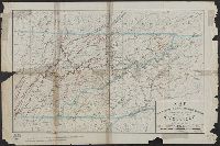
Description:
"Reproduced from Russian Staff map 1904."
Publisher:
War Office,
Subject (Geographic):
Harbin Region (China)--Maps and Manchuria (China)--Maps
Subject (Name):
Great Britain. War Office. General Staff. Geographical Section
Found in:
Beinecke Rare Book and Manuscript Library > Map of country south of Harbin : to illustrate the campaign in Manchuria.
Published / Created:
1905
Call Number:
565 N622 1905
Container / Volume:
BRBL_00299
Image Count:
1
Resource Type:
Maps, Atlases & Globes
Alternative Title:
TSGS ; 2044 and TSGS ; 2044.
Description:
"Reproduced from Russian Staff map 1904.", "War Office, May, 1905.", and Includes index map.
Publisher:
War Office,
Subject (Geographic):
Manchuria (China)--Maps
Subject (Name):
Great Britain. War Office. General Staff. Geographical Section
Found in:
Beinecke Rare Book and Manuscript Library > Map of country west of Ninguta : to illustrate the campaign in Manchuria.
Creator:
Published / Created:
1974]
Call Number:
844 L89 1974
Container / Volume:
BRBL_00606
Image Count:
1
Resource Type:
Maps, Atlases & Globes
Description:
"Neg 160 R.", Blue line print., and Includes inset of Santa Catalina Island and San Clemente Island.
Publisher:
Dept. of County Engineer,
Subject (Geographic):
Los Angeles County (Calif.)--Maps
Subject (Name):
Brandt, Harvey T
Found in:
Beinecke Rare Book and Manuscript Library > Map of county of Los Angeles / Harvey T. Brandt, County Engineer.
Published / Created:
1925
Call Number:
738GC 1924
Container / Volume:
BRBL_00387
Image Count:
1
Resource Type:
Maps, Atlases & Globes
Alternative Title:
Saskatchewan, Central. Soil. 190,080. 1925.
Description:
NTS 73 F/13, 14, 15; K/2, 3, 4.
Publisher:
Topographical Survey,
Subject (Geographic):
Saskatchewan--Maps
Subject (Name):
Canada. Topographical Survey
Found in:
Beinecke Rare Book and Manuscript Library > Map of district north and east of Onion Lake, comprising part of Prince Albert Land District.
Creator:
Published / Created:
1876
Call Number:
801gbc K77 1876
Container / Volume:
BRBL_00541
Image Count:
1
Resource Type:
Maps, Atlases & Globes
Description:
Includes note., Prime meridians: Greenwich and Washington., Relief shown by hachures., and Shows railroads, and copper and iron ores.
Publisher:
[The Company] ; and Am. Photo-Lithographic Co.,
Subject (Geographic):
North Carolina--Maps and Tennessee--Maps
Subject (Name):
American Photo-Lithographic Company
Subject (Topic):
Minerals--North Carolina--Maps and Minerals--Tennessee--Maps
Found in:
Beinecke Rare Book and Manuscript Library > Map of east Tennessee & western North Carolina : showing mineral deposits in vicinity of Knoxville, Tenn. / drawn by Charles Waring & Co.
Published / Created:
187-?]
Call Number:
825gme 1870
Container / Volume:
BRBL_00576
Image Count:
1
Resource Type:
Maps, Atlases & Globes
Alternative Title:
General profile of the road-bed of the Mo.R.F.S. & G.R.R., showing the elevation of the road bed, stations, streams & summits, relative distances & gradients.
Description:
Date inferred from status of Miissouri River, Fort Scott & Gulf Railroad, shown complete to Baxter Springs (1870). and Includes "General profile of the road-bed of the Mo.R.F.S. & G.R.R., showing the elevation of the road bed, stations, streams & summits; relative distances & gradients" (scale vertical [1:4,800] and horizontal [1:480,000]).
Publisher:
s.n.,
Subject (Name):
Missouri River, Fort Scott & Gulf Railroad--Maps
Subject (Topic):
Railroads--Kansas--Maps
Found in:
Beinecke Rare Book and Manuscript Library > Map of eastern Kansas : showing the lines of the Mo.R.F.S. & G.R.R. and connections.
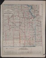
Published / Created:
1883
Call Number:
824 1883
Container / Volume:
BRBL_00570
Image Count:
1
Resource Type:
Maps, Atlases & Globes
Alternative Title:
Map showing main lines of railroad leading to Nebraska.
Description:
Includes text and "Map showing main lines of railroad leading to Nebraska.", Library's copy stamped: B.F. Munroe., and Shows lands for sale.
Publisher:
O.F. Davis & Co.,
Subject (Geographic):
Nebraska--Maps
Subject (Name):
Munroe, B. F. and O.F. Davis & Co
Subject (Topic):
Real property--Nebraska--Maps
Found in:
Beinecke Rare Book and Manuscript Library > Map of eastern Nebraska.
Creator:
Published / Created:
[191-]
Call Number:
53ed 1917
Container / Volume:
BRBL_00286
Image Count:
1
Resource Type:
Maps, Atlases & Globes
Publisher:
Royal Geographical Society,
Subject (Geographic):
Turkey, Eastern--Maps
Subject (Topic):
Ethnology--Turkey, Eastern--Maps
Found in:
Beinecke Rare Book and Manuscript Library > Map of eastern Turkey in Asia, Syria and western Persia (ethnographical).
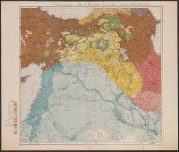
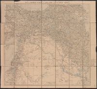
Creator:
Published / Created:
1921
Call Number:
53 1921
Container / Volume:
BRBL_00285
Image Count:
1
Resource Type:
Maps, Atlases & Globes
Alternative Title:
Eastern Turkey in Asia
Description:
"Published by the Royal Geographical Society, 1910. Railways inserted to January, 1921.", Covers on verso not digitized, Includes glossary of terms in margin., and Relief shown by hachures and spot heights.
Publisher:
Royal Geographical Society,
Subject (Geographic):
Middle East--Maps
Found in:
Beinecke Rare Book and Manuscript Library > Map of eastern Turkey in Asia, Syria and western Persia [cartographic material].
Creator:
Published / Created:
[1915?]
Call Number:
53 1915
Container / Volume:
BRBL_00285
Image Count:
1
Resource Type:
Maps, Atlases & Globes
Description:
"Published by the Royal Geographical Society, 1910. Railways inserted to November 1915.", Includes reference list of terms for mountains, rivers, lakes, etc., in Turkish, Persian, Arabic and Egyptian., and Relief shown by shading, hachures, and spot heights.
Publisher:
Royal Geographical Society,
Subject (Geographic):
Middle East--Maps
Found in:
Beinecke Rare Book and Manuscript Library > Map of eastern Turkey in Asia, Syria and western Persia [cartographic material].
Branch:v1.61.6 ,Deployed:2024-06-12T09:55:36-04:00