Skip to search
Skip to main content
Skip to first result
Search
You Searched For
Resource Type
Maps, Atlases & Globes
Language
Russian
New Search
Search Results
Creator:
Call Number:
547 1897
Container / Volume:
BRBL_00291
Image Count:
6
Resource Type:
Maps, Atlases & Globes
Alternative Title:
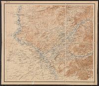
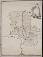
[Карта десятиверстная Туркестанского Военного Округа].
Description:
"Pod redakt︠s︡īeĭ polkovn. Rodīonova.", "Sostav. klas. topogr. Khondazhevskīĭ, graviroval [?], 1897 g."--Sheet P. VII, L.8., "Под редакціей полков. Родіонова.", "Состав. клас. топогр. Хондажевскій, гравировалъ [?], 1897 г."--Sheet P. VII, L.8., and Imperfect
Subject (Geographic):
Asia, Central--Maps
Found in:
Beinecke Rare Book and Manuscript Library > [Karta desi︠a︡tiverstnai︠a︡ Turkestanskogo Voennogo Okruga].
Published / Created:
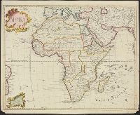
1722
Call Number:
60 1722
Container / Volume:
BRBL_00323
Image Count:
1
Resource Type:
Maps, Atlases & Globes
Description:
Resembles Guillaume de L'Isle's map of Africa, except there is less interior detail in the Russian map ...
Subject (Geographic):
Africa--Maps--Early works to 1800
Found in:
Beinecke Rare Book and Manuscript Library > [Map of Africa].
Published / Created:
[1720?]
Call Number:
30 1720
Container / Volume:
BRBL_00029
Image Count:
1
Resource Type:
Maps, Atlases & Globes
Description:
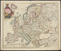
Preliminary record. and Text in Russian, ca. 1720.
Subject (Geographic):
Europe--Maps--Early works to 1800
Found in:
Beinecke Rare Book and Manuscript Library > [Map of Europe, completely identical to the maps of Guillaume de L'Isle].
Creator:
Published / Created:
[between 1750 and 1800?]
Call Number:
BrSides Double Folio 2019 79
Image Count:
1
Resource Type:
Maps, Atlases & Globes
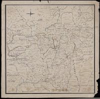
Description:
In manuscript on map: Kapitan" Matveĭ Loginov"; on verso: Ural-Gebiet, zwischen Kasan u. Jekaterinburg; stampf of the Königliches Kartographisches Institut, Berlin., Relief shown pictorially and by spot heights., and Title devised by cataloger.
Subject (Geographic):
Orenburgskai︠a︡ oblastʹ (Russia)--Maps--Early works to 1800. and Ural Mountains (Russia)--Maps--Early works to 1800.
Subject (Name):
Königliches Kartographisches Institut (Berlin) Stamp.
Found in:
Beinecke Rare Book and Manuscript Library > [Map of the Central and Southern Ural Mountains].
Published / Created:
[1780?]
Call Number:
BrSides Folio 2019 54
Image Count:
1
Resource Type:
Maps, Atlases & Globes
Description:
Illegible annotation on verso of sheet., Title devised by cataloger., and Unfinished manuscript map.
Subject (Geographic):
Permskai︠a︡ oblastʹ (Russia)--Maps--Early works to 1800.
Found in:
Beinecke Rare Book and Manuscript Library > [Map of the Perm province].
Published / Created:
[19--].
Call Number:
30em 350-650
Container / Volume:
BRBL_00037B
Image Count:
2
Resource Type:
Maps, Atlases & Globes
Description:
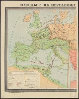
In Russian.
Subject (Geographic):
Europe--Maps
Found in:
Beinecke Rare Book and Manuscript Library > [Migrations of peoples in Europe during the 4th-7th centuries].
Published / Created:
ca. 1914?]
Call Number:
30am 1914A
Container / Volume:
BRBL_00037
Image Count:
1
Resource Type:
Maps, Atlases & Globes
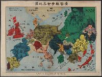
Description:
"No. 32". and In Russian, Japanese and English.
Subject (Geographic):
Europe--Maps
Subject (Topic):
World War, 1914-1918--Maps
Found in:
Beinecke Rare Book and Manuscript Library > [Pictorial war map, in Russian.]
Published / Created:
[1720]
Call Number:
11 1720A
Container / Volume:
BRBL_00004
Image Count:
1
Resource Type:
Maps, Atlases & Globes
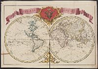
Description:
American N.W. Coast is not continued (except in a dotted line) North of California, and no mention is made of Bering's discoveries. and Preliminary record.
Subject (Geographic):
World--Maps--Early works to 1800
Found in:
Beinecke Rare Book and Manuscript Library > [Russian World Map, identical to the maps of Guillaume de L'Isle].
Branch:v1.61.6 ,Deployed:2024-06-12T09:55:37-04:00