Skip to search
Skip to main content
Skip to first result
Yale University Library
Ask Yale Library
Reserve Rooms
Places to Study
Research
Quicksearch
Search Library Catalog (Orbis)
Search Law Library Catalog (MORRIS)
Search Borrow Direct
Search WorldCat
Search Articles+
Search Digital Collections
Search Archives at Yale
Research Guides
Find Databases by Title
Find eJournals by Title
Guide to Using Special Collections
Services
Your Personal Librarian
Subject Specialists
Research Support and Workshops
Citation Tools
OverDrive: Popular Audio and eBooks
Get It @ Yale (Borrow Direct, Interlibrary Loan, Scan & Deliver)
Course Reserves
Off-Campus Access
EliScholar
OverDrive: Popular Audio and eBooks
Bass Media Equipment
Libraries & Collections
Arts Library
Bass Library
Beinecke Library
Classics Library
Divinity Library
Film Study Center
Fortunoff Archive
Humanities Collections
International Collections
Law Library
Lewis Walpole Library
Library Collection Services
Manuscripts & Archives
Map Collection
Marx Science & Social Science Library
Medical Library
Music Library
Sterling Library
Yale Center for British Art
Information & Policies
Library Hours
Departments & Staff
Borrowing & Circulation
Services for Persons with Disabilities
Copyright Basics
Scanning, Printing & Copying
Computers & Wireless
Library Policies
About the Library
Giving to the Library
Purchase Request
Working at the Library
Terms Governing Use of Materials
Search in
All Fields
Creator
Title
Call Number
Date
Subject
Orbis ID
Full Text
Description
Full text
search for
Search
Search
Advanced Search
Digital Collections
Search
You Searched For
Format
cartographic
Publication Place
London :
New Search
« Previous
|
280
-
288
of
935
|
Next »
Sort
by relevance
relevance
Creator (A --> Z)
Creator (Z --> A)
Title (A --> Z)
Title (Z --> A)
Year (ascending)
Year (descending)
Number of results to display per page
9
per page
9
per page
30
per page
60
per page
99
per page
View results as:
List
List
Gallery
Gallery
Search Results
280.
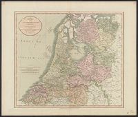
A new map of the United Provinces ... By John Cary, Engraver.
Published / Created:
1811
Call Number:
331 1811
Container / Volume:
BRBL_00079
Image Count:
1
Resource Type:
Maps, Atlases & Globes
Description:
Preliminary record.
Publisher:
J. Cary,
Subject (Geographic):
Netherlands--Maps
Found in:
Beinecke Rare Book and Manuscript Library
>
A new map of the United Provinces ... By John Cary, Engraver.
281.
A new map of the United States of America ... by John Cary, Engraver.
Published / Created:
1806
Call Number:
755 1806B
Container / Volume:
BRBL_00438
Image Count:
1
Resource Type:
Maps, Atlases & Globes
Publisher:
J. Cary,
Subject (Geographic):
Canada--Maps and East (U.S.)--Maps
Found in:
Beinecke Rare Book and Manuscript Library
>
A new map of the United States of America ... by John Cary, Engraver.
282.
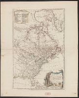
A new map of the United States of North America ... with Upper and Lower Canada &c ... by John Cary, Engraver.
Published / Created:
1805
Call Number:
755 1805B
Container / Volume:
BRBL_00437
Image Count:
1
Resource Type:
Maps, Atlases & Globes
Description:
Plain and colored.
Publisher:
J. Cary,
Subject (Geographic):
Canada--Maps and East (U.S.)--Maps
Found in:
Beinecke Rare Book and Manuscript Library
>
A new map of the United States of North America ... with Upper and Lower Canada &c ... by John Cary, Engraver.
283.
A new map of the United States of North America ... with Upper and Lower Canada &c ... by John Cary, Engraver.
Published / Created:
1805
Call Number:
755 1805B
Container / Volume:
BRBL_00437
Image Count:
1
Resource Type:
Maps, Atlases & Globes
Description:
Plain and colored.
Publisher:
J. Cary,
Subject (Geographic):
Canada--Maps and East (U.S.)--Maps
Found in:
Beinecke Rare Book and Manuscript Library
>
A new map of the United States of North America ... with Upper and Lower Canada &c ... by John Cary, Engraver.
284.
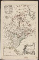
A new map of the United States of North America with the British Dominions ... By Samuel Dunn, Mathematician; Improved from the surveys of Capt. Carver.
Published / Created:
1786
Call Number:
755 1786A
Container / Volume:
BRBL_00435
Image Count:
1
Resource Type:
Maps, Atlases & Globes
Publisher:
Robt. Sayer,
Subject (Geographic):
Canada--Maps--Early works to 1800 and East (U.S.)--Maps--Early works to 1800
Found in:
Beinecke Rare Book and Manuscript Library
>
A new map of the United States of North America with the British Dominions ... By Samuel Dunn, Mathematician; Improved from the surveys of Capt. Carver.
285.
A new map of the United States of North America with the British Dominions on the Continent &c. By Samuel Dunn, Mathematician; improved from the Surveys of Capt. Carver.
Published / Created:
1783
Call Number:
755 1783C
Container / Volume:
BRBL_00434
Image Count:
1
Resource Type:
Maps, Atlases & Globes
Description:
Colored to show U.S., British, French, Spanish possessions.
Publisher:
R. Sayer & J. Bennett,
Subject (Geographic):
Canada--Maps--Early works to 1800 and East (U.S.)--Maps--Early works to 1800
Found in:
Beinecke Rare Book and Manuscript Library
>
A new map of the United States of North America with the British Dominions on the Continent &c. By Samuel Dunn, Mathematician; improved from the Surveys of Capt. Carver.
286.
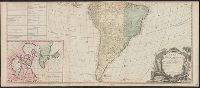
A new map of the Whole Continent of American ... from the Original Materials of Governor Pownall, M.P.
Published / Created:
1786
Call Number:
70 1786B
Container / Volume:
BRBL_00357
Image Count:
2
Resource Type:
Maps, Atlases & Globes
Description:
English and U.S. possessions shown in color with index to same., Inset: Hudson, Baffins Bay, Greenland, Iceland etc., and Possessions of France, Spain, Portugal, Dutch, and Denmark shown in color, with index to same.
Publisher:
Robt. Sayer,
Subject (Geographic):
America--Maps--Early works to 1800
Found in:
Beinecke Rare Book and Manuscript Library
>
A new map of the Whole Continent of American ... from the Original Materials of Governor Pownall, M.P.
287.
A new map of the circle of Austria ... / by John Cary, engraver.
Published / Created:
1811
Call Number:
41 AU79 1811
Container / Volume:
BRBL_00242
Image Count:
1
Resource Type:
Maps, Atlases & Globes
Publisher:
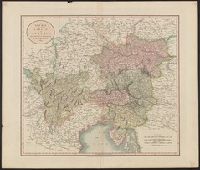
J. Cary,
Subject (Geographic):
Austria--Maps and Hungary--Maps
Found in:
Beinecke Rare Book and Manuscript Library
>
A new map of the circle of Austria ... / by John Cary, engraver.
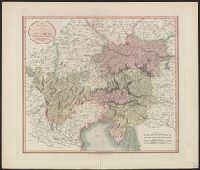
288.
A new map of the circle of Austria ... / by John Cary, engraver.
Published / Created:
1801
Call Number:
41 AU79 1801
Container / Volume:
BRBL_00242
Image Count:
1
Resource Type:
Maps, Atlases & Globes
Publisher:
J. Cary,
Subject (Geographic):
Austria--Maps and Hungary--Maps
Found in:
Beinecke Rare Book and Manuscript Library
>
A new map of the circle of Austria ... / by John Cary, engraver.
PREVIOUS
«
1
2
…
28
29
30
31
32
33
34
35
36
…
103
104
»
NEXT
Limit your search
Extent of Digitization
Completely digitized
923
Partially digitized
6
Unspecified
6
Access
Public
935
Repository
Beinecke Rare Book and Manuscript Library
935
Format
cartographic
✖
[remove]
935
text
4
Genre
Maps
866
Nautical charts
28
Maps.
16
Early maps
8
Topographic maps
7
Armorial bookplates (Provenance)
6
Early works
6
Maps in books
6
Nautical charts.
5
Hand coloring
4
more
Genre
»
Resource Type
Maps, Atlases & Globes
928
Books, Journals & Pamphlets
3
Language
English
909
French
9
Latin
6
German
4
Spanish; Castilian
3
Croatian
2
Italian
2
Swedish
2
Irish
1
Welsh
1
Creator
Wyld, James, 1812-1887
32
Arrowsmith, John, 1790-1873
23
Ordnance Survey of Great Britain and Ireland
22
Royal Geographical Society (Great Britain). Geographical Section
22
Edward Stanford Ltd
16
Cary, John, ca. 1754-1835
14
George Philip & Son
13
Vancouver, George, 1757-1798
12
Jefferys, Thomas, d. 1771
10
Great Britain. Hydrographic Dept
9
more
Creator
»
Subject (Topic)
World War, 1914-1918--Maps
21
British--America--Maps--Early works to 1800
11
Coasts--Alaska--Maps--Early works to 1800
4
World maps--Early works to 1800
4
British--America--Maps--Early works to 1800.
3
Discoveries in geography
3
Ethnology--Yugoslavia--Maps
3
Maps--Facsimiles
3
Russo-Turkish War, 1877-1878--Maps
3
World War, 1914-1918--Eurasia--Maps
3
more
Subject (Topic)
»
Subject (Name)
Sayer, Robert, 1725-1794
19
Robert Laurie and James Whittle
15
Robert Sayer and John Bennett (Firm)
15
Jefferys, Thomas, d. 1771. American atlas
12
Seymour, Charles,--1885-1963--Autograph
12
Arnold, Robert M.--Ownership
9
Robinson, G. G. (George G.)
9
Edwards, James, 1757-1816
8
Baker, Joseph, 1768-1817
7
Cary, John, ca. 1754-1835. Cary's new universal atlas
7
more
Subject (Name)
»
Publication Place
London :
✖
[remove]
935
Edinburgh ;
3
Glasgow ;
3
Edinburgh :
2
Berlin :
1
New York :
1
Paris :
1
Date Created
View distribution
Current results range from
1543
to
1999
Date Created range begin
Date Created range end
View larger »
[Missing]
2