Skip to search
Skip to main content
Skip to first result
Search
You Searched For
Date
Unknown
Repository
Beinecke Rare Book and Manuscript Library
Resource Type
Maps, Atlases & Globes
Date Created
[Missing]
New Search
Search Results
Call Number:
1973 Folio 114
Collection Title:
The English pilot: describing the West-India navigation, from Hudson's-Bay to the river Amazones
Image Count:
1
Resource Type:
Maps, Atlases & Globes
Subject (Geographic):
Atlantic Ocean --Maps --Early works to 1800 and South Carolina --Maps --Early works to 1800
Subject (Topic):
Navigation --Early works to 1800, Pilot guides --Atlantic Coast (U.S.) --Early works to 1800, and Pilot guides --Caribbean Area --Early works to 1800
Collection Created:
London : Printed for W. and J. Mount, T. Page and son, on Tower-Hill, MDCCLIX [1759]
Found in:
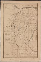
Beinecke Rare Book and Manuscript Library > A large draft of South Carolina from Cape Roman to Port Royall
Call Number:
1973 Folio 114
Collection Title:
The English pilot: describing the West-India navigation, from Hudson's-Bay to the river Amazones
Image Count:
1
Resource Type:
Maps, Atlases & Globes
Subject (Geographic):
Antigua --Maps --Early works to 1800, Atlantic Ocean --Maps --Early works to 1800, and West Indies --Maps --Early works to 1800
Subject (Topic):
Navigation --Early works to 1800, Pilot guides --Atlantic Coast (U.S.) --Early works to 1800, and Pilot guides --Caribbean Area --Early works to 1800
Collection Created:
London : Printed for W. and J. Mount, T. Page and son, on Tower-Hill, MDCCLIX [1759]
Found in:
Beinecke Rare Book and Manuscript Library > A large draft of the island Antegua
Creator:
Call Number:
71 1776
Container / Volume:
BRBL_00687
Image Count:
1
Resource Type:
Maps, Atlases & Globes
Description:
According to Sellers and Van Ee, this map is the 2nd state., At lower margin "London, printed for R. Sayer & J. Bennett, map & sea chartseller, no. 53, Fleet Street, as the act directs, Augst. 17th 1776., Includes a list of British colonies and territories., and Relief shown pictorially.
Publisher:
[Printed and sold by R. Sayer and J. Bennett, map and print seller, no. 53, Fleet St. 1776]
Subject (Geographic):
North America--Maps--Early works to 1800
Subject (Name):
Carver, Jonathan, 1710-1780, Jefferys, Thomas, d. 1771. American atlas, and Robert Sayer and John Bennett (Firm)
Found in:
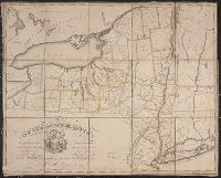
Beinecke Rare Book and Manuscript Library > A map of the British Empire, in North America / by Samuel Dunn, mathematician, improved from the surveys of Capt. Carver.
Branch:v1.64.0 ,Deployed:2024-09-11T10:25:40-04:00