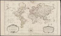
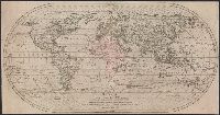
At bottom of the title cartouche: "Par le S.r Bellin, Ingenieur de la Marine and New Guinea shown joined to New Holland; Dampier's Strait marked. Bellin traces the 'hypothetical' coast of New Holland which was object of speculation before Cook's discoveries.
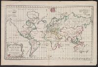
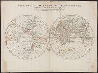
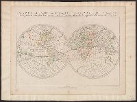
"Gravé par E. Dussy.", Cross collection no. 44., Map of the world, showing imaginary coastline of Australia joining Van Diemen's Land to d'Esprit., and Title in decorative frame; colour-coded according to major world religions.
Publisher:
Chez l'Auteur, Quai de l'Horloge pres le Pont neuf,
Subject (Name):
Dussy, E., fl. 1754-1778
Subject (Topic):
Religions--Maps--Early works to 1800 and World maps--Early works to 1800
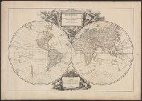
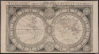
A re-issue by Jaillot of Jaugeon's 1688 map--Cf. Shirley, R. Mapping of the world, no. 538., Bernard Jaillot was the son of map maker Alexis Hubert Jaillot., Cross collection no. 21., and Relief shown pictorially.
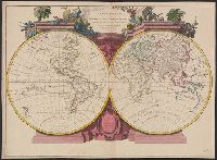
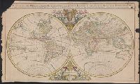
Description generale du globe terrestre et aquatique en deux-plans-hemispheres and Mappe-monde geo-hydrographique
Description:
"Presenté a Monseigneur le Dauphin, par son tres-humble, tres-obeissant et tres-fidele feruiteur, Hubert Jaillot"--Cartouche., Cross collection no. 27., Imperfect: chipped along edges, with no loss of text. Plate IV, state 3 (cf. Shirley 462)., Includes surrounding decorative illustrations., One of a number of printings from a map first drawn by Nicolas Sanson in 1674; later issued in Jaillot's Atlas nouveau [1681 and onwards]., and Relief shown pictorially.
Publisher:
Hubert Jaillot,
Subject (Name):
Jaillot, Alexis Hubert, 1632?-1712 and Jaillot, Alexis Hubert, 1632?-1712. Atlas nouveau