Skip to search
Skip to main content
Skip to first result
Search
You Searched For
Extent of Digitization
Completely digitized
Genre
Maps
Publication Place
Paris
New Search
Search Results
Creator:
Published / Created:
1889 [i.e 1890].
Call Number:
Atlas Coll. Colombia EEhe 889C
Image Count:
57
Description:
BEIN Atlas Coll. Colombia EEhe 889C: Errata slip dated January 15, 1892 pasted to map XI. and Plate xxi dated 1890.
Publisher:
Imprenta A. Lahure
Subject (Geographic):
Colombia
Subject (Topic):
Historical geography
Found in:
Beinecke Rare Book and Manuscript Library > Atlas geográfico é histórico de la república de Colombia (Antigua Nueva Granada) : el cual comprende las repúblicas de Venezuela y Ecuador con arreglo á los trabajos geográficos del general de ingenieros Agustin Codazzi, ejecutados en Venezuela y Nueva Granada
Creator:
Published / Created:
1645
Call Number:
1983 Folio 19
Collection Title:
[Atlas factice of 96 maps by Blaeu, Visscher, Jansson, Hondius and others]
Image Count:
1
Description:
Numbered 58 on verso. and Reinforced along lower edges with manuscript waste. Sheet measures 39.5 x 51.7 cm. No. 54 of 92 maps bound together.
Publisher:
N. Berey
Subject (Geographic):
Boulonnais (France) --Maps --Early works to 1800 and Pas-de-Calais (France) --Maps --Early works to 1800
Found in:
Beinecke Rare Book and Manuscript Library > Boulonnois, Pontieu, Artois, Comte de S. Paul et Pays de la Locoue
Published / Created:
1844.
Call Number:
30 1844
Image Count:
1
Publisher:
Aug. Logerot
Subject (Geographic):
Europe
Found in:
Beinecke Rare Book and Manuscript Library > Carte Générale des routes de Poste de L'Europe ... par A.R. Fremin, Géographe 1844
Creator:
Published / Created:
1643
Call Number:
1983 Folio 19
Collection Title:
[Atlas factice of 96 maps by Blaeu, Visscher, Jansson, Hondius and others]
Image Count:
1
Description:
Sheet measures 39.1 x 51.3 cm. Reinforced along lower edges with manuscript waste. No. 37 of 92 maps bound together.
Publisher:
[Pierre Mariette]
Subject (Geographic):
Auvergne (France) --Maps --Early works to 1800
Collection Created:
[1556-1680]
Found in:
Beinecke Rare Book and Manuscript Library > Carte d'Auuergne
Creator:
Published / Created:
[ca. 1634]
Call Number:
1983 Folio 19
Collection Title:
[Atlas factice of 96 maps by Blaeu, Visscher, Jansson, Hondius and others]
Image Count:
1
Description:
Sheet measures 39.1 x 51.3 cm. Reinforced along lower edges with manuscript waste. No. 38 of 92 maps bound together.
Publisher:
Christophe Tassin
Subject (Geographic):
Berry (France) --Maps --Early works to 1800
Found in:
Beinecke Rare Book and Manuscript Library > Carte de Berry
Creator:
Published / Created:
[1634]
Call Number:
1983 Folio 19
Collection Title:
[Atlas factice of 96 maps by Blaeu, Visscher, Jansson, Hondius and others]
Image Count:
1
Description:
Imperfect: wormhole in center crease, with some loss of text. Reinforced along lower edges with manuscript waste. Sheet measures 38.8 x 51.6 cm. No. 34 of 92 maps bound together.
Publisher:
Christophe Tassin
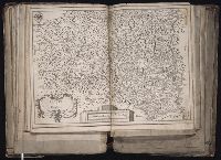
Subject (Geographic):
Bresse (France : Region) --Maps --Early works to 1800
Found in:
Beinecke Rare Book and Manuscript Library > Carte de Bresse
Creator:
Published / Created:
[1634]
Call Number:
1983 Folio 19
Collection Title:
[Atlas factice of 96 maps by Blaeu, Visscher, Jansson, Hondius and others]
Image Count:
1
Description:
Imperfect: wormhole in center crease, with no loss of text. Reinforced along lower edges with manuscript waste. Sheet measures 38.9 x 51.5 cm. No. 33 of 92 maps bound together.
Publisher:
Christophe Tassin
Subject (Geographic):
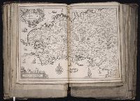
Brittany (France) --Maps --Early works to 1800
Found in:
Beinecke Rare Book and Manuscript Library > Carte de Bretagne
Creator:
Published / Created:
[1634?]
Call Number:
1983 Folio 19
Collection Title:
[Atlas factice of 96 maps by Blaeu, Visscher, Jansson, Hondius and others]
Image Count:
1
Description:
Sheet measures 39 x 51.5 cm. Reinforced along lower edges with manuscript waste. No. 40 of 92 maps bound together.
Publisher:
s.n
Subject (Geographic):
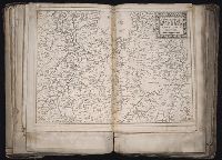
Dauphine (France) --Maps --Early works to 1800
Found in:
Beinecke Rare Book and Manuscript Library > Carte de Dauphine
Creator:
Published / Created:
1645
Call Number:
1983 Folio 19
Collection Title:
[Atlas factice of 96 maps by Blaeu, Visscher, Jansson, Hondius and others]
Image Count:
1
Description:
Numbered 61 on verso. and Reinforced along lower edges with manuscript waste. Sheet measures 39.1 x 51.3 cm. No. 57 of 92 maps bound together.
Publisher:
N. Berey proche les Augustins
Subject (Geographic):
Gelderland (Netherlands) --Maps --Early works to 1800
Found in:
Beinecke Rare Book and Manuscript Library > Carte des duches de Gueldres et Cleves, Comte de Zutphen, Frise et Overyssel
Creator:
Published / Created:
1828, i.e. 1834.
Call Number:
60 1828
Image Count:
2
Alternative Title:
Carte détaillée de l'Afrique et des îles qui en dependent and Afrique méridionale
Description:
BEIN 60 1828: Blindstamps: G.H. Picouet a Paris. Manuscript annotations on both sheets., Relief shown by hachures., Northern sheet has "Atlas en 65 feuilles, No. 52" above neat line; southern sheet "Atlas en 65 feuilles, No. 53.", and Includes insets: Extrémité Sud de l'Afrique, ou Colonie du Cap, Pays des Hottentots et Betjouanas; Archipel du Nord-Est de Madagascar; Abyssinie et Pays des Gallas, etc.
Publisher:
Chez l'Auteur
Subject (Geographic):
Africa
Found in:
Beinecke Rare Book and Manuscript Library > Carte détaillée (en deux feuilles), de l'Afrique et des îles qui en dependent (partie septentrionale) [cartographic material]
Branch:v1.61.6 ,Deployed:2024-06-12T09:55:37-04:00