Skip to search
Skip to main content
Skip to first result
Search
You Searched For
Language
Italian
New Search
Search Results
Published / Created:
[1800?]
Call Number:
402 1800
Container / Volume:
BRBL_00705
Image Count:
12
Resource Type:
Maps, Atlases & Globes
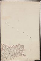
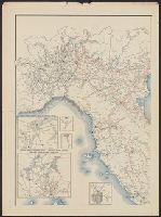
Description:
Color: Pen and green, red, yellow, and blue water color.
Subject (Geographic):
Lombardy (Italy)--Maps, Manuscript--Early works to 1800
Found in:
Beinecke Rare Book and Manuscript Library > [Manuscript map of Lombardy]. Fratelli Bordiga inc.
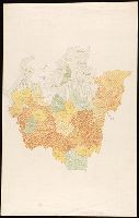
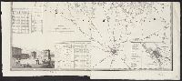
Published / Created:
[between 1840 and 1849?]
Call Number:
BrSides Folio 2018 146
Image Count:
1
Resource Type:
Maps, Atlases & Globes
Description:
Coordinates not present on map and are approximated., Each region provided with manuscript number., and Manuscript number on verso: 2170.
Subject (Geographic):
Italy, Northern--Maps
Found in:
Beinecke Rare Book and Manuscript Library > [Manuscript map of the regions in northern Italy].
Creator:
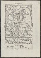
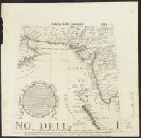
Published / Created:
155-?]
Call Number:
60 155X
Container / Volume:
BRBL_00321
Image Count:
2
Resource Type:
Maps, Atlases & Globes
Description:
Appears in the author's Delle navigationi et viaggi., Covers Africa, except for the western bulge and southern tip., Has watermark., Includes text on verso., Oriented with north to the bottom., Pg. no. in upper right margin: 261., Relief shown pictorially., and Titl
Publisher:
G.B. Ramusio,
Subject (Geographic):
Africa--Maps--Early works to 1800
Subject (Name):
Ramusio, Giovanni Battista, 1485-1557. Delle navigationi et viaggi
Found in:
Beinecke Rare Book and Manuscript Library > [Map of Africa].
Published / Created:
1918
Call Number:
2006 2031
Collection Title:
La beffa di Buccari : con aggiunti La canzone del Quarnaro, Il catalogo dei trenta di Buccari, Il
Image Count:
1
Description:
Bound in after p. 76 and Map of Istria on verso
Subject (Geographic):
Bakar (Croatia) and Italy --Politics and government --1914-1922
Subject (Topic):
World War, 1914-1918 --Territorial questions --Croatia --Rijeka
Collection Created:
Milano : Fratelli Treves, 1918
Found in:
Beinecke Rare Book and Manuscript Library > [Map of Buccari and Porto Re (Bakar and Kraljevica, Croatia)]
Published / Created:
1651
Call Number:
30 1651
Container / Volume:
BRBL_00029
Image Count:
1
Resource Type:
Maps, Atlases & Globes
Description:
Preliminary record.
Publisher:
Cornelio Dancherts,
Subject (Geographic):
Europe--Maps--Early works to 1800
Found in:
Beinecke Rare Book and Manuscript Library > [Map of Europe] Carta Noua accurata del passagio et strada dalli Paesi Bassi per via de Allemagna per Italia et per via di paesi Sinzeri a Geneva Lione et Roma.
Published / Created:
[1917].
Call Number:
11hcf 1919D-28
Container / Volume:
BRBL_00010X
Image Count:
2
Resource Type:
Maps, Atlases & Globes
Description:
"Legge 19 Sett. 1882, No. 1012." and Map torn in 3 pieces.
Publisher:
Istituto Geografico militare,
Subject (Geographic):
Italy--Maps
Found in:
Beinecke Rare Book and Manuscript Library > [Map of Italy and surrounding region during World War I.]
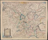
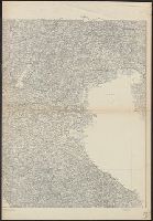
Published / Created:
[1816]
Call Number:
40 M59 1816
Container / Volume:
BRBL_00210
Image Count:
1
Resource Type:
Maps, Atlases & Globes
Description:
Inset: Pianta dell ra. città di Como. and Title supplied by cataloger.
Subject (Geographic):
Como (Italy)--Maps and Milan (Italy : Province)--Maps
Found in:
Beinecke Rare Book and Manuscript Library > [Map of province of Milan.]
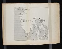
Published / Created:
1918
Call Number:
2006 2031
Collection Title:
La beffa di Buccari : con aggiunti La canzone del Quarnaro, Il catalogo dei trenta di Buccari, Il
Image Count:
1
Description:
Bound in after p. 76 and Map of Buccari and Porto Re on verso
Subject (Geographic):
Istria (Croatia and Slovenia)
Subject (Topic):
World War, 1914-1918 --Territorial questions --Croatia --Rijeka
Collection Created:
Milano : Fratelli Treves, 1918
Found in:
Beinecke Rare Book and Manuscript Library > [Map of the Istrian penninsula (Croatia)]
Creator:
Published / Created:
1696?]
Call Number:
29 1696
Container / Volume:
BRBL_00028
Image Count:
2
Resource Type:
Maps, Atlases & Globes
Description:
Appears in: Isolario, descrittione geografico-historica, sacro-profana...di tutte l'isole...del globo terracqueo / del P. maestro Vincenzo Coronelli, 1696. Parte II, p. 113., Appears to have, At head of page: Isolario del P. Coronelli., and In upper right: 113.
Publisher:
A' spese dell'autore,
Subject (Geographic):
Indian Ocean--Maps--Early works to 1800
Found in:
Beinecke Rare Book and Manuscript Library > [Map of the area of the western Indian Ocean from the southern Arabian Peninsula to the southern tip of India.]
Published / Created:
[19--?]
Call Number:
40gme 1865
Container / Volume:
BRBL_00230
Image Count:
2
Resource Type:
Maps, Atlases & Globes
Description:
Title supplied by cataloger.
Publisher:
C.Civelli,
Subject (Geographic):
Italy--Maps
Subject (Topic):
Railroads--Italy
Found in:
Beinecke Rare Book and Manuscript Library > [Map of the railways of Italy].
Branch:v1.61.8 ,Deployed:2024-06-20T11:14:55-04:00