Skip to search
Skip to main content
Skip to first result
Search
You Searched For
Extent of Digitization
Partially digitized
Format
cartographic
New Search
Search Results
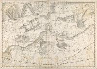
Published / Created:
[1625]
Call Number:
Pequot +P978
Collection Title:
Purchas his pilgrimes : In fiue bookes. The first, contayning the voyages and peregrinations made
Image Count:
1
Description:
Bound in following p. 1690.
Subject (Geographic):
America--Discovery and exploration--Early works to 1800
Subject (Topic):
Geography--Early works to 1800, Religions--Early works to 1800, and Voyages and travels--Early works to 1800
Collection Created:
London :
Found in:
Beinecke Rare Book and Manuscript Library > Virginia
Creator:
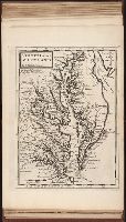
Published / Created:
[1732]
Call Number:
E1015 M66 1732
Collection Title:
Atlas minor: or a set of sixty-two new and correct maps, of all parts of the world. All composed
Image Count:
1
Description:
Autograph of Gravely. Autograph of Baldock. Autograph of Aston. Autograph of W. Alington.
Subject (Geographic):
America--Maps--Early works to 1800
Subject (Topic):
Atlases--Early works to 1800.
Collection Created:
London :
Found in:
Beinecke Rare Book and Manuscript Library > Virginia and Maryland by H. Moll geographer.
Creator:
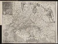
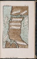
Call Number:
Taylor 256
Collection Title:
A map of Virginia : vvith a description of the covntrey, the commodities, people, government and
Image Count:
1
Abstract:
Inset depicting Powhatan.
Subject (Geographic):
Virginia --History --Colonial period, ca. 1600-1775
Subject (Topic):
Voyages and travels
Collection Created:
At Oxford : Printed by Joseph Barnes, 1612
Found in:
Beinecke Rare Book and Manuscript Library > Virginia discouered and described by Captayn John Smith
Call Number:
1973 Folio 114
Collection Title:
The English pilot: describing the West-India navigation, from Hudson's-Bay to the river Amazones
Image Count:
1
Resource Type:
Maps, Atlases & Globes
Subject (Geographic):
Atlantic Ocean --Maps --Early works to 1800, Maryland --Maps --Early works to 1800, New Jersey --Maps --Early works to 1800, and Virginia --Maps --Early works to 1800
Subject (Topic):
Navigation --Early works to 1800, Pilot guides --Atlantic Coast (U.S.) --Early works to 1800, and Pilot guides --Caribbean Area --Early works to 1800
Collection Created:
London : Printed for W. and J. Mount, T. Page and son, on Tower-Hill, MDCCLIX [1759]
Found in:
Beinecke Rare Book and Manuscript Library > Virginia, Maryland, Pennsilvania, east & west New Jarsey
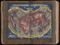
Published / Created:
[1542]
Call Number:
Taylor 86
Collection Title:
Rvdimenta cosmographica
Image Count:
1
Alternative Title:
Universalis cosmographia
Description:
Map of the world
Subject (Topic):
Cosmography, Early maps, and Geography, Medieval
Collection Created:
Impressvm in inclyta Transylvaniae Corona 1542
Found in:
Beinecke Rare Book and Manuscript Library > Vniversalis cosmographia
Branch:v1.61.8 ,Deployed:2024-06-20T11:14:55-04:00