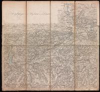
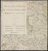
Relief shown by hachures., Sheets dated 1870 to 1874., Sheets dissected and mounted on linen. Stamp on verso of maps: Karpinski-von Wieser Map Collection. Seven sheets with labels and manuscript titles on verso., and Title supplied by cataloger.
Publisher:
[publisher not identified],
Subject (Geographic):
Tyrol (Austria)--Maps.
Subject (Name):
Karpinski, Louis Charles,--1878-1956--Ownership., Karpinski-von Wieser Map Collection., and Wieser, Franz,--Ritter von,--1848-1923--Ownership.
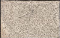
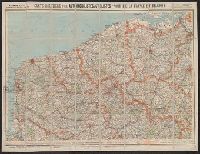
Carte routière pour automobilistes et cyclistes, Carte Taride, Cartes Taride pour automobilistes et cyclistes, and Nouvelle carte de France à l'usage des cyclistes et automobilistes
Description:
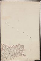
Also shows adjacent areas of Germany, Belgium, the Netherlands, Luxembourg, Switzerland, Italy, and Spain., Coverage complete in 34 sheets. Copy 3 incomplete., Each sheet separately numbered and titled: e.g., no. 3, Environs de Paris, section nord-est ; no. 27, Les bords du Rhin, Mayence à Strasbourg., Relief shown by shading and spot heights., and Some sheets dated in lower right corner, e.g., 5-18.
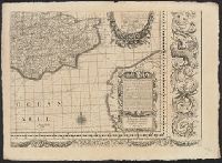
Engravers: Emanuel Bowen, C. Moore, and G. Child., From Jean-Baptiste Du Halde's Description géographique, historique, chronologique, politique, et physique de l'empire de la Chine (English edition, 1738)., From maps originally drawn in 1709-1710 by Jean Baptiste, Pierre Jartoux, Xavier Ehrenbert Fridelli, and Guillaume Bonjour., Prime meridians: Paris and Peking [Beijing]., Relief shown pictorially., and Watermarks.
Publisher:
[T. Gardner for Edward Cave],
Subject (Geographic):
Asia, Central--Maps--Early works to 1800.
Subject (Name):
Bonjour, Guillaume, 1670-1714, cartographer., Bowen, Emanuel, 1693 or 1694-1767, engraver., Child, G., engraver., and Du Halde, J.-B. (Jean-Baptiste), 1674-1743. Description géographique, historique, chronologique, politique,
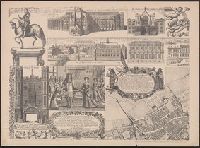
"This survey was begun by Mr. Ogilby, and finished & humbly dedicated by Wm. Morgan.", Alternate title: A prospect of London and Westminster., Cadastral map., Facsimile., and Includes "A prospect of London and Westminster taken at several stations to the southwar
Publisher:
London Topographical Society,
Subject (Geographic):
London (England)--Aerial views--Early works to 1800--Facsimiles, London (England)--Maps--Early works to 1800--Facsimiles, and Westminster (London, England)--Aerial views--Early works to 1800--Facsimiles
Subject (Name):
Lea, Philip, active 1683-1700, London Topographical Society, Morden, Robert, approximately 1650-1703, and Ogilby, John, 1600-1676