Skip to search
Skip to main content
Skip to first result
Search
You Searched For
Genre
Maps
Publication Place
London :
New Search
Search Results
Published / Created:
1794
Call Number:
755cea 1794
Container / Volume:
BRBL_00441
Image Count:
4
Resource Type:
Maps, Atlases & Globes
Description:
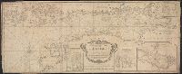
From the North American pilot. A new ed. much enlarged of the second part of the North Am. Pilot. fol. London, R. Laurie & J. Whittle, 1800. and Insets: 1. Plan of Hell Gate with view of Hell Gate by W.A. Williams 1777. 2. The Rivers Kennebeck and Sheepcut by
Publisher:
Laurie & Whittle,
Subject (Geographic):
Canada--Maps--Early works to 1800 and East (U.S.)--Maps--Early works to 1800
Found in:
Beinecke Rare Book and Manuscript Library > A New and Correct Chart of the Coast of New England and New York with the adjacent parts of Nova Scotia and New Brunswick from Cape Sable to the entrance of Hudsons or North River by Captain Holland.
Published / Created:
[1764?]
Call Number:
76cea 1764
Container / Volume:
BRBL_00446
Image Count:
1
Resource Type:
Maps, Atlases & Globes
Description:
From the English Pilot, the Fourth Book, London, W.&I. Mount, T. Page, 1764 and later editions. and Inset of coast views.
Publisher:
W.&I. Mount & T. Page,
Subject (Geographic):
New England--Maps--Early works to 1800
Found in:
Beinecke Rare Book and Manuscript Library > A New and Correct Chart of the Sea Coast of New-England, from Cape Codd to Casco Bay. Lately Surbey'd by Capt. Henry Barnsley.
Published / Created:
1794
Call Number:
303cea 1794
Container / Volume:
BRBL_00033
Image Count:
1
Resource Type:
Maps, Atlases & Globes
Description:
Aspo Is. & Harbor: 1:15,000., Insets: Entrance & Harbor of Revel, 1:204,000., Kasperwik Bay: 1:35,000., and Plan of Cronstal: 1:125,000.
Publisher:
Laurie & Whittle,
Subject (Geographic):
Baltic Sea--Maps--Early works to 1800
Found in:
Beinecke Rare Book and Manuscript Library > A New and Correct chart of the Gulf of Finland ... Published by command of the Empress of all the Russias.
Published / Created:
1743
Call Number:
319 1743
Container / Volume:
BRBL_00040
Image Count:
1
Resource Type:
Maps, Atlases & Globes
Description:
Preliminary record. and Views and text.
Publisher:
Henry Overton,
Subject (Geographic):
British Isles--Maps--Early works to 1800
Found in:
Beinecke Rare Book and Manuscript Library > A New and exact map of Great Britain ... [Including Ireland].
Published / Created:
1811
Call Number:
319 1811
Container / Volume:
BRBL_00040
Image Count:
1
Resource Type:
Maps, Atlases & Globes
Description:
Preliminary record.
Publisher:
J. Cary,
Subject (Geographic):
British Isles--Maps
Found in:
Beinecke Rare Book and Manuscript Library > A New map of the British Isles ... By John Cary, Engraver.
Published / Created:
1793
Call Number:
304gmd 1793
Container / Volume:
BRBL_00034B
Image Count:
1
Resource Type:
Maps, Atlases & Globes
Description:
Preliminary record.
Publisher:
Robert Sayer,
Subject (Geographic):
Europe,Central--Maps--Early works to 1800
Found in:
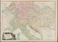
Beinecke Rare Book and Manuscript Library > A New map of the Emperor's Dominions exhibiting the Post Roads of Germany, Hungary, and the Netherlands ... parts of France, Italy, Switzerland and Poland ...
Published / Created:
1828
Call Number:
38GMD 1828
Container / Volume:
BRBL_00171
Image Count:
1
Resource Type:
Maps, Atlases & Globes
Description:
Inset: Corsica. and Preliminary record.
Publisher:
C. Smith,
Subject (Geographic):
France--Maps
Found in:
Beinecke Rare Book and Manuscript Library > A Physical and Topographical map of France ... the post Roads & Relays ... inland Navigation &c. Pickett Sculp. J. Smith Delin.
Published / Created:
1776
Call Number:
792cea Am32 1776
Container / Volume:
BRBL_00519
Image Count:
1
Resource Type:
Maps, Atlases & Globes
Description:
From the North American Pilot 1783.
Publisher:
R. Sayer & J. Bennett,
Subject (Geographic):
Florida--Maps--Early works to 1800
Found in:
Beinecke Rare Book and Manuscript Library > A Plan of Amelia Harbour and Barr in east Florida ...
Published / Created:
1776
Call Number:
786cea P838 1776
Container / Volume:
BRBL_00516
Image Count:
1
Resource Type:
Maps, Atlases & Globes
Description:
From the North America Pilot 1783.
Publisher:
R. Sayer & J. Bennett,
Subject (Geographic):
Port Royal (S.C.)--Maps--Early works to 1800
Found in:
Beinecke Rare Book and Manuscript Library > A Plan of Port Royal in South Carolina ...
Published / Created:
1755
Call Number:
97 L62 1755
Container / Volume:
BRBL_00678
Image Count:
1
Resource Type:
Maps, Atlases & Globes
Publisher:
John Rocque,
Subject (Geographic):
Lima (Peru)--Maps--Early works to 1800
Found in:
Beinecke Rare Book and Manuscript Library > A Scenographic Plan of the City of the Kings, otherwise called Lima, the capital of the Kingdonm of Peru ... as it was before the late earthquakes.
Branch:v1.61.8 ,Deployed:2024-06-20T11:15:04-04:00