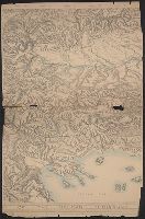
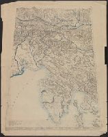
"Approximate scale in center of diagram 1:150,000, vertical exaggeration about 1 1/2 times.", 11hcf 1919E: Hand col. Sheet 1 with typed descriptive notes attached., and Relief shown by shading, land form drawing, hachures and spot heights.
Publisher:
American Geographical Society,
Subject (Geographic):
Friuli (Italy)--Maps, Istria (Croatia and Slovenia)--Maps, and Trieste Region (Italy)--Maps
Subject (Topic):
Block diagrams--Friuli (Italy : Province) and Block diagrams--Istria (Croatia and Slovenia)
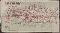
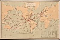
Includes "Table showing distances in miles between commercial ports of the world and distances saved by the Nicaragua Canal." and Shows "present routes" in black and "new routes via Nicaragua canal" in red.
Publisher:
Julius Bein & Co., Photo. Lith.,
Subject (Geographic):
Nicaragua Canal (Nicaragua)--Maps. and Nicaragua--Nicaragua Canal
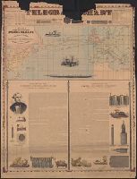
Incl. ill., 2 texts: [1.] Account of the invention and operation of the magnetic telegraph -- [2.] Description of making and laying submarine telegraph cables.
Publisher:
H.H. Lloyd & Co.,
Subject (Geographic):
Atlantic Ocean--Maps
Subject (Topic):
Cables, Submarine--Atlantic Ocean--Maps and Telegraph cables--Atlantic Ocean--Maps