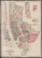
Topographical map of the cities of New York, Brooklyn, Jersey City and Hoboken
Description:
Hand colored., Insets: New York County north of 150th St. -- Map of New Neth, and Shows wards, other unspecified districts, ferry lines, some buildings and topographical details of surrounding islands, and parts of Queens County and New Jersey north of Hoboken.
Publisher:
M. Dripps,
Subject (Geographic):
Brooklyn (New York, N.Y.)--Administrative and political divisions--Maps, Brooklyn (New York, N.Y.)--Maps, Hoboken (N.J.)--Maps, Jersey City (N.J.)--, and New York (N.Y.)--Administrative and political divisions--Maps
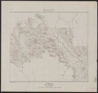
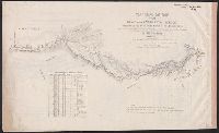
"Arthur O. Wheeler, Alpine Club House, Baniff 10th July 1912.", Ancillary map titled: Map showing Yellowhead Pass route from Edmonton to Tete-Jaune Cache., and Relief shown by form lines and spot heights.
United States. Army Service Schools (Fort Leavenworth, Kan.)
Published / Created:
1913
Call Number:
774 G33 1913R
Container / Volume:
BRBL_00499
Image Count:
1
Resource Type:
Maps, Atlases & Globes
Description:
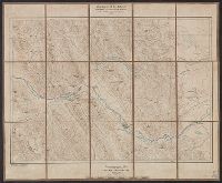
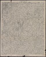
"Reduced from 12 in. W, Covers area from Heidlersburg, Pa. to Mayberry, Md., Datum is mean sea level., Imperfect: Mutilated, with some loss of text., In upper right margin: New Oxford sheet., Lower right margin: R 21., and Relief shown by contours and spot heights.
Publisher:
Army Service Schools,
Subject (Geographic):
Antietam Region (Md.)--Topographic maps and Gettysburg Region (Pa.)--Topographic maps