Skip to search
Skip to main content
Skip to first result
Search
You Searched For
Genre
Maps
Publication Place
[Washington] :
New Search
Search Results
Creator:
Published / Created:
1909
Call Number:
844fcm Y83 1909
Container / Volume:
BRBL_00615
Image Count:
1
Resource Type:
Maps, Atlases & Globes
Description:
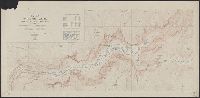
Includes "Index map" and table of "Elevations of principal points." and Relief shown by contours and spot heights.
Publisher:
The Survey,
Subject (Geographic):
Yosemite Valley (Calif.)--Maps
Subject (Name):
Douglas, Edward Morehouse, 1855-1932, Marshall, R. B. (Robert Bradford), 1867-1949, and Matthes, François, 1874-1948
Found in:
Beinecke Rare Book and Manuscript Library > Map of Yosemite Valley, Mariposa County, California / U.S. Geological Survey, George Otis Smith, Director ; E.M. Douglas, geographer ; State of California, George C. Pardee, Govenor.
Creator:
Published / Created:
1843
Call Number:
73fab 1843
Container / Volume:
BRBL_00375B
Image Count:
1
Resource Type:
Maps, Atlases & Globes
Alternative Title:
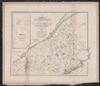
Rouse's Point and its vicinity on Lake Champlain.
Description:
Backed with linen. and Includes text and map of "Rouse's Point and its vicinity on Lake Champlain."
Publisher:
Corps of Topl. Engineers,
Subject (Geographic):
Canada--Boundaries--United States--Maps and United States--Boundaries--Canada--Maps
Subject (Name):
Graham, J. D. (James Duncan), 1799-1865 and Graham, J. D.--(James Duncan),--1799-1865--Presentation inscription to Yale College
Found in:
Beinecke Rare Book and Manuscript Library > Map of the boundary lines between the United States and the adjacent British provinces : from the mouth of the River St. Croix to the intersection of the parallel of 45 degrees of north latitude with the River St. Lawrence near St. Regis.
Creator:
Published / Created:
1843
Call Number:
73fab 1843
Container / Volume:
BRBL_00375B
Image Count:
1
Resource Type:
Maps, Atlases & Globes
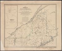
Alternative Title:
Rouse's Point and its vicinity on Lake Champlain.
Description:
"Map G no. 3." and Includes text and map of "Rouse's Point and its vicinity on Lake Champlain."
Publisher:
Corps of Topl. Engineers,
Subject (Geographic):
Canada--Boundaries--United States--Maps and United States--Boundaries--Canada--Maps
Found in:
Beinecke Rare Book and Manuscript Library > Map of the boundary lines between the United States and the adjacent British provinces : from the mouth of the River St. Croix to the intersection of the parallel of 45 degrees of north latitude with the River St. Lawrence near St. Regis.
Creator:
Published / Created:
1866
Call Number:
792 1866
Container / Volume:
BRBL_00518
Image Count:
1
Resource Type:
Maps, Atlases & Globes
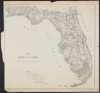
Description:
Imperfect.
Publisher:
General Land Office,
Subject (Geographic):
Florida--Maps and Florida--Maps--1866
Found in:
Beinecke Rare Book and Manuscript Library > Map of the state of Florida : showing the progress of the surveys accompanying [the] annual report of [the] Commissioner.
Published / Created:
1860
Call Number:
792 1860
Container / Volume:
BRBL_00518
Image Count:
1
Resource Type:
Maps, Atlases & Globes
Description:
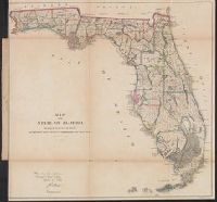
Above neat line at right: Sen. ex: doc. no. 1 2d. sess: 36 Cong., Identifies counties with basic surveying grid superimposed over state., Lithographed by: J. Bien, 180 Broadway N.Y., Map approved by Francis L. Dancy, Surveyor General, October 1st, 1860., and Status of surveys identified by symbols.
Publisher:
U.S. Senate,
Subject (Geographic):
Florida--Maps
Subject (Name):
Bien, Julius, 1826-1909, Dancy, Francis L, and United States. Congress. Senate
Subject (Topic):
Maps shelf, Real property--Florida--Maps, and Real property--Maps
Found in:
Beinecke Rare Book and Manuscript Library > Map of the state of Florida showing the progress of the surveys accompanying annual report of the surveyor general for 1860.
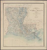
Creator:
Published / Created:
1896
Call Number:
795 1896
Container / Volume:
BRBL_00521
Image Count:
1
Resource Type:
Maps, Atlases & Globes
Alternative Title:
State of Louisiana
Description:
Prime meridians: Greenwich and Washington.
Publisher:
G.L.O.,
Subject (Geographic):
Louisiana--Maps
Subject (Name):
United States. General Land Office
Found in:
Beinecke Rare Book and Manuscript Library > Map of the state of Louisiana / compiled from the official records of the General Land Office and other sources under the direction of Harry King ; revised and drawn by Daniel O'Hare.
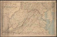
Creator:
Published / Created:
1863
Call Number:
783 1863B
Container / Volume:
BRBL_00509
Image Count:
1
Resource Type:
Maps, Atlases & Globes
Description:
Also covers Delaware, Maryland, West Virginia and parts of adjacent states., Includes table: Distances by railroads., and Relief shown by hachures.
Publisher:
The Office,
Subject (Geographic):
Delaware--Maps, Maryland--Maps, Virginia--Maps, and West Virginia--Maps
Subject (Name):
Bache, A. D. (Alexander Dallas), 1806-1867, Krebs, Charles G, and United States Coast Survey
Found in:
Beinecke Rare Book and Manuscript Library > Map of the state of Virginia / compiled from the best authorities and printed at the Coast Survey Office, A.D. Bache, supdt. ; compiled by W.L. Nicholson ; lith. by Chas. G. Krebs.
Creator:
Published / Created:
1945
Call Number:
23ak M58 1945
Container / Volume:
BRBL_00021
Image Count:
1
Resource Type:
Maps, Atlases & Globes
Description:
"No. 5932 ... 31 January 1945."
Publisher:
Reproduction Branch, OSS,
Subject (Geographic):
Micronesia--Maps, Outline and base
Found in:
Beinecke Rare Book and Manuscript Library > Micronesia : [outline maps] / R & A, OSS.
Published / Created:
1913
Call Number:
11hc 1913
Container / Volume:
BRBL_00010A
Image Count:
1
Resource Type:
Maps, Atlases & Globes
Publisher:
U.S. Geological Survey,
Subject (Geographic):
Caucasus--Maps
Found in:
Beinecke Rare Book and Manuscript Library > Mineral Production in the Caucasus / Authority: U.S. Geological Survey.
Creator:
Published / Created:
1934
Call Number:
831fb 1930
Container / Volume:
BRBL_00581
Image Count:
1
Resource Type:
Maps, Atlases & Globes
Publisher:
U.S. Govt. Print. Off.,
Subject (Geographic):
Montana--Administrative and political divisions--Maps
Found in:
Beinecke Rare Book and Manuscript Library > Montana, minor civil divisions : 1930 / Bureau of the Census.
Branch:v1.61.6 ,Deployed:2024-06-12T09:55:37-04:00