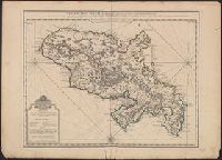
"Delahaye, sculpsit.", Bar scales given in "Lieues Marines de France et d'Angleterre de 20 au Deg.," "Lieues Marines et d'Espagne de 17 1/2 au Degré" and "Lieues Com. de France dont 25 font un Degré.", Legend in French and Dutch., Prime meridian: Ferro., and Shows settlements, mills, roads, anchorages, rivers, etc.
Publisher:
Chez la Vve. du Sr. Delisle, sur le Quay del'Horloge,
Subject (Geographic):
Martinique--Maps--Early works to 1800
Subject (Name):
Buache, Philippe, 1700-1773 and Delahaye, Jean Baptiste Henri, engraver
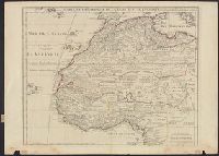
"Avec privil, "The words 'premier geographe du Roi' added in the title ... [indicate] that [a map] could not have been issued before 1718 when [De l'Isle] was appointed to that office"--Tooley, R.V. Guide to maps of Africa, p. 68., and Relief shown pictorially.
Publisher:
chez l'auteur fur le Quai de l'Horloge a l'Aigle d'Or,
Subject (Geographic):
Africa, North--Maps--Early works to 1800 and Africa, West--Maps--Early works to 1800
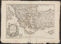
Bar scales given in "milles de Turquie," "lieues marines de France," and "lieues com[m]unes de France"., Covers also Albania, Macedonia and parts of Turkey, Cyprus, Bulgaria, Serbia, Montenegro and Bosnia., O, Prime meridian: Ferro., and Relief shown pictorially.
Publisher:
Chez l'Auteur ...,
Subject (Geographic):
Balkan Peninsula--Maps--Early works to 1800, Cyprus--Maps--Early works to 1800, Greece--Maps--Early works to 1800, and Turkey--Maps--Early works to 1800
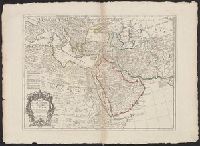
Hand col. in outlines only. Sheet measures 58.2 x 79.8 cm., Includes five bar scales., Prime meridian: Ferro., Relief shown pictorially., and Watermark.
Publisher:
Chez l'Auteur ...,
Subject (Geographic):
Africa, Northeast--Maps--Early works to 1800 and Middle East--Maps--Early works to 1800
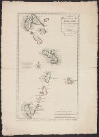
Includes text to left of compass rose: En 1706, le R.P. Feuillée observa dns l'Isle de la Martinique..., Includes three bar scales: lieues communes de France, lieues marines de France et d'Angleterre, and lieues marines d'Espagne., Relief shown pictorially., and Shows islands from Guadeloupe to Grenada, including Barbados.
Publisher:
Chez I'auteur sur le Quay de l'Horloge,
Subject (Geographic):
Antilles, Lesser--Maps--Early works to 1800, West Indies, French--Maps--Early works to 1800, and Windward Islands (West Indies)--Maps--Early works to 1800
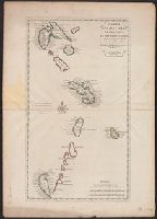
Hand col. Sheet measures 75.5 x 54 cm. Ms. no. on verso [some, Includes text to left of compass rose: En 1706, le R.P. Feuillée observa dns l'Isle de la Martinique..., Relief shown pictorially., and Shows islands from Guadeloupe to Grenada, including Barbados.
Publisher:
Chez I'auteur sur le Quay de l'Horloge,
Subject (Geographic):
Antilles, Lesser--Maps--Early works to 1800, West Indies, French--Maps--Early works to 1800, and Windward Islands (West Indies)--Maps--Early works to 1800
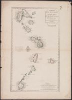
"Cette carte a été rectifiée en 1769 par Phil. Buache.", Cross Collection no. 257., Hand col., Includes three bar scales: lieues communes de France, lieues marines de France e, Ms. no. on verso: 134., and Relief shown pictorially.
Publisher:
Chez Dezauche, successeur des Srs. Del'Isle et Bauche ...,
Subject (Geographic):
Antilles, Lesser--Maps--Early works to 1800, West Indies, French--Maps--Early works to 1800, and Windward Islands (West Indies)--Maps--Early works to 1800
Subject (Name):
Buache, Philippe, 1700-1773, Dezauche, J, and Petit, Jean de
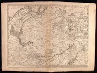
Crépy, Etienne Louis, printer Fricx, Eugène-Henri, d. 1733 Fricx, Eugène-Henri, d. 1733. Cartes des provinces des Pays Bas
Published / Created:
[1743]
Call Number:
1977 Folio 177
Image Count:
2
Resource Type:
Maps, Atlases & Globes
Description:
"No. 7" in lower right corner., Bar scales given in "echelle de deux Lieues et demie com[m]une de France" and "echelle de deux Lieues de Brabant"., From Fricx's Cartes des provinces des Pays Bas, 1744., Relief shown by hachures., Sheet measures 54.7 x 73.6 cm. No. 17 of 34 maps bound together., and Watermark.