Skip to search
Skip to main content
Skip to first result
Search
You Searched For
Genre
Maps
Publication Place
Boston :
New Search
Search Results
Published / Created:
1918
Call Number:
764gme B65 1918
Container / Volume:
BRBL_00462
Image Count:
1
Resource Type:
Maps, Atlases & Globes
Description:
Includes relevant legal acts printed between sections of title.
Publisher:
Boston Transit Commission,
Subject (Geographic):
Boston (Mass.)--Maps
Found in:
Beinecke Rare Book and Manuscript Library > Boston Subway, East Boston Tunnel, Washington St. Tunnel, tunnel for Cambridge connection, Dorchester Tunnel, Boylston St. Subway & East Boston Tunnel Connection.
Published / Created:
1897
Call Number:
764 M64 1897
Container / Volume:
BRBL_00458
Image Count:
1
Resource Type:
Maps, Atlases & Globes
Publisher:
Heliotype Printing Co.,
Subject (Geographic):
Milton (Mass.)--Maps
Found in:
Beinecke Rare Book and Manuscript Library > Breck's map of Milton : showing area taken for the Blue Hills Reservation of the Metropolitan Park System, also location of fire alarm boxes and police signal stations / Chas. C.E. Breck, Civil Engr.
Published / Created:
1875
Call Number:
764hc B65 1775
Container / Volume:
BRBL_00462
Image Count:
2
Resource Type:
Maps, Atlases & Globes
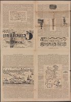
Description:
A newspaper with maps, drawings and description of the battle of Bunker Hill, June 17, 1775.
Publisher:
Rand, Avery, & Co.,
Subject (Geographic):
Boston (Mass.)--Maps
Found in:
Beinecke Rare Book and Manuscript Library > Bunker Hill Centennial.
Creator:
Published / Created:
1865
Call Number:
764 B65 1865
Container / Volume:
BRBL_00455
Image Count:
1
Resource Type:
Maps, Atlases & Globes
Description:
In center lower margin: Entered according to Act of Congress in the year 1861 by E.P. Dutton & Co. in the Clerks Office of the District Court in the District of Massachusetts., Relief shown by hachures., Sho, and Shows location of buoys, lighthouses, rocks, etc.
Publisher:
E.P. Dutton & Co.,
Subject (Geographic):
Boston Harbor (Mass.)--Maps and Massachusetts--Maps
Subject (Name):
Boston Map Store
Found in:
Beinecke Rare Book and Manuscript Library > Chart of Boston Harbor and Massachusetts Bay : with map of the adjacent country / published at the Boston Map Store.
Published / Created:
[1820?]
Call Number:
49cea 1820
Container / Volume:
BRBL_00268
Image Count:
1
Resource Type:
Maps, Atlases & Globes
Publisher:
Wells & Lilly,
Subject (Geographic):
Mediterranean Sea--Maps
Found in:
Beinecke Rare Book and Manuscript Library > Chart of the Black Sea, the Sea of Azop, the Sea of Marmora, the Archipelago and a part of the Mediterranean. Engraved by Annen & Smith, Boston.
Creator:
Published / Created:
c1896.
Call Number:
766 N46 1896A
Container / Volume:
BRBL_00473
Image Count:
1
Resource Type:
Maps, Atlases & Globes
Description:
Includes inset of Yale College campus.
Publisher:
Geo. H. Walker & Co.,
Subject (Geographic):
New Haven (Conn.)--Maps and New Haven Metropolitan Area (Conn.)--Maps
Subject (Name):
Geo. H. Walker & Co
Found in:
Beinecke Rare Book and Manuscript Library > City of New Haven, Connecticut / A.B. Hill ; engraved by Geo. H. Walker & Co.
Creator:
Published / Created:
c1893.
Call Number:
766 N46 1893J
Container / Volume:
BRBL_00473
Image Count:
1
Resource Type:
Maps, Atlases & Globes
Description:
Inset: [Yale campus]. Scale [1:2,400]. and Shows city wards, schools, churches, parks, etc.
Publisher:
Geo. H. Walker & Co.,
Subject (Geographic):
New Haven (Conn.)--Maps
Subject (Name):
Geo. H. Walker & Co
Found in:
Beinecke Rare Book and Manuscript Library > City of New Haven, Connecticut / A.B. Hill, c.e.
Creator:
Published / Created:
c1904.
Call Number:
764gmb T193 1904
Container / Volume:
BRBL_00462
Image Count:
1
Resource Type:
Maps, Atlases & Globes
Alternative Title:
Latest map of Taunton City Massachusetts
Description:
"Revised by Geo. A. King, C.E." below neat line bottom right. and Ward boundaries shown in color.
Publisher:
Geo. H. Walker & Co.,
Subject (Geographic):
Taunton (Mass.)--Maps
Found in:
Beinecke Rare Book and Manuscript Library > City of Taunton.
Creator:
Published / Created:
1880
Call Number:
75FCB 1880G
Container / Volume:
BRBL_00410
Image Count:
1
Resource Type:
Maps, Atlases & Globes
Description:
Includes list of votes by state, district and party affiliation in the Congressional election of 1878.
Publisher:
James R. Osgood & Co.,
Subject (Name):
United States.--Congress--Elections, 1878 and Whitman & Breck
Subject (Topic):
Political parties--United States--Maps
Found in:
Beinecke Rare Book and Manuscript Library > Congressional district vote map of the United States / designed by Fred B. Perkins ; drawn by Whitman & Breck.
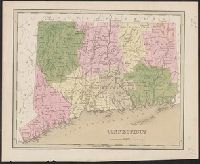
Published / Created:
1838
Call Number:
766 1838
Container / Volume:
BRBL_00466
Image Count:
1
Resource Type:
Maps, Atlases & Globes
Description:
Engraved by G.W. Boynton. and Preliminary record.
Publisher:
G.T. Bradford,
Subject (Geographic):
Connecticut--Maps
Found in:
Beinecke Rare Book and Manuscript Library > Connecticut.
Branch:v1.61.8 ,Deployed:2024-06-20T11:14:46-04:00