Skip to search
Skip to main content
Skip to first result
Search
You Searched For
Format
cartographic
Genre
Manuscript maps
New Search
Search Results
Published / Created:
1789
Call Number:
761 St24 1789
Container / Volume:
BRBL_00710
Image Count:
1
Resource Type:
Maps, Atlases & Globes
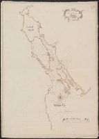
Description:
Color: pen and ink drawing.
Subject (Geographic):
Standish (Me. : Town)--Maps, Manuscript--Early works to 1800
Found in:
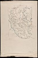
Beinecke Rare Book and Manuscript Library > A plan of Pearsontonn [i.e. Standish Township] planned by ... Ephraim Jones Surveyor. Falmonth, Sept. 26, 1775. Copied August 28th, 1789 (by) Saml. Freeman.
Creator:
Published / Created:
1751
Call Number:
732 H13 1751
Container / Volume:
BRBL_00708
Image Count:
1
Resource Type:
Maps, Atlases & Globes
Subject (Geographic):
Halifax Harbour (N.S.)--Maps--Early works to 1800
Subject (Topic):
Harbors--Nova Scotia--Halifax--Maps--Early works to 1800
Found in:
Beinecke Rare Book and Manuscript Library > A plan of the harbour of Halifax / by Charles Morris, chf. surveyr.
Published / Created:
1747
Call Number:
764 W52 1747
Container / Volume:
BRBL_00710
Image Count:
1
Resource Type:
Maps, Atlases & Globes
Description:
Color: pen and ink.
Subject (Geographic):
Westborough (Mass.)--Maps, Manuscript--Early works to 1800
Found in:
Beinecke Rare Book and Manuscript Library > An exact plan of Westborough South Precinct ... protracted and laid down by a scale of 200 perch for an inch by Hesebiah Ward, Surveyor.
Published / Created:
1757
Call Number:
732 An73 1757
Container / Volume:
BRBL_00708
Image Count:
1
Resource Type:
Maps, Atlases & Globes
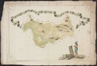
Description:
2 sheets in 1., Color; some green and red, pen drawing., and Key at bottom right.
Subject (Geographic):
Nova Scotia--Maps, Manuscript--Early works to 1800
Found in:
Beinecke Rare Book and Manuscript Library > Annapolis-Royal with the adjacent country 1757.
Published / Created:
[1935?]
Call Number:
766 B76 1935
Container / Volume:
BRBL_00711
Image Count:
1
Resource Type:
Maps, Atlases & Globes
Description:
Color: green and blue with red and orange detail., Key in bottom right hand corner., and Manuscript map showing roadwork, bridges repaired & painted, parks and park development, public bldgs. repaired and painted, new buildings and proposed projects.
Subject (Geographic):
Bridgeport (Conn.)--Maps
Found in:
Beinecke Rare Book and Manuscript Library > C.W.A. - F.E.R.A., Bridgeport Conn. Prepared from Official records. [Drawn by G.W. Carmalt].
Published / Created:
[1780?]
Call Number:
40 P28 1780D
Container / Volume:
BRBL_00705
Image Count:
1
Resource Type:
Maps, Atlases & Globes
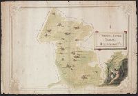
Description:
Color: various shades of green with some yellow detail. and Notes: Drawing of male figure in bottom right hand corner.
Subject (Geographic):
Italy--Maps, Manuscript--Early works to 1800
Found in:
Beinecke Rare Book and Manuscript Library > Campagna Soprana Pavese Delegazione V.
Published / Created:
[1780?]
Call Number:
40 P28 1780A
Container / Volume:
BRBL_00705
Image Count:
1
Resource Type:
Maps, Atlases & Globes
Description:
Color: various shades of green with some yellow detail. and Notes: Drawing of female figure on bottom right hand corner.
Subject (Geographic):
Italy--Maps, Manuscript--Early works to 1800
Found in:
Beinecke Rare Book and Manuscript Library > Campagna Sottana Pavese Delegazione VI.
Published / Created:
[between 1840 and 1849?]
Call Number:
BrSides Double Folio 2018 104
Image Count:
1
Resource Type:
Maps, Atlases & Globes
Description:
Cartographer's name in lower right corner illegible., Coordinates not present on map and are approximated., Manuscript number at bottom: 334., and Manuscript number on verso: 2170.
Subject (Geographic):
Lombardy (Italy)--Maps.
Found in:
Beinecke Rare Book and Manuscript Library > Carta geographia della provincia di Milano.
Published / Created:
1675
Call Number:
38hc 1675
Container / Volume:
BRBL_00172
Image Count:
1
Resource Type:
Maps, Atlases & Globes
Description:
ms map.
Subject (Geographic):
France--Maps--Early works to 1800
Found in:
Beinecke Rare Book and Manuscript Library > Carte ... du cours du Rhin depuis Basle jusqu'á Mayence dans laquelle sont compris ... sur laquelle on a tracé les mouvements et les positions des armées ... de 1674 et 1675. Par le Cher. de Beaurain.
Published / Created:
[1768?]
Call Number:
BrSides 2019 58
Image Count:
1
Resource Type:
Maps, Atlases & Globes
Description:
"Verstes russiennes dont une contient 500 toises de 7 pieds d'angleter"., Coordinates converted by cataloger to express longitude as measured from the Greenwich meridian., Includes map key of marble quarry locations, unidentified royal crown stamp, and shelf mark (K.3a)., and Relief shown by hachures.
Subject (Geographic):
Leningradskai︠a︡ oblastʹ (Russia)--Maps--Early works to 1800.
Subject (Topic):
Marble industry and trade--Russia (Federation)--Leningradskai︠a︡ oblastʹ--Maps--Early works to 1800.
Found in:
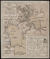
Beinecke Rare Book and Manuscript Library > Carte des carrieres de marbre decouvertes en Russie dans l'année 1768 sous la direction de S.E. Mr. le Lieut. General Comté de Bruce par le Conseiller d'État Koschin.
Branch:v1.61.8 ,Deployed:2024-06-20T11:15:04-04:00