Coastal chart., Imperfect: Mutilated with loss of information., Includes text: "Instructions for the coast of South Carolina, Georgia, and the coast of St. Augustin"., and Oriented with north to the left.
Publisher:
W. Mount and T. Page,
Subject (Geographic):
Atlantic Coast (South Atlantic States)--Maps., Georgia--Maps--Early works to 1800., and South Carolina--Maps--Early works to 1800.
Subject (Topic):
Coastwise navigation--Atlantic Coast (South Atlantic States)
Appears in Thomas Kitchin's General atlas describing the whole universe., Imperfect: chipped., Includes text., Insets: The Seven Islands -- A continuation of the river from Quebec to Lake Ontario -- St. Nicholas or English Harbor -- The mountains of our Lady or Notre Dame -- The road of Tadousac -- The traverse or passage from Cape Torment into the South Channel of Orleans Island -- A view of the lands from Cape Torment to the Butt as it appears in sailing through the Travers into the South Channel., Relief shown pictorially. Soundings shown in fathoms., Watermark., and With dedication to John Montagu, Earl of Sandwich.
Publisher:
Printed for Robt. Sayer, map & printseller,
Subject (Geographic):
Saint Lawrence River Valley--Maps--Early works to 1800. and Saint Lawrence River--Maps--Early works to 1800.
Subject (Name):
George Washington's American Atlas, Kitchin, Thomas, d. 1784. General atlas describing the whole universe., Sayer, Robert, 1725-1794, and Washington, George,--1732-1799,--Ownership.
Subject (Topic):
Nautical charts--Saint Lawrence River--Early works to 1800.
At head of title: Australia Gulf of Carpentaria., Coordinates not present on map and are approximated., In lower right corner: 1708., and Soundings in fathoms.
Publisher:
Hydrographic Office of the Admiralty,
Subject (Geographic):
Queensland.
Subject (Name):
Bate, R. B. (Robert Brettell), bookseller., Great Britain. Hydrographic Office, publisher., and J. & C. Walker (Firm), engraver.
Subject (Topic):
Albert River (Qld.)--Maps., Albert River (Qld.)--Navigation--Maps., and Nautical charts--Australia--Queensland.
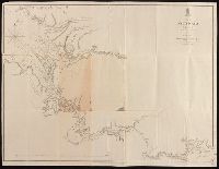
At head of title: Australia N.W. Coast., Coordinates not present on map and are approximated., Imperfect: mutilated and repaired, with no loss of text., In lower right corner: 1705., and Relief shown by hachures; soundings in fathoms.
Publisher:
Hydrographic Office of the Admiralty,
Subject (Geographic):
Victoria River (N.T.)--Maps. and Victoria River (N.T.)--Navigation--Maps.
Subject (Name):
Bate, R. B. (Robert Brettell), bookseller., Great Britain. Hydrographic Office, publisher., and J. & C. Walker (Firm), engraver.