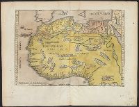
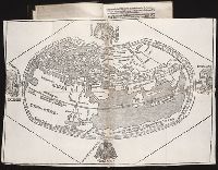
Appears in the author's Delle navigationi et viaggi., Covers Africa, except for the western bulge and southern tip., Has watermark., Includes text on verso., Oriented with north to the bottom., Pg. no. in upper right margin: 261., Relief shown pictorially., and Titl
Publisher:
G.B. Ramusio,
Subject (Geographic):
Africa--Maps--Early works to 1800
Subject (Name):
Ramusio, Giovanni Battista, 1485-1557. Delle navigationi et viaggi
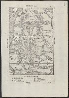
Cosmographia Pii Papae in Asiæ & Europæ eleganti descriptione : Asia. Historias rerum vbique
Image Count:
1
Description:
Map bound in before aaii
Subject (Topic):
Discoveries in geography and World maps --Early works to 1800
Collection Created:
[Paris]: Impressa ... per Henricum Stephanum impressorem dilige[n]tiss. Parrhisijs e regione scholae Decretorum. sumptib. eiusdem He[n]rici. & Ioa[n]nis Hongo[n]ti. VI. Idus Octobris anno Domini M.D.IX. [1509]
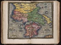
Qazwīnī, Zakarīyā ibn Muḥammad, 1208 or 9-1283 or 4.
Published / Created:
[15--?]
Call Number:
Arabic MSS 575
Image Count:
2
Resource Type:
Maps, Atlases & Globes
Abstract:
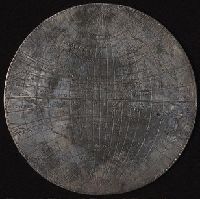
In the center of the map is Mecca; the ocean is located on each side along the outer edge of the sheet with the pillars of the earth in the four corners. Great emphasis is placed on Africa and the Nile river. Other places of interest include: Wasteland where nobody lives, Mountains of the Moon, Land of the Slavs and Franks, Gog and Magog, Land of the Turks (Central Asia), Red Sea (rectangular water mass), the Source of life.
Description:
Gift of Thomas E. Marston, Yale '27, in honor of Alexander O. Vietor, Yale '36, in November 1978., Removed from a bound volume., and Tempera and ink.
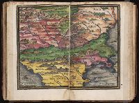
Regnum Congo hoc est vera descriptio regni Africani : quod tam ab incolis quam Lusitanis Congus
Image Count:
1
Description:
Map has two identical small holes on both the top left and top right corners. and Third of three maps bound following leaf [4] of preface, continued from previous leaves.