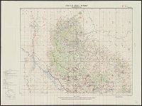
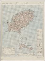
Great Britain. War Office. General Staff. Geographical Section
Published / Created:
1943
Call Number:
11hd 1942D-39
Container / Volume:
BRBL_00010ZD
Image Count:
1
Resource Type:
Maps, Atlases & Globes
Alternative Title:
G.S, G.S. (Series) ; 4249, Geographic Section, General Staff (Series) ; 4249, and Les Pieux-Guernsey
Description:
"50,000/12/43.C.K." print, "French 1:80,000 sheets 16 N.E. S.E.; 27 N.E.; 1:10,560 map of Alderney, 1:21,120 map of Guernsey and part of 1:31,680 map of Jersey.", and Copy 2 Imperfect: Torn, left half of map wanting. Fragment measures 66 x 51 cm.
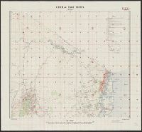
Great Britain. War Office. General Staff. Geographical Section
Published / Created:
1943
Call Number:
11hd 1942D-41
Image Count:
1
Resource Type:
Maps, Atlases & Globes
Alternative Title:
G.S, G.S. (Series) ; 4249, Geographic Section, General Staff (Series) ; 4249, and St. Lo-Vire
Description:
"50,000/1/44 F.C.", "French 1:80,000 sheets 28 S.W., S.E.; 44 N.W., N.E., S.W., S.E.", and Includes glossary, reference table, index to adjoining sheets, incidence of grid letters, and reliability diagram.
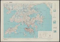
Great Britain. War Office. General Staff. Geographical Section
Published / Created:
1945
Call Number:
5681 1945
Container / Volume:
BRBL_00300
Image Count:
2
Resource Type:
Maps, Atlases & Globes
Alternative Title:
GSGS (Series), Hong Kong and Lema Islands, Hong Kong and Lema Islands., and Hong Kong and New territory.
Description:
"7-45.", "8-45.", "Reproduced under the direction of the Chief of Engineers by the Army Map Service (AM), U.S. Army ... 1945, from Kodalines of GSGS Second Edition 1945...", and North sheet. Hong Kong and New territory -- South sheet. Hong Kong and Lema Islands.
Publisher:
Army Map Service, U.S. Army,
Subject (Geographic):
Hong Kong (China)--Maps and New Territories (China)--Maps
Great Britain. War Office. General Staff. Geographical Section
Published / Created:
1943
Call Number:
3969 Ib4 1943
Container / Volume:
BRBL_00194
Image Count:
1
Resource Type:
Maps, Atlases & Globes
Alternative Title:
Great Britain. War Office. General Staff. Geographical Section. G.S.G.S. ; 4376., GSGS (Series) ; 4376., Ibiza and Formentera, and Its [G.S.G.S.] ; 4376
Description:
"Contour interval 50 metres.", "N3835-E109 / 35x34.", Five classes of roads and paths, and wooded and intensely culivated areas are shown., In upper margin: Balearic islands 1:100,000 ..., and Insets: Index to adjoining sheets and incidence of grid letters--Relia