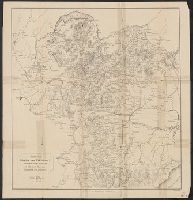
Dating: 1853 -Wyld's new address; before 1854, as Victorian railways not shown., Hand col. Mounted on linen. Sheet measures 68 x 101 cm., and Map of southern Australia with notes on the topography and gold deposits marked. Relief shown by hachures and
Publisher:
Published by Jas. Wyld, Geographer to the Queen, Charing Cross East ... & Model of the Earth, Leicester Square,
Subject (Geographic):
New South Wales--Maps, South Australia--Maps, Tasmania--Maps, and Western Australia--Maps
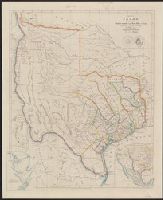
From the Streeter collection., Includes area map and ancillary map of "Plan of Galveston Bay from a ms.", Relief shown by hachures., and Shows 31 counties, notes from Le Grand's survey, various routes, "Fisher & Comp.y" northwest of Austin, "Al Bourgeois d'Orvanne's Grant" west of San Antonio, and names for projected land holdings, "Mr. Kennedy", "Mr. H. Castro", and "Mr. Pierson."
Publisher:
John Arrowsmith,
Subject (Geographic):
Texas--Administrative and political divisions--Maps and Texas--Maps
Subject (Name):
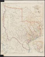
Arrowsmith, John, 1790-1873. London atlas of universal geography
Appears in Arrowsmith's London atlas of universal geography., From the Streeter collection., Includes area map and ancillary map of "Plan of Galveston Bay from a ms.", Library's copy annotated in pencil., Relief shown by hachures., and Shows 31 counties, notes from Le Grand's survey, and various routes.
Publisher:
John Arrowsmith,
Subject (Geographic):
Texas--Administrative and political divisions--Maps and Texas--Maps
Subject (Name):
Arrowsmith, John, 1790-1873. London atlas of universal geography
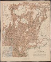
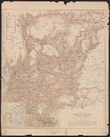
Geographical Section General Staff ; no. 2112 and GSGS (Series) ; 2112.
Description:
"War Office, April 1906. Corrected to Dec. 1908.", Includes explanations and conventional signs., Includes inset: sketch map of China (Scale 1:20,000,000)., and Relief shown by spot heights and shading.
Geographical Section General Staff ; no. 2112 and GSGS (Series) ; 2112.
Description:
"War Office, April 1906. Corrected to Dec. 1908.", Includes explanations and conventional signs., Includes inset: sketch map of China (Scale 1:20,000,000)., and Relief shown by spot heights and shading.